
 United Kingdom
 France
 Germany
 Netherlands
 Sweden
 USA
USA
 Italy
Italy
 Spain
Spain
More From Contributor


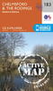

Cheetham And Higher Broughton 1931
Cheetham and Higher Broughton in 1931 in a fascinating series of reproductions of old Ordnance Survey plans in the Alan Godfrey Editions, ideal for anyone interested in the history of their neighbourhood or family. Three versions of this map have been published, covering Cheetham, Higher Broughton and High Town area north of Manchester. Coverage stretches from Broughton Lane and Derby Street northward to Tetlow Lane and Heath Street, and from the River Irwell eastward to Cheetham Hill.Features include Albert Park, Cromwell Bridge, Broughton Town Hall, Kersal Dale, St John`s church Broughton, Mandley Park, Fairy Lane Brickworks, St James church, St Alban`s church, Cheetham Park, St John`s church Cheetham, Oakhill Home, Broughton Street Brickworks, The Cliff, football
ground (Broughton Rangers and today Manchester United`s training ground), etc. Bury New Road and Waterloo Road run through the map. On the reverse are selections of street directory entries.About the Alan Godfrey Editions of the 25” OS Series:Selected towns in Great Britain and Ireland are covered by maps showing the extent of urban development in the last decades of the 19th and early 20th century. The plans have been taken from the Ordnance Survey mapping and reprinted at about 15 inches to one mile (1:4, 340). On the reverse most maps have historical notes and many also include extracts from contemporary directories. Most maps cover about one mile (1.6kms) north/south, one and a half miles (2.4kms) across; adjoining sheets can be combined to provide wider coverage.FOR MORE
INFORMATION AND A COMPLETE LIST OF ALL AVAILABLE TITLES PLEASE CLICK ON THE SERIES LINK.

Product Description
Reviews/Comments
Add New
Intelligent Comparison
Archived Product

Cheetham & Higher Broughton 1915 Stanfords
£3.50
Vouchers
No voucher codes found.
Do you know a voucher code for this product or supplier? Add it to Insights for others to use.
Do you know a voucher code for this product or supplier? Add it to Insights for others to use.
 Denmark