More From Contributor

£12.99
Topographic survey of France at 1:25, 000 in IGN`s excellent TOP25 / Série Bleue series. All the maps are GPS compatible, with a 1km UTM grid plus latitude & longitude lines at 5’ intervals. Contours are at 5m intervals except for mountainous areas where the maps have contours at 10m intervals, vividly enhanced by hill shading & graphics for rocky terrain. Colouring with graphics indicates different types of vegetation or land use (deciduous or coniferous forests, moors, orchards, vineyards, etc). PLEASE NOTE: coverage of France at this scale is currently being revised – the format & the presentation of each title are indicated by the letters at the end of its Sheet Reference number (e.g. 0416ET, 3531ETR, 1923SB, etc.)MAPS WITH FULL TOURIST OVERPRINT & AN ENGLISH MAP LEGEND: all TOP25 maps & the SB editions of Série Bleue have an overprint highlighting waymarked walking trails including long-distance GR routes &, where appropriate, ski routes. Symbols indicate campsites, gîtes d’etape, refuges, equestrian centres & other recreational facilities or sites, tourist information centres, cultural heritage, etc. Towns & locations of particular interest are highlighted.- ET or OT = single-sided TOP25 map covering approx. 29x 21 km / 18x 13 miles.- ETR or OTR = waterproof & tear resistant TOP25 map covering the same area as the corresponding ET or OT number, but double-sided, printed on a smaller size sheet with a good overlap between the sides.- SB = Série Bleue map with full tourist overprint; these maps, first introduced in summer 2014, each cover approx. 29x 24km / 18x 15 miles.SÉRIE BLEUE maps with numbers ending in E (Est) or O (Ouest): most editions now indicate the GR routes, but do not show any other tourist information. Map legend is in French only. Each map covers approx. 14x 20km / 9x 12 miles. ...
Archived Product
£9.50
Topographical survey of Belgium at 1:20, 000 from Nationaal Geografisch Instituut / Institut Géographique National, the country’s national survey organization. Each 20K map covers one quarter of the corresponding 1:50, 000 map (with adjustments in the border & coastal areas). The maps provide all the information expected of topographic mapping at this scale & in addition have an unusually large amount of vegetation and/or land use information (different types of woodlands, gardens, orchards, heath, etc). The maps have a 1-km UTM grid, with margin ticks for latitude & longitude at intervals of 1`. Map legend & a glossary of terms used on the maps include English. Stanfords keeps as regular stock 20K maps for the World War I battlefields around the Ypres, Messines & Passchendaele, & for the area of the Battle of Waterloo. The 1:20, 000 survey covers the whole of Belgium & maps for other regions can be supplied as special orders. To see the list of titles in this series please click on the series link.PLEASE NOTE: the Long-Distance Footpaths Map of Belgium at 1:300, 000 which shows the division of Belgium into the 50K survey sheets can also be used to see in more detail coverage by the 20K maps. ...
Archived Product
£7.99
Topographic survey of France at 1:25, 000 in IGN`s excellent TOP25 / Série Bleue series. All the maps are GPS compatible, with a 1km UTM grid plus latitude & longitude lines at 5’ intervals. Contours are at 5m intervals except for mountainous areas where the maps have contours at 10m intervals, vividly enhanced by hill shading & graphics for rocky terrain. Colouring with graphics indicates different types of vegetation or land use (deciduous or coniferous forests, moors, orchards, vineyards, etc). PLEASE NOTE: coverage of France at this scale is currently being revised – the format & the presentation of each title are indicated by the letters at the end of its Sheet Reference number (e.g. 0416ET, 3531ETR, 1923SB, etc.)MAPS WITH FULL TOURIST OVERPRINT & AN ENGLISH MAP LEGEND: all TOP25 maps & the SB editions of Série Bleue have an overprint highlighting waymarked walking trails including long-distance GR routes &, where appropriate, ski routes. Symbols indicate campsites, gîtes d’etape, refuges, equestrian centres & other recreational facilities or sites, tourist information centres, cultural heritage, etc. Towns & locations of particular interest are highlighted.- ET or OT = single-sided TOP25 map covering approx. 29x 21 km / 18x 13 miles.- ETR or OTR = waterproof & tear resistant TOP25 map covering the same area as the corresponding ET or OT number, but double-sided, printed on a smaller size sheet with a good overlap between the sides.- SB = Série Bleue map with full tourist overprint; these maps, first introduced in summer 2014, each cover approx. 29x 24km / 18x 15 miles.SÉRIE BLEUE maps with numbers ending in E (Est) or O (Ouest): most editions now indicate the GR routes, but do not show any other tourist information. Map legend is in French only. Each map covers approx. 14x 20km / 9x 12 miles. ...
Archived Product
£18.99
Topographic survey of France at 1:25, 000 in IGN`s excellent TOP25 / Série Bleue series. All the maps are GPS compatible, with a 1km UTM grid plus latitude & longitude lines at 5’ intervals. Contours are at 5m intervals except for mountainous areas where the maps have contours at 10m intervals, vividly enhanced by hill shading & graphics for rocky terrain. Colouring with graphics indicates different types of vegetation or land use (deciduous or coniferous forests, moors, orchards, vineyards, etc). PLEASE NOTE: coverage of France at this scale is currently being revised – the format & the presentation of each title are indicated by the letters at the end of its Sheet Reference number (e.g. 0416ET, 3531ETR, 1923SB, etc.)MAPS WITH FULL TOURIST OVERPRINT & AN ENGLISH MAP LEGEND: all TOP25 maps & the SB editions of Série Bleue have an overprint highlighting waymarked walking trails including long-distance GR routes &, where appropriate, ski routes. Symbols indicate campsites, gîtes d’etape, refuges, equestrian centres & other recreational facilities or sites, tourist information centres, cultural heritage, etc. Towns & locations of particular interest are highlighted.- ET or OT = single-sided TOP25 map covering approx. 29x 21 km / 18x 13 miles.- ETR or OTR = waterproof & tear resistant TOP25 map covering the same area as the corresponding ET or OT number, but double-sided, printed on a smaller size sheet with a good overlap between the sides.- SB = Série Bleue map with full tourist overprint; these maps, first introduced in summer 2014, each cover approx. 29x 24km / 18x 15 miles.SÉRIE BLEUE maps with numbers ending in E (Est) or O (Ouest): most editions now indicate the GR routes, but do not show any other tourist information. Map legend is in French only. Each map covers approx. 14x 20km / 9x 12 miles. ...
Archived Product
£9.99
It is said that a picture may be worth a thousand words but an old photograph can inspire many more. In this beguiling book, Alexander Mc Call Smith casts his eye over five chanced-upon photographs from the era of black-&-white photography & imagines the stories behind them. Who were those people, what were their stories, why are they smiling, what made them sad? What emerges are surprising & poignant tales of love & friendship in a variety of settings
- an estate in the Highlands of Scotl&, a travelling circus in Canada, an Australian gold-mining town, a village in Irel&, & the Scottish capital, Edinburgh. Some will find joy & fulfilment
- others would prefer happier endings. Each of them, though, will find love, & that is ultimately what matters.

...
Archived Product
£14.99
Chance, risk, uncertainty: they`re all part of our lives, whether we`re in business or on the school run, deciding future strategy or just the best route home. Sometimes their effects are intriguing: a streak of extraordinary luck, say, or some bizarre coincidence. More often they just leave us confused, unnerved
- even anxious. When is a series of odd events mere happenstance, or something more significant? How do we make sense of the ever-changing evidence about what`s good or bad for us? Just how reliable are predictions of weather, climate & elections
- & how should we respond to them? In this book, award-winning scientist & writer Robert Matthews shows how we can cut through such conundrums using some of the most potent intellectual tools ever developed: the laws of probability. Using real-life examples, he shows how to wield them to: Understand & even predict coincidences Tell when insurance policies are worth having Make sense of medical tests & scientific `breakthroughs` Judge when ”expert” evidence is compelling or questionable Make decisions about everything from sports betting to weather forecasts Professor Matthews also gives a groundbreaking introduction to the power of Bayes`s Theorem, whose ability to turn evidence into insight is now transforming our lives
- & helping to unmask a major scientific scandal.


...
Archived Product
£12.99
Map No. 1300, Chancy, in the topographic survey of Switzerland at 1:25, 000 from Bundesamt für Landestopographie (swisstopo), covering the whole country on 247 small format sheets, with special larger maps published for popular regions including some titles now available in hiking versions. Highly regarded for their superb use of graphic relief & hill shading, the maps give an almost 3-D picture of Switzerland`s mountainous terrain. Contours are at 10 m intervals, with 20m intervals in the mountainous areas. All the maps have a 1-km grid for Swiss national coordinates (datum CH 1903). * Small format sheets (Nos. 1011
- 1374)* Map legend in the language of the area covered by the map. Additional margin ticks show latitude & longitude in steps of 2`. The area covered by each map is 17 x 12 km (11 x 7 miles approx). * Special larger sheets (Nos. from 2501 onwards) – STANDARD editions:* No map legend is included but a separate leaflet can be provided instead. The area covered by each map is 25 x 17 km (15 x 11 miles approx).* Special larger sheets (Nos. from 2501 onwards) – HIKING editions:* An overprint highlights hiking, mountain & alpine paths, including regional & national long-distance trails. The maps also show bus routes with bus stops, plus inns in remote locations. The area covered by each map is 25 x 17 km (15 x 11 miles approx).
...
Archived Product
£8.99
” Change the World 9 to 5” is the latest book from the team that brought you the best selling ” Change the World for a Fiver”. ” Change the World 9 to 5” features 50 simple, practical things which we can all do during the working day to make a difference to the world & those around us, regardless of our profession. & like ” Change the World for a Fiver”, it will be packed with tricks, gimmicks & even the odd surprise. With the longest working hours in Europe, ” Change the World 9 to 5” will help us all make the most of the time we spend at work & feel good about ourselves. ...
Archived Product
£8.99
` The essential first step for all couples planning to sail away; this is a must-read`
- Paul & Sheryl Shard, authors of ” Sail
...
Archived Product
£6.99
Merrick Hilton`s done a runner. His folks think he`s studying, but the real world has been calling for years & he can`t ignore it any longer. A postie bike, a bedroll & a big sky
- that`s all he needs. But there`s no telling how he`ll handle the rough stuff, let alone roadkill, stolen oranges & unexpected romance. & in the real world nothing goes entirely as planned. Thankfully Victor
- the old bloke he meets on the road
- knows a thing or two about broken bike chains. & broken hearts.


...
Archived Product

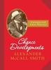
Chance Developments: Unexpected Love Stories

In this beguiling book, Alexander McCall Smith casts his eye over five chanced-upon photographs from the era of black-and-white photography and imagines the stories behind them. Who were those people, what were their stories, why are they smiling, what made them sad? What emerges are surprising and poignant tales of love and friendship in a variety of settings - an estate in the Highlands of Scotland, a travelling circus in Canada, an Australian gold-mining town, a village in Ireland, and the Scottish capital, Edinburgh. Some will find joy and fulfilment - others would prefer happier endings.Each of them, though, will find love, and that is ultimately what matters.
RIP - This product is no longer available on our network. It was last seen on 25.09.2019

This page now acts as a permanent archive for this product. Add more information using the comments box below to ensure it can still be found by future generations.

Use our search facility to see if it is available from an alternative contributor.
  • External links may include paid for promotion
  • Availability: Out Of Stock
  • Supplier: Stanfords
  • SKU: 9781846973703
Availability: In Stock
£7.99

Product Description

In this beguiling book, Alexander Mc Call Smith casts his eye over five chanced-upon photographs from the era of black-&-white photography & imagines the stories behind them. Who were those people, what were their stories, why are they smiling, what made them sad? What emerges are surprising & poignant tales of love & friendship in a variety of settings
- an estate in the Highlands of Scotl&, a travelling circus in Canada, an Australian gold-mining town, a village in Irel&, & the Scottish capital, Edinburgh. Some will find joy & fulfilment
- others would prefer happier endings. Each of them, though, will find love, & that is ultimately what matters.

Reviews/Comments

Add New

Intelligent Comparison

Oooops!
We couldn't find anything!
Perhaps this product's unique.... Or perhaps we are still looking for comparisons!
Click to bump this page and we'll hurry up.

Price History

Vouchers

No voucher codes found.
Do you know a voucher code for this product or supplier? Add it to Insights for others to use.

Facebook

Jargon Buster

Gold - A precious highly conductive metal
Black - A colour which does not emit any colour of the spectrum. Black absorbs all frequencies of the spectrum.
White - A colour combining all colours
Edinburgh - The capital city of Scotland
Eye - An organ which detects light
Love - Someone who shows deep affection for someone else.
Gold - A colour, a type of rich metal. Chemical symbol AU.
Estate - A group of houses on the same land or area.

Supplier Information

Stanfords
Stanfords was established in 1853 and opened their iconic Covent Garden flagship store in 1901. They have become the top retailer of maps, travel books and accessories in the UK and arguably offer the largest selection of maps and travel books worldwide. Famous names such as Captain Robert Falcon Scott, Ranulph Fiennes and Michael Palin have purchased from Stanfords. They now have a shop in Bristol and both stores together with other venues operate a calendar of events including talks, book signings and exhibitions. As a specialist map retailer, the map selection is comprehensive and includes road maps, street maps and walking maps from worldwide destinations, as well as a selection of world atlases and wall maps. Books include travel guides and travel literature. Stanfords also stock globes, from miniatures made of blue marble to magnificent floor-standing globes. The website features a selection of interesting articles on travel topics.
Page Updated: 2023-11-12 20:15:36

Community Generated Product Tags

Oh No! The productWIKI community hasn't generated any tags for this product yet!
Menu