
 United Kingdom
 France
 Germany
 Netherlands
 Sweden
 USA
USA
 Italy
Italy
 Spain
Spain
More From Contributor


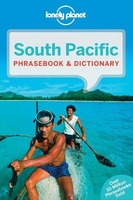
South Pacific Phrasebook
Lonely Planet`s South Pacific Phrasebook & Dictionary is your handy passport to culturally enriching travels with the most relevant and useful South Pacific phrases and vocabulary for all your travel needs. Chat over dinner with a local family in Fiji, understand the hula in Hawaii, and join a traditional umukai feast in Rarotonga, all with your trusted travel companion. With language tools in your back pocket, you can truly get to the heart of wherever you go, so begin your journey now!Get More From Your Trip with Easy-to-Find Phrases for Every Travel Situation!- Feel at ease with essential tips on culture, manners, idioms and multiple meanings- Order with confidence, explain food allergies, and try new foods with the menu decoder- Save time and hassles with vital phrases at your
fingertips- Never get stuck for words with the 3500-word two-way, quick-reference dictionary- Be prepared for both common and emergency travel situations with practical phrases and terminologyInside Lonely Planet`s South Pacific Phrasebook & Dictionary:- Colour throughout- User-friendly layout organized by travel scenario categories- Survival phrases inside front cover for at-a-glance on-the-fly cuesCovers:- Languages - Fijian, Hawaiian, Kanak languages, Maori, Niuean, Rapanui, Rarotongan Maori, Samoan, Tahitian, Tongan, Fijian Hindi, Pacific French, Spanish, Pacific Englishes- Basics - time, dates, numbers, amounts, pronunciation, reading tips, grammar rules- Practical - travel with kids, disabled travellers, sightseeing, business, banking, post office, internet,
phones, repairs, bargaining, accommodations, directions, border crossing, transport- Social - meeting people, interests, feelings, opinions, going out, romance, culture, activities, weather- Safe Travel - emergencies, police, doctor, chemist, dentist, symptoms, conditions- Food - ordering, at the market, at the bar, dishes, ingredients

Product Description
Reviews/Comments
Add New
Vouchers
No voucher codes found.
Do you know a voucher code for this product or supplier? Add it to Insights for others to use.
Do you know a voucher code for this product or supplier? Add it to Insights for others to use.
 Denmark