More From Contributor
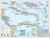
£4.99
This large-scale topographical map of the Caribbean region (scale 1:3, 500, 000) uses clear lettering & symbols to enable cities & towns, as well as rivers & other physical features, to be easily identified. Inset around the main Caribbean map are individual maps of Jamaica, Trinidad, Tobago, St Lucia, Barbados, Guadeloupe & Martinique. This wall chart is available either rolled flat in a clear plastic tube & laminated on both sides or unlaminated & folded into a tipped-on card cover & shrinkwrapped. It is designed for mounting on a bedroom wall or in the classroom or office & the clarity of the name detail should make it accessible for both adults & children. ...
Archived Product
£13.95
The Caribbean at 1:4, 000, 000 on a colourful map from Michal Kasprowski, showing both the whole region & 36 enlargements of individual islands. Its unusual feature is the presentation of numerous lighthouses, including many on small islands off the coast of Central America. The map covers the whole region with the surrounding mainland: in USA from Savannah to New Orleans; Central America from eastern Yucatan & Guatemala; & the coast of Colombia & Venezuela. All countries are shown in bright but pleasant colours. Islands which are also presented on enlargements are annotated with the number of the relevant panel. Depth contours & soundings, in metres, are drawn across the sea & many basin, trenches, ridges, etc. are named. Latitude & longitude lines are at intervals of 5 ...
Archived Product
£13.99
The Caribbean at 1:4, 000, 000 on a colourful map from Michal Kasprowski, showing both the whole region & 36 enlargements of individual islands. Its unusual feature is the presentation of numerous lighthouses, including many on small islands off the coast of Central America. The map covers the whole region with the surrounding mainland: in USA from Savannah to New Orleans; Central America from eastern Yucatan & Guatemala; & the coast of Colombia & Venezuela. All countries are shown in bright but pleasant colours. Islands which are also presented on enlargements are annotated with the number of the relevant panel. Depth contours & soundings, in metres, are drawn across the sea & many basin, trenches, ridges, etc. are named. Latitude & longitude lines are at intervals of 5°. In the centre of the Gulf of Mexico & across the Atlantic & the mainland of Venezuela 36 panels provide enlargements of various islands to show each one in greater detail. An unusual feature of this map is the inclusion of numerous lighthouses, shown on the main map along the coast of the continental countries, Cuba & Hispaniola, plus on the smaller island are included on the enlargement panels. ...
Archived Product
£10.99
The southern part of the Caribbean at 1:2, 500, 000 from Nelles Verlag, combining separate maps of the individual islands with an overview of the whole region from Jamaica & the Dominican Republic to the coastline of South America. On one side is an overview map of the southern part of the Caribbean, with Jamaica, Hispaniola (Haiti & the Dominican Republic), Puerto Rico, Virgin Islands, Leeward Islands & Windward Islands, & the northern coast of South America. Next to the map & on the reverse are insets at various scales presenting enlargements of the individual islands or groups: Jamaica, Puerto Rico, Trinidad, Tobago, Virgin Islands, Anguilla with St Martin/ Sint Maarten, St Berthélemy, Saba, St Eustatius, St Kitts & Nevis, Montserrat, Barbuda, Antigua, Guadeloupe, Aruba, Curaçao, Bonaire, Barbados, St Vincent & the Grenadines, Grenada, Saint Lucia, Martinique & Dominica. Topography of the islands is presented by relief shading with, where appropriate, names & heights of main peaks. The maps show each island’s network of main roads & tracks & locations of airports. Numerous places of interest & beaches are highlighted. On the overview map latitude & longitude are indicated by margin ticks at 2° intervals. Maps of the individual islands have no geographical coordinates. The map has no index of localities. Map legend

Includes::
English.

...
Archived Product
£18.99
Full-color guide
- Make your trip to the Caribbean unforgettable
Customize your trip with simple planning tools
- Top experiences


...
Archived Product
£11.80
The Caribbean Certificate Atlas is a completely new atlas focusing on the most accurate & up-to-date digital mapping of all countries of the Caribbean, with special thematic maps newly designed to illustrate the economic & social character of the region. New digital world maps are incorporated from a series of internationally acclaimed Macmillan school atlases.- Completely revised & expanded by educational specialists in the Caribbean region
- Contains over 220 informative & stimulating maps.
- Special focus on the nature & exploitation of the environment.- Thematic maps enhanced by the inclusion of related photographs, satellite imagery, diagrams & explanatory text.- Uses the latest cartographic technology to ensure the clearest possible presentation in a visually attractive fashion. -Much additional statistical information included in the form of tables, diagrams & graphs. Sections: Natural systems
- Caribbean & world mapping of geomorphic, climatic & biotic themes with special emphasis of the Caribbean environment & conservation issues. Man made systems
- Caribbean & world mapping on agricultural, industrial & settlement themes. Caribbean
- 27 maps of Caribbean countries emphasizing their individuality. Other continents & countries
- Map of Central, North & South America, Europe, Africa, Asia, Australasia & the Polar regions, including appropriate thematic maps & statistics. Index
- A comprehensive index of all names features in the atlas.


...
Archived Product
£7.99
Fully updated colour wall map of the Caribbean showing each country & capital city, towns, major roads, railways & cities. Details of all of the key islands in the Caribbean with all major places of interest noted. Call out panels highlight Jamaica, St Kitts & Nevis, Antigua & Barbuda, Monsterrat, Dominica, St Lucia & St Vincent & the Grenadines, Belize, Trinidad & Tobago, Grenada & Barbados.

Includes::
Caribbean regions of Latin America.

...
Archived Product
£14.99
Packed with information on more than 40 ports of call & a dozen ports of embarkation, Caribbean Cruise Ports of Call is a comprehensive guide to everything from sightseeing information & strategies to help cruisers plan their own shore excursions to some basic information on the cruise-ship experience. ...
Archived Product
£10.99
Caribbean Cruises Map from Freytag & Berndt showing on one side the whole region & on the reverse individual countries or islands on separate maps accompanied by descriptions & general information. On one side is a general map of the whole of the Caribbean, from Florida to the coast of South America, at 1:2, 500, 000, plus the index & information panels for Florida, Jamaica, Puerto Rico Haiti & the Dominican Republic. On the reverse are individual maps at various scales & information panels with descriptions of main places on interest for: Anguilla, Antigua & Barbuda, Aruba, Bahamas, Barbados, Bonaire, Cayman Islands, Curaçao, Dominica, Grenada, Guadeloupe, Martinique, Montserrat, St Kitts & Nevis, St. Lucia, St. Martin/ Maarten with St Barthélemy, St. Vincent & the Grenadines, Trinidad & Tobago, Turks & Caicos Islands, British & US Virgin Islands, plus San Andrés in Colombia & Isla de Margarita in Venezuela. Multilingual map legend

Includes::
English. The text in the information panels is in English & German.

...
Archived Product
£16.99
Caribbean Cruises Insight Guide is a detailed exploration the three cruise routes with a selection of glossy illustrations. Introductory sections explore background information to cruising in general as well as the history & culture of the places en route, whilst selective photo-features illustrate the variety of the places you will visit. The guide is broken down into itineraries for the Western, Eastern & Southern cruise routes & also provides information on the main attractions & best beaches across the Caribbean. Essential practical information is provided in the Travel Tips chapter on planning your trip, getting around on dry l&, information on ports visited, as well as a small directory of local attractions & restaurants. A useful location finder & travel tip index with relevant page numbers are given on the inside covers. ...
Archived Product

Caribbean 2013

In amazing full color, Fodor's Caribbean covers almost 50 destinations in the Caribbean, from the Dominican Republic and Trinidad & Tobago, to Turks & Caicos and even Montserrat. The guide reviews the best each island has to offer, including activities, resorts, restaurants, nightspots, shops, and more. This guide is a complete planning tool that will help travelers put together the perfect trip to an island paradise.
RIP - This product is no longer available on our network. It was last seen on 25.09.2019

This page now acts as a permanent archive for this product. Add more information using the comments box below to ensure it can still be found by future generations.

Use our search facility to see if it is available from an alternative contributor.
  • External links may include paid for promotion
  • Availability: Out Of Stock
  • Supplier: Stanfords
  • SKU: 9780307929341
Availability: In Stock
£17.99

Product Description

In amazing full color, Fodor's Caribbean covers almost 50 destinations in the Caribbean, from the Dominican Republic & Trinidad & Tobago, to Turks & Caicos & even Montserrat. The guide reviews the best each island has to offer, including activities, resorts, restaurants, nightspots, shops, & more. This guide is a complete planning tool that will help travelers put together the perfect trip to an island paradise.

Reviews/Comments

Add New

Intelligent Comparison

Oooops!
We couldn't find anything!
Perhaps this product's unique.... Or perhaps we are still looking for comparisons!
Click to bump this page and we'll hurry up.

Price History

Vouchers

No voucher codes found.
Do you know a voucher code for this product or supplier? Add it to Insights for others to use.

Facebook

Jargon Buster

Caribbean - An area of islands within the Caribbean sea.

Supplier Information

Stanfords
Stanfords was established in 1853 and opened their iconic Covent Garden flagship store in 1901. They have become the top retailer of maps, travel books and accessories in the UK and arguably offer the largest selection of maps and travel books worldwide. Famous names such as Captain Robert Falcon Scott, Ranulph Fiennes and Michael Palin have purchased from Stanfords. They now have a shop in Bristol and both stores together with other venues operate a calendar of events including talks, book signings and exhibitions. As a specialist map retailer, the map selection is comprehensive and includes road maps, street maps and walking maps from worldwide destinations, as well as a selection of world atlases and wall maps. Books include travel guides and travel literature. Stanfords also stock globes, from miniatures made of blue marble to magnificent floor-standing globes. The website features a selection of interesting articles on travel topics.
Page Updated: 2023-11-12 20:15:36

Community Generated Product Tags

Oh No! The productWIKI community hasn't generated any tags for this product yet!
Menu