
 United Kingdom
 France
 Germany
 Netherlands
 Sweden
 USA
USA
 Italy
Italy
 Spain
Spain
More From Contributor


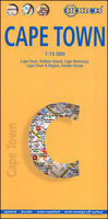
Cape Town Borch
Laminated, waterproof map combining a plan of Cape Town ith maps of the Peninsula, the Cape Winelands region and the Garden Route, plus plenty of tourist information, including 30 recommended best sites. The street plan of the city itself extends south to the Upper Cableway Station in the Cape Peninsula National Park and the university campus. The plan highlights places of interest and selected hotels, and indicates one way streets, car parks, recreational facilities, main public buildings, etc.Four more maps of the Robben Island (1:40, 000), the Cape Peninsula (1:140, 000), the wider region accessible as day trips from the city including the Winelands and the Sixteen Mile Beach (1:635, 000), and the Garden Route to Port Elizabeth (1:3, 000, 000) highlight more places of
interest, including national parks and reserves, scuba diving and windsurfing sites, campsites, etc. Both the main street plan and the road maps have indexes listing streets/localities, main public buildings, places of interest, and selected hotels. 30 top sights in the city itself and in the surrounding region are listed and highlighted on the appropriate maps. Further information for visitors is provided by a diagram of the Cape Metrorail system, a small map of the whole of South Africa, and climate charts.
interest, including national parks and reserves, scuba diving and windsurfing sites, campsites, etc. Both the main street plan and the road maps have indexes listing streets/localities, main public buildings, places of interest, and selected hotels. 30 top sights in the city itself and in the surrounding region are listed and highlighted on the appropriate maps. Further information for visitors is provided by a diagram of the Cape Metrorail system, a small map of the whole of South Africa, and climate charts.

Product Description
Reviews/Comments
Add New
Vouchers
No voucher codes found.
Do you know a voucher code for this product or supplier? Add it to Insights for others to use.
Do you know a voucher code for this product or supplier? Add it to Insights for others to use.
 Denmark