More From Contributor

£7.99
Map No. 179, Canterbury & East Kent 1816-1819, in the Cassini Historical Series of old Ordnance Survey mapping of England & Wales at 1:50, 000 in a format designed to offer a convenient comparison with the present day coverage from the OS, & most locations in three different editions. Old historical maps have been combined so that the sheet lines correspond to the current Landranger series & reproduced with the scale changed from one inch to one mile to 1:50, 000. Most locations are covered by three separate maps, showing how the area has changed over the decades, with selected major cities also presented in a fourth edition. Old Series: the first detailed survey mapping dating for most areas from the first half of the 19th century, in black & white & with relief shown by hachuring. Revised New Series from 1880s/1900s, with some colouring & a mixture of hachuring & contour lines. Popular Edition from the inter-war years, with contour lines & colouring to indicate woodlands, parks, etc. New Popular Edition from the late 1940s, reproduced in the Cassini series for the major cities. Each map

Includes::
notes on the development of Ordnance Survey & the various series produced by them. For those interested in maps & cartography in general, the Cassini series also provides a fascinating insight into how Ordnance Survey cartographic style has developed over a period of over 100 years. Coverage in this title

Includes::
present day Dover, Folkestone, Margate, Hythe, Deal, Ramsgate, Broadstairs, Herne Bay, Whitstable, Sandwich, Laysdown-on-Sea, Boughton Street, Selling, Blean, Upstreet, Minster, St. Nicholas at Wade, Chilham, Bridge, Wingham, Aylesham, Bossingham, Stelling Minnis, Tilmanstone, St. Margaret


...
Archived Product
£14.99
Map No. 179, Canterbury & East Kent 1816-1921 (3-map set), in the Cassini Historical Series of old Ordnance Survey mapping of England & Wales at 1:50, 000 in a format designed to offer a convenient comparison with the present day coverage from the OS, & most locations in three different editions. Old historical maps have been combined so that the sheet lines correspond to the current Landranger series & reproduced with the scale changed from one inch to one mile to 1:50, 000. Most locations are covered by three separate maps, showing how the area has changed over the decades, with selected major cities also presented in a fourth edition. Old Series: the first detailed survey mapping dating for most areas from the first half of the 19th century, in black & white & with relief shown by hachuring. Revised New Series from 1880s/1900s, with some colouring & a mixture of hachuring & contour lines. Popular Edition from the inter-war years, with contour lines & colouring to indicate woodlands, parks, etc. New Popular Edition from the late 1940s, reproduced in the Cassini series for the major cities. Each map

Includes::
notes on the development of Ordnance Survey & the various series produced by them. For those interested in maps & cartography in general, the Cassini series also provides a fascinating insight into how Ordnance Survey cartographic style has developed over a period of over 100 years. Coverage in this title

Includes::
present day Dover, Folkestone, Margate, Hythe, Deal, Ramsgate, Broadstairs, Herne Bay, Whitstable, Sandwich, Laysdown-on-Sea, Boughton Street, Selling, Blean, Upstreet, Minster, St. Nicholas at Wade, Chilham, Bridge, Wingham, Aylesham, Bossingham, Stelling Minnis, Tilmanstone, St. Margaret


...
Archived Product
£9.99
Map No. 179, Canterbury & East Kent 1898-1899, in the Cassini Historical Series of old Ordnance Survey mapping of England & Wales at 1:50, 000 in a format designed to offer a convenient comparison with the present day coverage from the OS, & most locations in three different editions. Old historical maps have been combined so that the sheet lines correspond to the current Landranger series & reproduced with the scale changed from one inch to one mile to 1:50, 000. Most locations are covered by three separate maps, showing how the area has changed over the decades, with selected major cities also presented in a fourth edition. * Old Series: the first detailed survey mapping dating for most areas from the first half of the 19th century, in black & white & with relief shown by hachuring.* Revised New Series from 1880s/1900s, with some colouring & a mixture of hachuring & contour lines.* Popular Edition from the inter-war years, with contour lines & colouring to indicate woodlands, parks, etc.* New Popular Edition from the late 1940s, reproduced in the Cassini series for the major cities. Each map

Includes::
notes on the development of Ordnance Survey & the various series produced by them. For those interested in maps & cartography in general, the Cassini series also provides a fascinating insight into how Ordnance Survey cartographic style has developed over a period of over 100 years. Coverage in this title

Includes::
present day Dover, Folkestone, Margate, Hythe, Deal, Ramsgate, Broadstairs, Herne Bay, Whitstable, Sandwich, Laysdown-on-Sea, Boughton Street, Selling, Blean, Upstreet, Minster, St. Nicholas at Wade, Chilham, Bridge, Wingham, Aylesham, Bossingham, Stelling Minnis, Tilmanstone, St. Margaret’s at Cliffe, Lydden, Lyminge, Lympne, Bilsington, Sellindge, Brabourne Lees & Wye.* PLEASE NOTE: Stanfords can also print on request mapping from all four series *centring the map on a location of your choice.* For more information please click on the link below.


...
Archived Product
£9.99
Map No. 179, Canterbury & East Kent 1920-1921, in the Cassini Historical Series of old Ordnance Survey mapping of England & Wales at 1:50, 000 in a format designed to offer a convenient comparison with the present day coverage from the OS, & most locations in three different editions. Old historical maps have been combined so that the sheet lines correspond to the current Landranger series & reproduced with the scale changed from one inch to one mile to 1:50, 000. Most locations are covered by three separate maps, showing how the area has changed over the decades, with selected major cities also presented in a fourth edition. * Old Series: the first detailed survey mapping dating for most areas from the first half of the 19th century, in black & white & with relief shown by hachuring.* Revised New Series from 1880s/1900s, with some colouring & a mixture of hachuring & contour lines.* Popular Edition from the inter-war years, with contour lines & colouring to indicate woodlands, parks, etc.* New Popular Edition from the late 1940s, reproduced in the Cassini series for the major cities. Each map

Includes::
notes on the development of Ordnance Survey & the various series produced by them. For those interested in maps & cartography in general, the Cassini series also provides a fascinating insight into how Ordnance Survey cartographic style has developed over a period of over 100 years. Coverage in this title

Includes::
present day Dover, Folkestone, Margate, Hythe, Deal, Ramsgate, Broadstairs, Herne Bay, Whitstable, Sandwich, Laysdown-on-Sea, Boughton Street, Selling, Blean, Upstreet, Minster, St. Nicholas at Wade, Chilham, Bridge, Wingham, Aylesham, Bossingham, Stelling Minnis, Tilmanstone, St. Margaret’s at Cliffe, Lydden, Lyminge, Lympne, Bilsington, Sellindge, Brabourne Lees & Wye.* PLEASE NOTE: Stanfords can also print on request mapping from all four series *centring the map on a location of your choice.* For more information please click on the link below.


...
Archived Product
£9.09
Map No. 179, Canterbury & East Kent, in the waterproof & tear-resistant OS Active version of the Ordnance Survey Landranger series at 1:50, 000, including Dover, Folkestone, Margate, Hythe, Deal, Ramsgate, Broadstairs, Herne Bay, Whitstable, Sandwich, Laysdown-on-Sea, Boughton Street, Selling, Blean, Upstreet, Minster, St. Nicholas at Wade, Chilham, Bridge, Wingham, Aylesham, Bossingham, Stelling Minnis, Tilmanstone, St. Margaret ...
Archived Product
£4.95
Canterbury & North Kent Coastal Towns Street Atlas at 1:15, 840 / 4 to a mile, in an indexed, glove box size paperback format, with national grid referencing. Street atlas covers Canterbury, Margate, Ramsgate, Broadstairs, Faversham, Herne Bay, Whitstable, Birchington, Blean, Chestfield, Manston, Minster, St. Nicholas at Wade, Sandwich & Westgate on Sea. Enlarged detail street plans are provided of Canterbury city centre & Margate & Ramsgate town centres at a scale of 1:7, 920 / 8 to a mile. Motorways, A roads, B roads, dual carriageways, one way streets, pedestrianized/restricted access roads & car parks are shown. The run of street numbers on A & B roads is also indicated. Traffic camera locations & speed limits are given. Tracks & footpaths are mapped, as are selected cycleways, railways, stations, level crossings & rail bridges. Colour coding distinguishes land use, e.g. shopping centre, educational establishment or industrial building. Post offices, churches, tourist information centres & emergency services are located, as are public toilets with & without disabled access. The atlas

Includes::
a mini-guide section to places of interest in the area. Post town & postcode boundaries are demarcated & the atlas is indexed by street name & places of particular interest. Current edition of this atlas
- 2010


...
Archived Product
£8.50
Canterbury & West Coast region in a series of maps covering various districts of New Zeal&, with each title combining a detailed road map with street plans of local towns, all with road & street indexes. The maps are published in two formats: handy Pocket Maps or Pathfinders with, as the publishers put it “ Larger print so you don’t squint”. The road maps, typically around 1:175, 000
- 1:275, 000, show local roads & 4WD tracks. Main sightseeing routes across the country, such as the Pacific Road Highway or Thermal Explorer Highway, are identified by small icons. Railways, local airports & where appropriate, ferry routes are shown. The maps also include selected local hiking tracks. A range of symbols highlight various places of interest & sport or recreational facilities. Topography is indicated by names of mountain ranges & selected peaks. Colouring shows forested areas, with national parks & reserves highlighted. The maps have no geographical coordinates but each one has an index listing names of local roads. Each title also

Includes::
numerous street plans of the main centres of population in the area covered by the road map. The plans are usually at 1:25, 000 to 1:35, 000, & for larger towns an enlargement of the town centre is also provided. The plans shows one way streets, public buildings & various facilities, including sport & recreational centres &, almost invariably, public toilets. Each plan has a separate street index.


...
Archived Product
£5.00
Despite devastating bomb damage during the Second World War, Canterbury offers visitors a wonderful mix of 2, 000 years of history within the framework of a modern city. Millions of visitors come every year to experience the rare flavour of its ancient streets & buildings, & to visit its spectacular cathedral. It was here in 1170 that Norman knights struck down & killed Archbishop Thomas Becket; pilgrims have travelled to the site ever since, bringing prosperity to the city for centuries. But the cathedral & its precincts are just one of the treasures that bring people to the city: with its links to literary greats including Christopher Marlowe, Geoffrey Chaucer & Charles Dickens
- & even Rupert Bear!
- plus a host of wonderful museums to explore, there is much to discover & enjoy in Canterbury.

...
Archived Product
£1.50
This title features Canterbury's clearest mapping in a handy, pocket-sized format. Quick to navigate & conveniently sized to carry with you around the city, the easy-to-read large scale map

Includes::
NCP car parks & one-way streets, public toilets, pubs, hotels, petrol stations & public buildings, as well as an index of all streets & places of interest. Fully revised & updated, Pocket Map Canterbury is all you need to keep you on the move in Canterbury.

...
Archived Product
£14.99
Eastern Kent with Canterbury, Dover & Margate, including sections of the North Downs Way & the E2 & E9 European Long-Distance Paths, on a waterproof & tear-resistant OS Active version of map No. 179 from the Ordnance Survey’s Landranger series at 1:50, 000, with contoured & GPS compatible topographic mapping plus tourist information.MOBILE DOWNLOADS: As well as the physical edition of the map, each Landranger title now

Includes::
a code for downloading after purchase its digital version onto your smartphone or tablet for viewing on the OS smartphone app.OS LANDRANGER SERIES: to see the list of all the titles in the OS Landranger series, both paper & waterproof versions, please click on the series link. Maps in the Landranger series provide plenty of recreational & tourist information, indicating the traditional public right of way paths (except in Scotland where different laws apply), including bridleways & byways restricted or open to motorized traffic. National Trails & selected other long-distance paths are marked, as well as on-road & traffic-free cycle routes with their National/ Regional Cycle Network numbers. National Trust/ National Trust for Scotland & Forestry Commission land is clearly marked, indicating open or restricted access. A range of symbols highlights camping & caravanning sites, youth hostels, tourist information offices & visitors’ centres, parking & picnicking places, World Heritage sites, sport & recreational facilities, etc. The maps provide detailed presentation of topography with contours at 10m intervals, numerous spot heights & additional colouring and/or graphics for different types of woodlands, orchards or parkl&, rock features including scree & cliffs, water features inland & along the sea shore with marshl&, dunes, s&, mud, shingle & the high water mark. All the standard information expected of survey mapping at this scale is included: finely graded road network, railway lines with stations, cuttings, embankments, etc; individual isolated buildings; archaeological & historical sites, etc. For GPS users the British National Grid is shown at 1km intervals, with latitude & longitude given by margin ticks at 1` & cross hairs on the map at 5`. Each map covers an area of 40 x 40km, (approx. 25 x 25 miles).

...
Archived Product

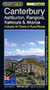
Canterbury And East Kent WATERPROOF

Map No. 179, Canterbury and East Kent, in a waterproof and tear-resistant version of the Ordnance Survey Landranger series at 1:50, 000, including Dover, Folkestone, Margate, Hythe, Deal, Ramsgate, Broadstairs, Herne Bay, Whitstable, Sandwich, Laysdown-on-Sea, Boughton Street, Selling, Blean, Upstreet, Minster, St. Nicholas at Wade, Chilham, Bridge, Wingham, Aylesham, Bossingham, Stelling Minnis, Tilmanstone, St. Margaret
RIP - This product is no longer available on our network. It was last seen on 25.09.2019

This page now acts as a permanent archive for this product. Add more information using the comments box below to ensure it can still be found by future generations.

Use our search facility to see if it is available from an alternative contributor.
  • Availability: Out Of Stock
  • Supplier: Stanfords
  • SKU: 9780755801794
Availability: In Stock
£10.39

Product Description

Map No. 179, Canterbury & East Kent, in a waterproof & tear-resistant version of the Ordnance Survey Landranger series at 1:50, 000, including Dover, Folkestone, Margate, Hythe, Deal, Ramsgate, Broadstairs, Herne Bay, Whitstable, Sandwich, Laysdown-on-Sea, Boughton Street, Selling, Blean, Upstreet, Minster, St. Nicholas at Wade, Chilham, Bridge, Wingham, Aylesham, Bossingham, Stelling Minnis, Tilmanstone, St. Margaret

Reviews/Comments

Add New

Price History

Vouchers

No voucher codes found.
Do you know a voucher code for this product or supplier? Add it to Insights for others to use.

Facebook

Jargon Buster

Waterproof - Resistant to water, usualy specified by depth in metres
Resistant - Something that can repel against something.

Supplier Information

Stanfords
Stanfords was established in 1853 and opened their iconic Covent Garden flagship store in 1901. They have become the top retailer of maps, travel books and accessories in the UK and arguably offer the largest selection of maps and travel books worldwide. Famous names such as Captain Robert Falcon Scott, Ranulph Fiennes and Michael Palin have purchased from Stanfords. They now have a shop in Bristol and both stores together with other venues operate a calendar of events including talks, book signings and exhibitions. As a specialist map retailer, the map selection is comprehensive and includes road maps, street maps and walking maps from worldwide destinations, as well as a selection of world atlases and wall maps. Books include travel guides and travel literature. Stanfords also stock globes, from miniatures made of blue marble to magnificent floor-standing globes. The website features a selection of interesting articles on travel topics.
Page Updated: 2023-11-12 20:15:36

Community Generated Product Tags

Oh No! The productWIKI community hasn't generated any tags for this product yet!
Menu