
 United Kingdom
 France
 Germany
 Netherlands
 Sweden
 USA
USA
 Italy
Italy
 Spain
Spain
More From Contributor


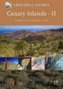
Canary Islands
Canary Islands at 1:150, 000 on a map from MairDumont with each island presented on a separate panel, plus street plans of central Santa Cruz de Tenerife and Las Palmas de Gran Canaria. A special feature of the “Marco Polo” maps and atlases is a set of seven peel-on/peel-off stickers which can be placed on the maps to help with navigating and removed without damaging the surface. The island’s topography is presented by unobtrusive relief shading with spot heights. National parks and other protected areas are highlighted. Road network emphasizes main and secondary routes, both shown with driving distances, but also includes local road and tracks. Scenic roads are highlighted. Ferry connections are also marked. Places of interest, including landscape features, are prominently
highlighted and given star rating. The panels have no geographical coordinates. The index is in a separate booklet attached to the map cover. Map legend includes English.Also provided is a small map of the whole Canary Islands archipelago showing ferry connections, plus street plans of central Santa Cruz de Tenerife and Las Palmas de Gran Canaria.
highlighted and given star rating. The panels have no geographical coordinates. The index is in a separate booklet attached to the map cover. Map legend includes English.Also provided is a small map of the whole Canary Islands archipelago showing ferry connections, plus street plans of central Santa Cruz de Tenerife and Las Palmas de Gran Canaria.
Product Description
Reviews/Comments
Add New
Vouchers
No voucher codes found.
Do you know a voucher code for this product or supplier? Add it to Insights for others to use.
Do you know a voucher code for this product or supplier? Add it to Insights for others to use.
 Denmark