More From Contributor

£6.95
Canada in the Culture Smart range of pocket-sized guide books; providing detailed information on local customs, culture, etiquette & manners & ensuring that visitors are prepared for a diverse range of social environments. The series covers an extensive number of countries worldwide & are designed both for those working & living abroad, as well as for visitors who do not want to offend, either intentionally or inadvertently. Their aim is to prevent readers from making embarrassing mistakes & feel confident in unfamiliar situations, while preparing them before arrival on what to expect & how to behave. Each guide is arranged thematically, with dedicated individual chapters on land & people, values & attitudes, customs & traditions, making friends, people at home, ...
Archived Product
£7.99
Canada in the Culture Smart range of pocket-sized guide books; providing detailed information on local customs, culture, etiquette & manners & ensuring that visitors are prepared for a diverse range of social environments. The series covers an extensive number of countries worldwide & are designed both for those working & living abroad, as well as for visitors who do not want to offend, either intentionally or inadvertently. Their aim is to prevent readers from making embarrassing mistakes & feel confident in unfamiliar situations, while preparing them before arrival on what to expect & how to behave. Each guide is arranged thematically, with dedicated individual chapters on land & people, values & attitudes, customs & traditions, making friends, people at home, ‘time-out’, travelling & communicating. There is also a separate chapter for business travelers, with important information on subjects such as business culture, meetings & making appointments. A Further Reading section also offers a list of recommended other history, travel literature & language titles available on the country. ...
Archived Product
£23.99
Canada & USA on an A4 spiral-bound road atlas from Map Art Publishing with 36 city maps for Canada & over 40 maps of towns & urban conurbations in USA. Canada is covered at different scales according to the density of urban development (see below), with for USA continuous coverage at 1:2, 130, 000 rather than state-by-state mapping at different scales. The maps show the road network on a background presenting the topography by relief shading, with names of mountain ranges, peaks, etc. National or provincial/state parks & other protected areas are highlighted. Road network

Includes::
secondary routes & selected local highways, with driving distances shown on main routes (within Canada also on secondary roads in south-eastern Ontario & southern Quebec). The maps also indicate 24-hour border crossings between the two countries. Railway lines are not included. The maps highlight various places of interest, & in the provincial/state parks indicate if camping facilities are provided. The maps have no geographical coordinates. The index is arranged by province/state. The atlas also provides numerous enlargements showing towns & cities are more detailed scale, indicating main traffic arteries. These plans are usually places on the relevant toad map pages; if placed elsewhere, the road mapping pages indicate where the street maps can be found.CANADA MAP SCALES vary according to the density of urban development: south-eastern Ontario & southern Quebec at 1:850, 000; south-eastern Quebec, Nova Scotia, New Brunswick & Prince Edward Island at 1:1, 060000; Newfound Land at 1, 440, 000; most of Labrador with the northern coast of the Gulf of St. Lawrence at 1:2, 550, 000; south-western Ontario with most of Manitoba, Saskatchewan, Alberta & British Columbia at 1:2, 100, 000; plus Yukon, Northwest Territories, Nunavut & the remaining parts of the other provinces at 1:6, 000, 000/1:6, 300, 000. UNITED STATES MAP SCALES: the atlas provides continuous mapping by overlapping pages at 2, 130, 000.PLEASE NOTE: following a number changes among Canadian cartographic publishers maps previously published by Map Art Publishing may now be available under one of the following imprints: Map Art, Canadian Cartographics Corporation or JDM Géo Inc. Within a series, therefore, some titles may still be published as Map Art whilst others will be available as Canadian Cartographics Corporation or JDM Géo Inc.

...
Archived Product
£13.99
Mountain ranges, rolling plains, lush rainforest & moonscape Badlands: get back to nature with Footprint's fully revised & updated guide to Western Canada. Now in its 3rd edition this guide gives you everything you need to get the most from the great outdoors, whether you want to strike out on your own or go with an adventure tour operator. Detailed listings include ranches & wilderness lodges, B&B s & bush camps, plus the best places to eat &, crucially, how to get around, whether it be by plane, train, snowcoach or water taxi! This title

Features:
in-depth listings of all the best adventure activities, from hiking & biking to canoeing, skiing, rock climbing & whitewater rafting, plus much more; coverage of British Columbia, the Rockies, Alberta & the Yukon; &, thorough listings of where to eat, sleep & drink to suit every budget, plus some secrets the locals normally keep to themselves.

...
Archived Product
£14.99
Western Canada in the Handbooks series from Footprint; comprehensive & leading guides designed & written for independent travellers who enjoy exploring off the beaten track. Footprint guides have an established reputation, built up since 1921, for catering for more adventurous & individual travellers. An unrestrictive editorial style also gives authors the freedom to capture & explore local cultures, sights & areas that are often not covered in other guides. Widely recognised for their reliability & independent writing style, Footprint guides all have the same layout. Introductory sections introduce the reader to the destination, with chapters on planning on your trip & essentials, including practical information & guidance on subjects such as when & where to go, itineraries, sport & activities, arts, getting there & around, eating & drinks, sleeping & a dedicated section on the anticipated carbon footprint involved in travelling to the destination. Each guide is organised geographically by region or country, with individual sections having a particular focus on an extensive range of sights & places of interest. Further, there are also details of accommodation, nightlife, restaurants & any notable local activities. Information boxes throughout the text give readers an insight into local customs, stories & sights of particular interest.A ...
Archived Product
£10.50
Central Canada in a series of three indexed, waterproof & tear-resistant road maps of the country with topographic & tourist information. The maps, published by Reise Know-How as part of their highly acclaimed World Mapping Project, are double-sided to provide the best balance between a good scale & a convenient size sheet. The map has altitude colouring with spot heights, graphics for swap areas, & plenty of names of geographical features, particularly rivers & lakes. National or provincial parks & other protected areas are highlighted. Road network

Includes::
selected minor local roads & tracks, & indicates routes suitable only for winter access. Intermediate distances are given on main roads. Railway lines, local airports are also shown. Symbols indicate locations of various places of interest & Indian reservations are marked. The map has a grid with latitude & longitude at intervals of 2º, plus an index of localities. Map legend

Includes::
English. To see the other maps in this series please click on the series link.


...
Archived Product
£7.99
Features of this title include: main chapters that focus on geography, people & culture, history, government & economy, & nature; ' At a Glance' double spreads to present a maximum amount of information in a minimal amount of space, utilizing charts, tables, time lines, & other highly visual elements; &, full-page maps that highlight physical features, vegetation & ecosystems, history, population, & political organization. As a bonus, every photograph within each chapter is tied to a location on the main map for that chapter. The work features smaller maps that zoom in on special topics, such as migration, rainfall, changing borders, resources, industry, & other important themes. It

Includes::
special feature sidebars that introduce intriguing people, places, & events, & a glossary to aid in comprehension of unfamiliar terms. It presents an extensive bibliography that lists books, National Geographic articles, & Web sites.

...
Archived Product
£12.99
Canada in Marshall Cavendish`s Culture Shock! Series; comprising a range of guides that inform visitors of the finer points & details relating to social etiquette, traditions & customs; bringing visitors to a sensitive yet substantial understanding of the country or city in question. The series targets those who are planning long stays in the destination or extended periods of residence. The guides are written by authors who have experienced the joys & pitfalls of cultural adaptation, & so are ideally placed to provide informative & relevant advice. Each title contains insights into local culture & traditions, guidance on adapting to the local environment, linguistic help & lots of general advice about local culture & idiosyncrasies to help prepare readers for their visit. Each title is structured similarly, beginning with the first impressions a visitor might expect to have. The guides aim to help readers understand the local culture through first appreciating the motivations, beliefs & attitudes of the local people. Practical advice on settling in is provided, with focused sections on accommodation, utilities, health, education & telecommunications. There is also extensive information on the destination’s culture, food & leisure, in addition to a specific section addressing the concerns of those travelling on business. ...
Archived Product
£6.50
Topographic coverage of mainland Spain at 1:25, 000 published by the Centro Nacional de Información Geograficá, the country’s civilian survey organization. The maps have contours at 10m intervals & colouring and/or graphics to show different types of vegetation or land use. Boundaries of national parks & other protected areas are marked. In addition to all the usual information shown on topographic maps at this scale, detailed presentation of the road & rail networks, rural tracks & paths, etc, the maps also show campsites. The maps have a 1-km UTM grid, with margin ticks for latitude & longitude at 1` intervals. Map legend is in Spanish only.PLEASE NOTE: our grid for the whole of Spain is in preparation
- in the meantime, for areas other than those shown on the attached grid please use CNIG’s topographic survey at 1:50, 000 by searching for ‘SI00000832’. Each 25K map covers one quarter of the corresponding 50K map, with the numbering system: I = NW quarter, II = NE quarter, III = SW quarter & IV = SE quarter. CNIG maps in the Provincial Road Maps series at 1:200, 000 are overprinted with the grid for the 1:50, 000 survey & can be used to see the area covered by each 50K or 25K title in more detail. To see the list of titles in this series please click on the series grid
- for map numbers not yet listed on our website please contact us by email.

...
Archived Product
£13.59
Canada in the Discover series from Lonely Planet; covering a range of countries worldwide & practically designed to allow travellers to find the most iconic sites & attractions at a glance. Uniquely designed, each title in the series

Includes::
a series of lists of the best things to do & see, with highlights, thematic

...
Archived Product

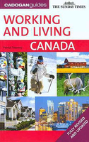
Canada - Working & Living

Canada in Cadogan’s Working and Living guide series; targeted at those who are moving abroad to live and work. The guides provide an unrivalled wealth of expert legal and financial advice and guidance on tackling red tape. They examine and recommend the best places to live and work, incorporating both places in the city and in the countryside, in addition to discussing the benefits and pitfalls of employment, going freelance or starting your own business. Written by authors who have lived and worked in each country, they also offer the personal experiences of people who have already overcome the challenges of emigrating. Individual titles have the same structure guiding readers through the emigration process. Extensive introductory chapters help acquaint readers with the country,
with information such as climate, geography and history in addition to comprehensive profiles of each region. A Chapter on the country ‘today’ illuminates issues such as the major political parties, religion, major media and food and wine. There are also dedicated chapters on First Steps – including the reasons for emigrating to the country and how to get there – and Red Tape, covering issues such as visas, permits and paperwork, tax, residency requirements, administrative departments and citizenship.
RIP - This product is no longer available on our network. It was last seen on 25.09.2019

This page now acts as a permanent archive for this product. Add more information using the comments box below to ensure it can still be found by future generations.

Use our search facility to see if it is available from an alternative contributor.
  • External links may include paid for promotion
  • Availability: Out Of Stock
  • Supplier: Stanfords
  • SKU: 9781860114045
Availability: In Stock
£13.99

Product Description

Canada in Cadogan’s Working & Living guide series; targeted at those who are moving abroad to live & work. The guides provide an unrivalled wealth of expert legal & financial advice & guidance on tackling red tape. They examine & recommend the best places to live & work, incorporating both places in the city & in the countryside, in addition to discussing the benefits & pitfalls of employment, going freelance or starting your own business. Written by authors who have lived & worked in each country, they also offer the personal experiences of people who have already overcome the challenges of emigrating. Individual titles have the same structure guiding readers through the emigration process. Extensive introductory chapters help acquaint readers with the country, with information such as climate, geography & history in addition to comprehensive profiles of each region. A Chapter on the country ‘today’ illuminates issues such as the major political parties, religion, major media & food & wine. There are also dedicated chapters on First Steps – including the reasons for emigrating to the country & how to get there – & Red Tape, covering issues such as visas, permits & paperwork, tax, residency requirements, administrative departments & citizenship.

Reviews/Comments

Add New

Intelligent Comparison

Oooops!
We couldn't find anything!
Perhaps this product's unique.... Or perhaps we are still looking for comparisons!
Click to bump this page and we'll hurry up.

Price History

Vouchers

No voucher codes found.
Do you know a voucher code for this product or supplier? Add it to Insights for others to use.

Facebook

Jargon Buster

Wine - An alcoholic drink made from fermented grapes.
Red - One of the three primary colours
History - Anything that happens in the past. An acedemic subject.
Parties - A gathering of people to celebrate and event or occasion
Personal - Something that belongs more to an individual due to it affecting them more by relating to them.
Individual - A single separate item or person.

Supplier Information

Stanfords
Stanfords was established in 1853 and opened their iconic Covent Garden flagship store in 1901. They have become the top retailer of maps, travel books and accessories in the UK and arguably offer the largest selection of maps and travel books worldwide. Famous names such as Captain Robert Falcon Scott, Ranulph Fiennes and Michael Palin have purchased from Stanfords. They now have a shop in Bristol and both stores together with other venues operate a calendar of events including talks, book signings and exhibitions. As a specialist map retailer, the map selection is comprehensive and includes road maps, street maps and walking maps from worldwide destinations, as well as a selection of world atlases and wall maps. Books include travel guides and travel literature. Stanfords also stock globes, from miniatures made of blue marble to magnificent floor-standing globes. The website features a selection of interesting articles on travel topics.
Page Updated: 2023-11-12 20:15:36

Community Generated Product Tags

Oh No! The productWIKI community hasn't generated any tags for this product yet!
Menu