
 United Kingdom
 France
 Germany
 Netherlands
 Sweden
 USA
USA
 Italy
Italy
 Spain
Spain
More From Contributor


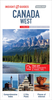


Canada West Reise Know-How
Western Canada in a series of three indexed, waterproof and tear-resistant road maps of the country with topographic and tourist information. The maps, published by Reise Know-How as part of their highly acclaimed World Mapping Project, are double-sided to provide the best balance between a good scale and a convenient size sheet. The area is divided north/south, with a good overlap between the two sides. Coverage on the north side extends beyond 70º of latitude and 110º west of longitude to include the western end of the Northwest Passage and most of the Northwest Territories. The southern side extends eastwards to cover virtually all of Alberta with Calgary, Edmonton and the Banff and Jasper National Parks. The map has altitude colouring with spot heights and plenty of names of
mountain and hill ranges, plateaux, peaks, passes, rivers and lakes. National and provincial parks and other protected areas are highlighted. Road network indicates unpaved sections of main and secondary routes, includes minor roads and tracks, and shows winter roads. Intermediate distances are given on main routes. Railway lines and ferry connections are also shown. Symbols mark locations of various places of interest including natural sites and UNESCO World Heritage areas, selected campsites and refuges, bird sanctuaries, ski areas, etc. The map has a grid with latitude and longitude at intervals of 2º, plus an index of localities. Map legend includes English.To see the other maps in this series please click on the series link.
mountain and hill ranges, plateaux, peaks, passes, rivers and lakes. National and provincial parks and other protected areas are highlighted. Road network indicates unpaved sections of main and secondary routes, includes minor roads and tracks, and shows winter roads. Intermediate distances are given on main routes. Railway lines and ferry connections are also shown. Symbols mark locations of various places of interest including natural sites and UNESCO World Heritage areas, selected campsites and refuges, bird sanctuaries, ski areas, etc. The map has a grid with latitude and longitude at intervals of 2º, plus an index of localities. Map legend includes English.To see the other maps in this series please click on the series link.

Product Description
Reviews/Comments
Add New
Vouchers
No voucher codes found.
Do you know a voucher code for this product or supplier? Add it to Insights for others to use.
Do you know a voucher code for this product or supplier? Add it to Insights for others to use.
 Denmark