More From Contributor

£3.25
This is a beautiful & unique wrapping paper featuring a map of central London from Cavallini & Co. measuring 51x 71 cm (20”x 28”). It is printed on thick quality Italian laid paper stock. Please note that this is not an up to date street plan of London. Perfect for wrapping special presents. Its high decorative & historical qualities make it also ideal for framing & other creative purposes. ...
Archived Product
£9.95
Canada's Maritime Provinces: Nova Scotia, New Brunswick & Prince Edward Island & 1:530, 000 on a double-sided indexed map from the Vancouver-based ITMB with street plans of central Halifax & Sydney. The region is divided east/west with a good overlap & a separate index for each side. Topography is shown by altitude coluring in feet, although spot heights are given in metres. National parks & other protected areas are highlighted. Road network

Includes::
selected local tracks & gives driving distances on main routes. Ferry connections, railways & local airports are marked. Symbols indicate various places of interest. Latitude & longitude lines are drawn at 1

...
Archived Product
£7.99
Canadian Rockies, including the Banff & Jasper National Parks, in a series of contoured & GPS compatible recreational maps at scales from 1:100, 000 to 1:20, 000, plus extensive tourist information: descriptions of hiking or cycling trails, scenic drives, resort maps, etc. Most titles are now printed on light, waterproof & tear-resistant synthetic paper. All the maps provide a vivid presentation of the topography through contours (usually 25m or 50m) enhanced by relief shading, colouring & spot heights (given in metres & feet). Extensive overprint and/or symbols indicate trails, facilities for various recreational pursuits, campsites & other accommodation, etc. Many trails are cross-referenced to descriptions provided on the map. The maps have a UTM grid. For more details of each title please see its individual description. ...
Archived Product
£19.95
Canada’s national parks in a series of GPS compatible recreational maps at various scales from Go Trekkers highlighting recreational possibilities including trekking and/or snowshoe trails, canoeing & kayaking routes, campgrounds, warden stations, etc. Cartography varies according to the terrain of the national park, but the maps are contoured & have spot heights plus, as appropriate, graphics to show wetlands, relief shading in mountainous areas, etc. All the titles are GPS compatible with either a UTM or latitude/longitude grid. Presentation of trails, recreational facilities such as campgrounds, access to the park by road or air, etc, also varies according to what each park has to offer & where it is situated. Each map also

Includes::
notes about the park.

...
Archived Product
£9.99
A series of detailed road maps of various regions of British Columbia from the Vancouver-based ITMB, providing both convenient coverage for easy access from Vancouver to the national parks of the Canadian Rockies & detailed mapping of other popular parts of the province including Vancouver Isl&. Cartography & presentation vary, with most maps using altitude colouring to indicate the topography. The maps also include tourist information, highlighting accommodation facilities, campsites & recreational areas, etc. For more information see individual descriptions of the titles. ...
Archived Product
£9.99
Topographic survey of selected areas of British Columbia & the Canadian Rockies from ITMB with cartography from Canada’s national survey organization. Most sheets are printed on light, waterproof & tear- resistant plastic paper. Whilst the Canadian Department of Natural Resources (previously Canada Map Office) decides whether to provide updated pre-printed editions of its survey mapping or switch to print-on-demand only, in 2007 it began co-operating with ITMB on this new series of maps with cartography of the Canadian topographic survey & additional tourist & recreational information provided by ITMB. The maps are double-sided, with either two 1:50, 000 maps combined in one title, or a 1:250, 000 map supplemented by more detailed coverage at 1:50, 000. * For contour interval, geographical coordinates & the amount of additional information provided by ITMB please see individual descriptions.* ...
Archived Product
£8.99
Canadian provinces & popular tourist regions on road maps from the Map Art / Canadian Cartographics Corporation / JDM Géo group, with most titles also providing several additional panels with street plans of local towns. Selected areas are also available on waterproof & tear-resistant “ Fast Track” maps. For more information please see individual descriptions.PLEASE NOTE: titles from the Map Art / Canadian Cartographics Corporation / JDM Géo publishing group are sometimes, without notice, changed from one imprint to another and/or published at different scales or with different additional insets to those specified on our website. Information is being regularly updated as it becomes available from the publishers. ...
Archived Product
£12.99
Road atlases of Canadian provinces & popular tourist regions from the Map Art / Canadian Catrographics Corporation / JDM Géo group, published in an A4 format & with selected provinces also available in a handy pocket size. Scales vary according to the size of the overall area covered by the atlas, with some titles also providing more detailed mapping for the more densely populated parts. For more information please see individual descriptions.PLEASE NOTE: titles from the Map Art / Canadian Cartographics Corporation / JDM Géo publishing group are sometimes, without notice, changed from one imprint to another and/or published at different scales or with different additional insets to those specified on our website. Information is being regularly updated as it becomes available from the publishers. ...
Archived Product
£7.99
Street plans & pocket street atlases of Canadian towns & cities from the Map Art / Canadian Cartographics Corporation / JDM Géo publishing group, produced at scales around 1:25, 000 to 1:35, 000 with smaller towns often shown at more detailed scales. Larger cities are also covered on waterproof & tear-resistant “ Fast Track” maps which can be annotated with suitable marker pens, or presented in street atlases. All plans have street indexes. Plans of larges cities usually include an enlargement for the downtown area. Plans grouping together several smaller towns often have an overview map showing the whole of the relevant region. The plans have colouring to indicate commercial, institutional or industrial use, etc. Main traffic arteries are highlighted & one way streets are marked. A range of symbols shows, as appropriate, parking facilities, bus terminals, metro and/or railway stations, various public facilities & services, places of interest, recreational centres, etc.PLEASE NOTE: street plans & atlases from the Map Art / Canadian Cartographics Corporation / JDM Géo publishing group are sometimes, without notice, changed from one imprint to another and/or published at different scales or with different additional insets to those specified on our website. Information is being regularly updated as it becomes available from the publishers. ...
Archived Product
£28.99
Popular tourist regions of British Columbia, the Rockies & Atlantic Provinces in a series of high quality contoured, GPS compatible atlases from Mussio Ventures, with extensive guides to recreational pursuits including hiking, off-road cycling, quad biking, fishing, etc. Each title is in a spiral-bound, A4 format & contains a detailed atlas section with contours excellently enhanced by altitude coluring & relief shading to provide an almost 3-D representation of the terrain. Further colouring indicates provincial or national parks & other conservation areas, First Nation lands & restricted access grounds. Detailed classification of the road network

Includes::
logging roads & 4WD tracks. Where appropriate, railways, local airports or airstrips & ferry connections are included.A wide range of symbols highlights various recreational areas & facilities, campsites & trailer parks, etc. An overprint indicates long-distance hiking paths, quod bike (ATV) routes, snowmobile trails, etc. The atlases are GPS compatible with a UTM grid & latitude/longitude margin ticks. The maps are followed by an extensive guide section providing descriptions of various parks & recreational areas; fishing lakes & rivers; hiking, cycling & quad (ATV) trails; wildlife viewing; winter sports, etc. The index covers both the atlas & the guide section.* For more information see individual descriptions.*

...
Archived Product

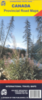
Canada: ITMB Provincial Road Maps

Canadian provinces in a series of double-sided maps from the Vancouver-based ITMB, with topography presented by altitude colouring rather than by relief shading. Tourist information includes places of interest, recreational facilities, etc., and some titles also provide street plans of main towns. *For more information see descriptions of individual titles.*
RIP - This product is no longer available on our network. It was last seen on 25.09.2019

This page now acts as a permanent archive for this product. Add more information using the comments box below to ensure it can still be found by future generations.

Use our search facility to see if it is available from an alternative contributor.
  • External links may include paid for promotion
  • Availability: Out Of Stock
  • Supplier: Stanfords
  • SKU: SI00000785
Availability: In Stock
£9.99

Product Description

Canadian provinces in a series of double-sided maps from the Vancouver-based ITMB, with topography presented by altitude colouring rather than by relief shading. Tourist information

Includes::
places of interest, recreational facilities, etc., & some titles also provide street plans of main towns. * For more information see descriptions of individual titles.*

Reviews/Comments

Add New

Intelligent Comparison

Oooops!
We couldn't find anything!
Perhaps this product's unique.... Or perhaps we are still looking for comparisons!
Click to bump this page and we'll hurry up.

Price History

Vouchers

No voucher codes found.
Do you know a voucher code for this product or supplier? Add it to Insights for others to use.

Facebook

Jargon Buster

Road - a manmade lane or a path that is used to speed up travel.
Altitude - Something that can be quite high in relation to sea or ground level.
Individual - A single separate item or person.

Supplier Information

Stanfords
Stanfords was established in 1853 and opened their iconic Covent Garden flagship store in 1901. They have become the top retailer of maps, travel books and accessories in the UK and arguably offer the largest selection of maps and travel books worldwide. Famous names such as Captain Robert Falcon Scott, Ranulph Fiennes and Michael Palin have purchased from Stanfords. They now have a shop in Bristol and both stores together with other venues operate a calendar of events including talks, book signings and exhibitions. As a specialist map retailer, the map selection is comprehensive and includes road maps, street maps and walking maps from worldwide destinations, as well as a selection of world atlases and wall maps. Books include travel guides and travel literature. Stanfords also stock globes, from miniatures made of blue marble to magnificent floor-standing globes. The website features a selection of interesting articles on travel topics.
Page Updated: 2023-11-12 20:15:36

Community Generated Product Tags

Oh No! The productWIKI community hasn't generated any tags for this product yet!
Menu