More From Contributor
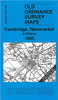
£8.99
Cambridge in the Cassini Past & Present map series which covers town & cities of England & Wales & offers a unique way of tracing their history & expansion by showing four different periods of their development using Ordnance Survey mapping from the mid-19th century, the late 19th century, the 1920s & the present day. Coverage

Includes::
Bottisham, Fen Ditton, Fulbourn, Girton, Great Shelford, Histon, Lode, Milton, Oakington & Sawston. Each Past & Present map consists of four panels, all centred on a city or a town & covering exactly the same 15km x 15km area. Three of the panels reproduce Ordnance Survey

...
Archived Product
£1.99
The ultimate pocket city map of Cambridge! Explore the historic city of Cambridge with ease with the help of this genuinely pocket-sized, pop-up map. Small in size yet big on detail, this compact, dependable, city map will ensure you don't miss a thing.

Includes::
a Pop Out map featuring detailed street layout of the central city area, including all the colleges Additional What To See... How To Get There section on back cover helps identify all key points of interest Handy, self-folding, tourist map is small enough to fit in your pocket yet offers extensive coverage of the city in an easy-to-use format Thorough street index is also featured & cross-referenced to the map so you can easily find your destination

...
Archived Product
£1.99
Explore the academic gem of Cambridge with the help of this genuinely pocket-sized, pop-up map. Small in size yet big on detail, this compact, dependable, Cambridge city map will ensure you don`t miss a thing. *

Includes::
a Pop Out map featuring detailed street map of the central city area, including all the colleges* Additional What To See... How To Get There section on back cover helps identify all key points of interest * Handy, self-folding, tourist map is small enough to fit in your pocket yet offers extensive coverage of the city in an easy-to-use format * Thorough street index is also featured & cross-referenced to the map so you can easily find your destination * Hotels, restaurants, stores & attractions are all included on the maps Ideal to pop in a pocket or bag for quick reference while exploring this wonderful city.

...
Archived Product
£20.00
The Cambridge Star Atlas is a particularly fine celestial atlas for beginners & more experienced amateur astronomers, observing with the naked eye, binoculars or small telescopes. Clearly laid out in two main sections: monthly sky maps & a general star atlas that shows stars down to magnitude +6. Each celestial chart page in the atlas section is paired with a facing page which lists the main variable & double stars, clusters, nebulae & galaxies for that map.

Includes::
a map of the visible side of the moon listing the Mare & main craters.

...
Archived Product
£15.99
Cambridge University Press’s Concise History series explores the history of a range of countries worldwide. Chronicling the country’s modern history since the Middle Ages, each title in the series has been comprehensively researched & written by an academic specialising in the field. Individual chapters chart the history of the nation, either by century or notable periods in its past, & are aimed both at those studying at undergraduate level or who may have a deeper interest in the country. ...
Archived Product
£14.99
Parts of Cambridgeshire, Suffolk & Essex with Cambridge, Newmarket & Saffron Walden, including part of the E2 European Long-distance path, on a waterproof & tear-resistant OS Active version of map No. 154 from the Ordnance Survey’s Landranger series at 1:50, 000, with contoured & GPS compatible topographic mapping plus tourist information.MOBILE DOWNLOADS: As well as the physical edition of the map, each Landranger title now

Includes::
a code for downloading after purchase its digital version onto your smartphone or tablet for viewing on the OS smartphone app.OS LANDRANGER SERIES: to see the list of all the titles in the OS Landranger series, both paper & waterproof versions, please click on the series link. Maps in the Landranger series provide plenty of recreational & tourist information, indicating the traditional public right of way paths (except in Scotland where different laws apply), including bridleways & byways restricted or open to motorized traffic. National Trails & selected other long-distance paths are marked, as well as on-road & traffic-free cycle routes with their National/ Regional Cycle Network numbers. National Trust/ National Trust for Scotland & Forestry Commission land is clearly marked, indicating open or restricted access. A range of symbols highlights camping & caravanning sites, youth hostels, tourist information offices & visitors’ centres, parking & picnicking places, World Heritage sites, sport & recreational facilities, etc. The maps provide detailed presentation of topography with contours at 10m intervals, numerous spot heights & additional colouring and/or graphics for different types of woodlands, orchards or parkl&, rock features including scree & cliffs, water features inland & along the sea shore with marshl&, dunes, s&, mud, shingle & the high water mark. All the standard information expected of survey mapping at this scale is included: finely graded road network, railway lines with stations, cuttings, embankments, etc; individual isolated buildings; archaeological & historical sites, etc. For GPS users the British National Grid is shown at 1km intervals, with latitude & longitude given by margin ticks at 1` & cross hairs on the map at 5`. Each map covers an area of 40 x 40km, (approx. 25 x 25 miles).

...
Archived Product
£3.50
Cambridge, Newmarket & District in 1905 in a series of reproductions of Ordnance Survey’s famous ” Inch to the Mile” maps published in the Alan Godfrey Editions to provide a historical record of England & Wales in the second half of 19th & early 20th century. Cambridge is at the foot of the map & coverage extends northward to Wilburton & Soham, & from Oakington eastward to Cheveley & Worlington. Other locations include Bottisham, Burwell, Chesterton, Chippenham, Coton, Cottenham, Dullingham, Fen Ditton, Fordham, Girton, Great Wilbraham, Haddenham, Histon, Horningsea, Impington, Isleham, Landbeach, Landwade, Little Wilbraham, Lode, Milton, Rampton, Snailwell, Stetchworth, Stow cum Quy, Stretham, Swaffham Bulbeck, Swaffham Prior, Teversham, Waterbeach. On the reverse is an extract from Cambridgeshire Sheet 40.04 showing Waterbeach in detail, complete with directory. About the Alan Godfrey Editions of the OS Inch to the Mile Maps: the maps provide an invaluable overview of a wider area, typically 18 x 12 miles (29 x 19 kms approx.), & offer historical mapping for small towns & villages not covered by the more detailed series for which the Godfrey Editions are better known. On the reverse all the maps have historical notes & most titles also include a more detailed, large scale map of a small town or a village in the area. To see other titles in this series please click on the series link. ...
Archived Product
£8.99
Parts of Cambridgeshire, Suffolk & Essex with Cambridge, Newmarket & Saffron Walden, including part of the E2 European Long-distance path, on a paper version of map No. 154 from the Ordnance Survey’s Landranger series at 1:50, 000, with contoured & GPS compatible topographic mapping plus tourist information.MOBILE DOWNLOADS: As well as the physical edition of the map, each Landranger title now

Includes::
a code for downloading after purchase its digital version onto your smartphone or tablet for viewing on the OS smartphone app.OS LANDRANGER SERIES: to see the list of all the titles in the OS Landranger series, both paper & waterproof versions, please click on the series link. Maps in the Landranger series provide plenty of recreational & tourist information, indicating the traditional public right of way paths (except in Scotland where different laws apply), including bridleways & byways restricted or open to motorized traffic. National Trails & selected other long-distance paths are marked, as well as on-road & traffic-free cycle routes with their National/ Regional Cycle Network numbers. National Trust/ National Trust for Scotland & Forestry Commission land is clearly marked, indicating open or restricted access. A range of symbols highlights camping & caravanning sites, youth hostels, tourist information offices & visitors’ centres, parking & picnicking places, World Heritage sites, sport & recreational facilities, etc. The maps provide detailed presentation of topography with contours at 10m intervals, numerous spot heights & additional colouring and/or graphics for different types of woodlands, orchards or parkl&, rock features including scree & cliffs, water features inland & along the sea shore with marshl&, dunes, s&, mud, shingle & the high water mark. All the standard information expected of survey mapping at this scale is included: finely graded road network, railway lines with stations, cuttings, embankments, etc; individual isolated buildings; archaeological & historical sites, etc. For GPS users the British National Grid is shown at 1km intervals, with latitude & longitude given by margin ticks at 1` & cross hairs on the map at 5`. Each map covers an area of 40 x 40km, (approx. 25 x 25 miles).

...
Archived Product
£5.95
Cambridgeshire in a series of colourful reproductions of attractive county maps by John Speede from about 1610-1611, printed on thick art paper & ideal for framing. Each title, 58 x 45cm / approx. 23” x 18”, is decorated with additional notes, drawings, coats of arms, street plans, etc. Little drawings are used to show locations of towns, larger villages, hills & woodlands or parks. Rivers & lakes are also drawn, as are boundaries of the administrative subdivisions with the names of the Hundreds. Surrounding the county are decorative panels filled with additional information which differs from title to title: street plans, coats of arms of notable local families, geographical features, notes about local history, etc. ...
Archived Product
£9.99
Cambridgeshire & East Midlands in the AA 50 Walks series; comprising an extensive range of walking guides helping you to explore the best walking routes in Great Britain. Each guide covers a total of 50 walks, many of which are circular, between 2-10 miles & also that are suitable for a range of different walking standards. Every walk in the guides has an information box showing clear details of distance, minimum time, level of difficulty, any ascents, the nature of the terrain & landscape, suggested Ordnance Survey map, grid references for starting & finishing points, dog friendliness, parking & any public toilets en route. There are also suggestions of what to look out for & recommended places to eat & drink. Detailed walk descriptions are accompanied by clear mapping of the route ahead, in addition to colour photographs illustrating the highlights of selected routes. ...
Archived Product

Cambridge Z-Map

Combines a map of Cambridge on one side with useful and engaging travel information on the reverse. Subjects covered include top attractions, a day planner, a guide to eating out and advice on getting around. Designed to make viewing and folding easy, this map is ideal for those taking a short city break.
RIP - This product is no longer available on our network. It was last seen on 25.09.2019

This page now acts as a permanent archive for this product. Add more information using the comments box below to ensure it can still be found by future generations.

Use our search facility to see if it is available from an alternative contributor.
  • Availability: Out Of Stock
  • Supplier: Stanfords
  • SKU: 9789812464774
Availability: In Stock
£1.99

Product Description

Combines a map of Cambridge on one side with useful & engaging travel information on the reverse. Subjects covered include top attractions, a day planner, a guide to eating out & advice on getting around. Designed to make viewing & folding easy, this map is ideal for those taking a short city break.

Reviews/Comments

Add New

Intelligent Comparison

Oooops!
We couldn't find anything!
Perhaps this product's unique.... Or perhaps we are still looking for comparisons!
Click to bump this page and we'll hurry up.

Price History

Vouchers

No voucher codes found.
Do you know a voucher code for this product or supplier? Add it to Insights for others to use.

Facebook

Jargon Buster

Day - The time it takes a planet or other space objects to complete one rotation.
Ideal - Something that satisfies a perfect criteria.

Supplier Information

Stanfords
Stanfords was established in 1853 and opened their iconic Covent Garden flagship store in 1901. They have become the top retailer of maps, travel books and accessories in the UK and arguably offer the largest selection of maps and travel books worldwide. Famous names such as Captain Robert Falcon Scott, Ranulph Fiennes and Michael Palin have purchased from Stanfords. They now have a shop in Bristol and both stores together with other venues operate a calendar of events including talks, book signings and exhibitions. As a specialist map retailer, the map selection is comprehensive and includes road maps, street maps and walking maps from worldwide destinations, as well as a selection of world atlases and wall maps. Books include travel guides and travel literature. Stanfords also stock globes, from miniatures made of blue marble to magnificent floor-standing globes. The website features a selection of interesting articles on travel topics.
Page Updated: 2023-11-12 20:15:36

Community Generated Product Tags

Oh No! The productWIKI community hasn't generated any tags for this product yet!
Menu