-
Home
-
Contributors
-
International
-
Account
-
Information
More From Contributor
- with a fun-seeking & cost-conscious slant. It provides ...
Includes:: 2 Pop Out maps
- an overview of Greater Cairo with an inset map of the Giza Pyramids, & a detailed street map of central Cairo Additional maps showing scuba diving sites along the Southern Sinai Peninsula, Egypt's location (with major sites of interest along the Nile) & the Cairo Metro are also included Handy, self-folding, tourist map is small enough to fit in your pocket yet offers extensive coverage of the city in an easy-to-use format Thorough street index is also featured & cross-referenced to the map so you can easily find your destination Key places of interest are listed offering you advice on the best things to see ...
- but the Germans were pushed back & Cairo life went on. Meanwhile, in the Egyptian Army, a handful of young officers were thinking dangerous thoughts. ...

Cairo F&B
This page now acts as a permanent archive for this product. Add more information using the comments box below to ensure it can still be found by future generations.
Use our search facility to see if it is available from an alternative contributor.
- External links may include paid for promotion
- Availability: Out Of Stock
- Supplier: Stanfords
- SKU: 9783707909074
Product Description
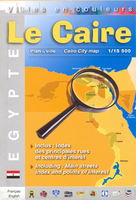
Indexed street plan of Cairo from Freytag &n Berndt, covering a substantial part of the city, from the Zomor Canal road in the west to the Al-Ahzar University area in the west, & from the northern tip of Zamalek Island to the Cairo Zoo in the south. An inset extends the coverage south to include the southern end of Rôda Island & Old Cairo. The cartography highlights main roads &
Includes:: ferries, railway & metro lines & stations. Colours distinguish built-up areas, public or notable buildings, industrial zones, parks & sports grounds, & symbols indicate places of interest & various facilities, including museums & monuments, tourist information offices, mosques & churches, etc. Multilingual legend
Includes:: English & the street index is on the reverse.
Reviews/Comments
Add New
Intelligent Comparison
Price History
Vouchers
Do you know a voucher code for this product or supplier? Add it to Insights for others to use.


 United Kingdom
 France
 Germany
 Netherlands
 Sweden
 USA
USA
 Italy
Italy
 Spain
Spain


 Denmark