More From Contributor
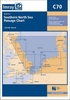
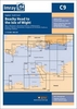
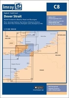
£19.95
Plans included: Loch Inchard (Kinlochbervie) (1:12 500) Loch Inver (1:15 000) Ullapool (1:10 000) Stornoway Harbour (1:15 000) Loch Carloway (1:20 000) On this 2017 edition the latest depth surveys have been included. The chart

Specification has been enhanced to show coloured light flashes. There has been general updating throughout.

...
Archived Product
£19.95
This Imray’s series of charts for the Western Europe

Includes::
comprehensive & easy-to-use sailing charts

...
Archived Product
£19.95
Plans included: Carnlough Harbour (sketch plan) Larne (1:18, 500) Carrickfergus (1:15, 000) Bangor Bay (1:17, 500) Donaghadee Sound (1:25, 000) Entrance to Strangford Lough (1:37, 500) Portaferry Marina (1:7, 500) Strangford (1:5, 000) Ardglass (1:15, 000) Stranraer (1:12, 500) Portpatrick (1:6, 000) This 2013 edition has been fully updated throughout using the latest available depth surveys. ...
Archived Product
£19.95
Plans included: Newquay Bay (1:10 000) Saint Ives (1:15 000) St Mary`s Road (1:25 000) Hugh Town (1:10 000) Mousehole (1:5000) Newlyn Harbour (1:12 000) Penzance (1:12 000) Saint Michael`s Mount (1:12 500) Porthleven (1:5000) Mullion Cove (1:7500) For this 2014 edition the chart has been fully updated using extensive new depth surveys throughout. ...
Archived Product
£19.95
Imray’s series of charts of Northwest Europe are comprehensive & easy-to-use sailing charts published on rip-proof, waterproof paper- ideal to be used on small tables or in cockpits. They show detailed coastline & depth information, & are constantly corrected to reflect latest information. The C Charts offer coverage for cruising on larger-size sheets; they are suitable for offshore passage making & the medium scales chosen also allow safe inshore navigation. This chart is a low-scale passage chart of the southern North Sea, showing the eastern British coast from Dundee to the Dover Strait, & the continental coasts of northern France, Belgium, the Netherlands, Germany & Denmark, from Calais to Thyborøn. Each chart contains insets showing local harbours annotated with symbols indicating what facilities can be found there (marinas, mooring & berth facilities, fuel, water, chandlers, etc.). Depths are shown in metres. Charts are fully updated to the latest printing date, & often include further corrections on a separate sheet. Subsequent corrections can be found on the Imray website. Positions referring to WGS84 Datum, such as most GPS readings, can be plotted directly onto these charts. Base cartography uses contours, several levels of colour shading, & spot measurements to indicate depth relative to Lowest Astronomical Tide, including distinct colour highlighting for tidally-covered l&. A large number of hatchings & markings are used to indicate coast types, salt flats, marshl&, etc. Compliant IALA ‘ System A’ buoys are clearly marked, & indications of other navigational aides such as light floats are given where possible. Lighthouses are clearly marked with arcs of visibility. A complex & comprehensive system of symbols is used to indicate all types of submerged obstructions, including wrecks, rocks, pipelines & cables, with depths where known. Flood tides, eddies races, ebb tide streams & other current information is given. A wide range of symbols indicate onshore features, anchorages, harbour details & other points of note. Danger areas, restricted areas & traffic zones are all shown. ...
Archived Product
£19.95
Plans included: Portsmouth, Langstone & Chichester Harbours (1:55, 000) Littlehampton (1:13, 500) Shoreham Harbour (1:20, 000) Brighton Marina (1:8, 500) Newhaven (1:16, 500) Sovereign Harbour (1:15, 000) On this 2013 edition, the latest known depths have been applied throughout the chart, particularly at Shoreham Harbour, Newhaven & Sovereign Harbour. ...
Archived Product
£6.50
Topographic coverage of mainland Spain at 1:25, 000 published by the Centro Nacional de Información Geograficá, the country’s civilian survey organization. The maps have contours at 10m intervals & colouring and/or graphics to show different types of vegetation or land use. Boundaries of national parks & other protected areas are marked. In addition to all the usual information shown on topographic maps at this scale, detailed presentation of the road & rail networks, rural tracks & paths, etc, the maps also show campsites. The maps have a 1-km UTM grid, with margin ticks for latitude & longitude at 1` intervals. Map legend is in Spanish only.PLEASE NOTE: our grid for the whole of Spain is in preparation
- in the meantime, for areas other than those shown on the attached grid please use CNIG’s topographic survey at 1:50, 000 by searching for ‘SI00000832’. Each 25K map covers one quarter of the corresponding 50K map, with the numbering system: I = NW quarter, II = NE quarter, III = SW quarter & IV = SE quarter. CNIG maps in the Provincial Road Maps series at 1:200, 000 are overprinted with the grid for the 1:50, 000 survey & can be used to see the area covered by each 50K or 25K title in more detail. To see the list of titles in this series please click on the series grid
- for map numbers not yet listed on our website please contact us by email.

...
Archived Product
£11.50
Cañón del Río Lobos Natural Park at 1:25, 000 in a series of GPS compatible maps from Editorial Piolet with cartography based on Spain’s civilian topographic survey overprinted with hiking routes & other tourist information. Hiking maps in the Editorial Piolet series, unless indicated to the contrary in the individual description, have contours at 10m intervals, enhanced by relief shading and/or altitude colouring, & provide very detailed presentation of the terrain & local road network. An overprint highlights hiking routes, distinguishing between short local routes, longer PR paths & long-distance GR routes. Symbols mark campsites & mountain huts or refuges, various places of interest, climbing or other recreational areas, etc. Each title has a UTM grid. Map legend

Includes::
English. To see other titles in this series please click on the series link.

...
Archived Product
£14.95
Cabañeros National Park south-west of Toledo on a large, double-sided map at 1:25, 000 on a contoured & GPS compatible map from IGN/CNIG with cartography from their topographic survey of Spain. The map is accompanied by a 75-page Spanish language guide with descriptions of walks, contact details for recommended accommodation, etc. The map has contours at 10m intervals enhanced by relief shading, plus colouring & graphics to show different types of vegetation. Hiking trails are highlighted, indicating routes which are described in the guide. A wide range of symbols indicate various facilities & places of interest, including different types of accommodation (campsites, refuges, etc), restaurants, sites for other recreational pursuits (climbing, caving, paragliding, etc), petrol stations, bus connections, etc. The map has a 1km UTM grid & margin ticks for latitude & longitude. Map legend is in Spanish only. The accompanying guide is in Spanish &

Includes::
a general description of the area, contact addresses for various types of accommodation, tourist information & medical services, etc., plus provides descriptions of 23 hiking routes. To see other titles in this series please click on the series link.

...
Archived Product

C8 Dover Strait

Plans included: Sovereign Harbour (1:20 000) Rye Harbour (1:35 000) Folkestone (1:10 000) Dover (1:15 000) River Stour Entrance (1:35 000) Ramsgate (1:6500) Calais (1:20 000) Boulogne-sur-Mer (1:25 000) For this 2014 edition the chart has been fully updated throughout. Revised depths have been applied as appropriate, particularly in the waters around Goodwin Sands, and at Folkestone, Dover and Ramsgate.
RIP - This product is no longer available on our network. It was last seen on 25.09.2019

This page now acts as a permanent archive for this product. Add more information using the comments box below to ensure it can still be found by future generations.

Use our search facility to see if it is available from an alternative contributor.
  • Availability: Out Of Stock
  • Supplier: Stanfords
  • SKU: 9781846239441
Availability: In Stock
£19.95

Product Description

Plans included: Sovereign Harbour (1:20 000) Rye Harbour (1:35 000) Folkestone (1:10 000) Dover (1:15 000) River Stour Entrance (1:35 000) Ramsgate (1:6500) Calais (1:20 000) Boulogne-sur-Mer (1:25 000) For this 2014 edition the chart has been fully updated throughout. Revised depths have been applied as appropriate, particularly in the waters around Goodwin Sands, & at Folkestone, Dover & Ramsgate.

Reviews/Comments

Add New

Intelligent Comparison

Oooops!
We couldn't find anything!
Perhaps this product's unique.... Or perhaps we are still looking for comparisons!
Click to bump this page and we'll hurry up.

Price History

Vouchers

No voucher codes found.
Do you know a voucher code for this product or supplier? Add it to Insights for others to use.

Facebook

Jargon Buster

Supplier Information

Stanfords
Stanfords was established in 1853 and opened their iconic Covent Garden flagship store in 1901. They have become the top retailer of maps, travel books and accessories in the UK and arguably offer the largest selection of maps and travel books worldwide. Famous names such as Captain Robert Falcon Scott, Ranulph Fiennes and Michael Palin have purchased from Stanfords. They now have a shop in Bristol and both stores together with other venues operate a calendar of events including talks, book signings and exhibitions. As a specialist map retailer, the map selection is comprehensive and includes road maps, street maps and walking maps from worldwide destinations, as well as a selection of world atlases and wall maps. Books include travel guides and travel literature. Stanfords also stock globes, from miniatures made of blue marble to magnificent floor-standing globes. The website features a selection of interesting articles on travel topics.
Page Updated: 2023-11-12 20:15:36

Community Generated Product Tags

Oh No! The productWIKI community hasn't generated any tags for this product yet!
Menu