More From Contributor
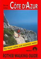
£9.99
Contoured, GPS-compatible, indexed road map at 1:200, 000 from CNIG
- Spain’s civilian survey organization, with exceptionally
...
Archived Product
£8.50
Cádiz on an indexed street plan at 1:7, 500 from Telstar Distrimapas, Spain’s leading publisher of city maps, with English language descriptions of three routes across the city, plus a road map of the Cádiz province. On one side is an indexed street plan of the city indicating locations of car parks, taxi ranks, petrol stations, etc., with main public buildings & places interest clearly named. Coverage extends just beyond the road linking the city with the mainl&. Three sightseeing routes in the city’s historic heart are highlighted & provided with descriptions. On the reverse is an indexed map of the Cádiz province at 1:275, 000 with altitude colouring to show the topography & symbols highlighting various places of interest. (Please note: road network may not necessarily be up to date). The map is accompanied by descriptions of four tours: the white villages, the bull route, the Atlantic route & the wine route. All the text

Includes::
English.

...
Archived Product
£10.99
Cévennes
- Gorges du Tarn region in a series of GPS compatible, contoured TOP75 maps at 1:75, 000 from the IGN, highlighting
...
Archived Product
£10.99
Cézallier
- Monts du Cantal region in a series of GPS compatible, contoured TOP 75 maps at 1:75, 000 from the IGN, highlighting
...
Archived Product
£9.99
Contoured, GPS-compatible, indexed road map at 1:200, 000 from CNIG
- Spain’s civilian survey organization, with exceptionally
...
Archived Product
£14.99
Côte d’ Azur
- Monaco Guide Vert *FRENCH Edition* in Michelin’s Green Guide series covering France, with all the regions available
...
Archived Product
£16.99
Côte d’ Azur
- Monaco Guide Vert *FRENCH Edition* in Michelin’s Green Guide series covering France, with all the regions available
...
Archived Product
£22.99
Côte de Granit rose
- Trégor morlaisien, FFRP topoguide Ref. no. 346, covering 608kms of routes along the northern coast of Brittany
...
Archived Product
£8.99
The vineyards of the Côtes du Rhône wine growing region on a map covering the area on two large panels: the southern part north of Avignon & Carpentras including Châteauneuf-du-Pape, & the northern vineyards along the Rhône between Valence & Vienne. A small additional inset covers an area between these two regions around St-Julien-en-St-Alban. The panels are accompanied by lists of the Appellations indicating the colour of the wines. The map is available in three versions which may differ slightly in the shades of colouring but contain the same information:FOLDED MAP – available either from Edition Benoit or from the IGN (this title).WALL MAP: published by Editions Benoit. ...
Archived Product
£12.99
Côte d` Opale North: Calais
- Dunkerque
- Saint Omer area in a series of cycling maps from Sportoena covering Belgium & the

...
Archived Product

Côte D’Azur

Rother’s Walking Guide to the Côte d`Azur covers 44 day and multiple-day excursions between Meton and Marseille. The guide includes tours that range from walks on the Îles de Lérins over beach hikes at St.Tropez to solid mountain tours in the Massiv de I`Estérel or the Lake Alps; the famous crossing of the Calanques and a long-distance tour in 15 stages from Menton to Marseille round off the tour suggestions. These are all complemented by hiking maps at 1:50, 000, 1:75, 000 and 1:100, 000 scales and one overview map for planning. The guide takes care to choose paths away from the flows of tourism; all proposed tours can be reached by public transport, which was the author`s exclusive means of transportation. The guide includes a wealth of information, stating the bus and train
lines as well as telephone numbers of the respective points of arrival. All of this is supplemented by details on accommodation (with telephone numbers), tips on sites and possible tour combinations.About this series:Rother Walking Guides were first published in 1920- since then Bergverlag Rother have continued to produce these comprehensive guides to “the finest valley and mountain walks”.Each book has a detailed description of walks, small walking maps and many tips on combining the walks, places of interest, accommodation and public transport; the guides are all in full colour with varying scales and types of cartography - the walks themselves vary from day-long hikes to mountain and valley walks, with varying levels of ease and difficulty indicated.Small enough to fit in your
pocket, comprehensive enough to take you everywhere; the books are printed in paperback but with a polytex-laminated cover, making them extremely durable too.
RIP - This product is no longer available on our network. It was last seen on 25.09.2019

This page now acts as a permanent archive for this product. Add more information using the comments box below to ensure it can still be found by future generations.

Use our search facility to see if it is available from an alternative contributor.
  • External links may include paid for promotion
  • Availability: Out Of Stock
  • Supplier: Stanfords
  • SKU: 9783763348176
Availability: In Stock
£12.95

Product Description

Rother’s Walking Guide to the Côte d` Azur covers 44 day & multiple-day excursions between Meton & Marseille. The guide

Includes::
tours that range from walks on the Îles de Lérins over beach hikes at St. Tropez to solid mountain tours in the Massiv de I` Estérel or the Lake Alps; the famous crossing of the Calanques & a long-distance tour in 15 stages from Menton to Marseille round off the tour suggestions. These are all complemented by hiking maps at 1:50, 000, 1:75, 000 & 1:100, 000 scales & one overview map for planning. The guide takes care to choose paths away from the flows of tourism; all proposed tours can be reached by public transport, which was the author`s exclusive means of transportation. The guide

Includes::
a wealth of information, stating the bus & train lines as well as telephone numbers of the respective points of arrival. All of this is supplemented by details on accommodation (with telephone numbers), tips on sites & possible tour combinations. About this series: Rother Walking Guides were first published in 1920- since then Bergverlag Rother have continued to produce these comprehensive guides to “the finest valley & mountain walks”. Each book has a detailed description of walks, small walking maps & many tips on combining the walks, places of interest, accommodation & public transport; the guides are all in full colour with varying scales & types of cartography
- the walks themselves vary from day-long hikes to mountain & valley walks, with varying levels of ease & difficulty indicated. Small enough to fit in your pocket, comprehensive enough to take you everywhere; the books are printed in paperback but with a polytex-laminated cover, making them extremely durable too.

Reviews/Comments

Add New

Intelligent Comparison

Oooops!
We couldn't find anything!
Perhaps this product's unique.... Or perhaps we are still looking for comparisons!
Click to bump this page and we'll hurry up.

Price History

Vouchers

No voucher codes found.
Do you know a voucher code for this product or supplier? Add it to Insights for others to use.

Facebook

Jargon Buster

Hiking - An outdoor activity envolving walking in nature
Beach - An area on the coast consisting of a sandy or pebbled area
Telephone - A device used for communicating audio over long distances
Colour - The categorised spectrum of light visable to humans
Day - The time it takes a planet or other space objects to complete one rotation.
Small - something that takes up less space than normal.
Accommodation - A room in which someone can live in, for example in a hotel
Exclusive - Something that is not including other things.
Pocket - A bag shaped insert in clothing used to carry items
Solid - Something that is firm and not liquid, a hard shape that cannot be changed easily.
Laminated - A thin layer of plastic that gives a coating and shine to a material.
Transport - Something that carries people or goods.

Supplier Information

Stanfords
Stanfords was established in 1853 and opened their iconic Covent Garden flagship store in 1901. They have become the top retailer of maps, travel books and accessories in the UK and arguably offer the largest selection of maps and travel books worldwide. Famous names such as Captain Robert Falcon Scott, Ranulph Fiennes and Michael Palin have purchased from Stanfords. They now have a shop in Bristol and both stores together with other venues operate a calendar of events including talks, book signings and exhibitions. As a specialist map retailer, the map selection is comprehensive and includes road maps, street maps and walking maps from worldwide destinations, as well as a selection of world atlases and wall maps. Books include travel guides and travel literature. Stanfords also stock globes, from miniatures made of blue marble to magnificent floor-standing globes. The website features a selection of interesting articles on travel topics.
Page Updated: 2023-11-12 20:15:36

Community Generated Product Tags

Oh No! The productWIKI community hasn't generated any tags for this product yet!
Menu