
 United Kingdom
 France
 Germany
 Netherlands
 Sweden
 USA
USA
 Italy
Italy
 Spain
Spain
More From Contributor


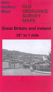
Brymbo 1909
Brymbo in 1909 in a fascinating series of reproductions of old Ordnance Survey plans in the Alan Godfrey Editions, ideal for anyone interested in the history of their neighbourhood or family. Tthe map covers the industrial village of Brymbo, just north-west of Wrexham. Brymbo Hall is near the centre of the map and coverage stretches from Smelt Wood eastward to Cefn, and from The Green southward to Ty-cerryg. The Brymbo Steel Works is a major feature surrounded by much of the village of Brymbo, including St John`s church (at top of map), Tai, Brymbo Colliery, The Green, and many railway tracks. The various (and confusing!) railways include GWR Wrexham & Minera line with The Lodge Halt, GCR Brymbo Branch with terminus, GCR Vron Branch and GWR Vron Branch. Other features include
Phosphate Works, Black Lane Colliery, Offa`s Dike, several old mine shafts, etc. Communities or areas include The Lodge, Cefn, Pen-rhos. On the reverse is a directory of Brymbo with railway timetables for the Wrexham-Berwig Halt line and Brymbo & Coed Talon Branch.About the Alan Godfrey Editions of the 25” OS Series:Selected towns in Great Britain and Ireland are covered by maps showing the extent of urban development in the last decades of the 19th and early 20th century. The plans have been taken from the Ordnance Survey mapping and reprinted at about 15 inches to one mile (1:4, 340). On the reverse most maps have historical notes and many also include extracts from contemporary directories. Most maps cover about one mile (1.6kms) north/south, one and a half miles (2.4kms)
across; adjoining sheets can be combined to provide wider coverage.FOR MORE INFORMATION AND A COMPLETE LIST OF ALL AVAILABLE TITLES PLEASE CLICK ON THE SERIES LINK.

Product Description
Reviews/Comments
Add New
Vouchers
No voucher codes found.
Do you know a voucher code for this product or supplier? Add it to Insights for others to use.
Do you know a voucher code for this product or supplier? Add it to Insights for others to use.
 Denmark