More From Contributor

£10.39
Brussels in the Countries, Regions & Cities series from Rough Guides; comprehensively detailed guidebooks specifically designed for independent travellers & serving a range of worldwide destinations. Widely recognised for their free editorial style, Rough Guide authors are allowed to express their personal opinions on a range of subjects. Although sometimes controversial, this editorial stance allows readers to experience more detailed & personal takes on each destination, a feature often more limited in other guidebooks. Cultural & historical nuances are explored in significant depth throughout the text & descriptions on the ambience of individual settings alongside personal recommendations, particularly in cities, are notably prevalent. Each Rough Guide in the Countries, Regions & Cities series has a similar layout. A ...
Archived Product
£3.99
Brussels in a series of street plans from Rough Guides published on very light waterproof & tear-resistant plastic paper, indexed, with recommendations for shops, restaurants, cafes & cars, & venues. The plan is folded to only 9x 19cm when detached from its protective cover, & can be easily rolled or folded into smaller size without any damage or creases. On one side is a plan of central districts of the city at 1:9, 700, including the Eurostar & Thalys terminal at Gare du Midi, the European Quarter with the EU institutions, & Parc du Cinquantenaire. The plan is extended further south on the reverse side to include the Ixelles West district. The city centre is shown in greater detail enlarged to 1:5, 700. Also provided is a plan of the Laeken & Haysel area with the Atomium. All the plans show tram routes with line numbers & stops, metro stations, taxi ranks, car parks & one way streets. Streets are also annotated with numbers of bus routes. Famous buildings, cultural institutions, etc. are highlighted & named. The plans are also annotated with colour-coded markers indicating publishers ...
Archived Product
£6.99
Brussels & Bruges in the City Pack series from AA Publishing; covering an extensive selection of world-wide cities in a handy, pocket-sized laminated format. The guides provde a detailed overview of each destination, with each city organised by district to allow for practical use on the city streets. An introductory section introduces readers to the city, with individual features on a short stay in the city, the Top 25 attractions, shopping by theme, the city by night, eating out & restaurants by cuisine. Each guide is presented in a similar format, exploring the city by geographical area & district. A basic overview map is provided at the start of each section & there is detailed listings information on the principal sights, walks, shops, entertainment & nightlife & restaurants for each area of the city. A Farther Afield section explores the area outside the city limits, with suggestions for possible excursions & day trips. A dedicated accommodation chapter provides information about a range of budget, mid-range & luxury hotels to suit for individual tastes. There is also a Need to Know chapter with practical information on getting there & around, essential facts, language & a timeline of the city. ...
Archived Product
£8.99
Brussels & Bruges in the Frommer's Day By Day series is a pocket-sized guide ideal for short trips, covering a variety of budgets. The best sights of each destination are listed in convenient full-day tours for one, two or three days such as: thematic tours for interests including art, architecture & history are described, allowing you to get the most out of your time; walking tours take you around each destination ...
Archived Product
£12.00
Brussels in the Cities of the Imagination guide series; providing an in-depth cultural & historical exploration of some of the great city landscapes of the world. Presented as a cultural & literary guide, each title in the series explores the history of the city, providing an overview of the city’s development from its earliest roots to the modern day. Particular emphasis is placed on the literary, poetic, architectural, cultural & historical elements that make up the city & each title is written & researched by an academic expert. An Epilogue offers thoughts on the future of the city, suggested further reading & indices of literary & historical names & famous places & attractions. ...
Archived Product
£9.50
Topographical survey of Belgium at 1:20, 000 from Nationaal Geografisch Instituut / Institut Géographique National, the country’s national survey organization. Each 20K map covers one quarter of the corresponding 1:50, 000 map (with adjustments in the border & coastal areas). The maps provide all the information expected of topographic mapping at this scale & in addition have an unusually large amount of vegetation and/or land use information (different types of woodlands, gardens, orchards, heath, etc). The maps have a 1-km UTM grid, with margin ticks for latitude & longitude at intervals of 1`. Map legend & a glossary of terms used on the maps include English. Stanfords keeps as regular stock 20K maps for the World War I battlefields around the Ypres, Messines & Passchendaele, & for the area of the Battle of Waterloo. The 1:20, 000 survey covers the whole of Belgium & maps for other regions can be supplied as special orders. To see the list of titles in this series please click on the series link.PLEASE NOTE: the Long-Distance Footpaths Map of Belgium at 1:300, 000 which shows the division of Belgium into the 50K survey sheets can also be used to see in more detail coverage by the 20K maps. ...
Archived Product
£120.00
Brussels, an original antique map by S.D.U.K., published in London, 1844. Steel plate, uncoloured. Map size 29 x 30 cm, overall mounted size 54 x 47.5 cm.A detailed map of Brussels published by the Society for the Diffusion of Useful Knowledge. The Society was founded by John, Earl Russell, & Henry Brougham, later Lord Chancellor of England in 1827. The Society's main purpose was to encourage universal literacy by publishing numbers of books of good quality that would be affordable to all. These town plans were published in perhaps the grandest of the Society's publications
- their atlas entitled Maps Of The Society For The Diffusion Of Useful Knowledge, first issued by Baldwin & Cradock, & then re-issued by other publishers, including Chapman & Hall & latterly Edward Stanford. The map

Includes::
a vignette view of Antwerp from the road to Mechlin, Brussels & Louvin. Along the bottom of the map the city's principal buildings are depicted. The map was engraved by B.R. Davies after W.B. Clarke. Antique maps from various original publishers are presented on the Stanford


...
Archived Product
£7.99
In this new edition, the Top 25 sights & experiences are now in one section. We`ve selected the must-see sights for you & put them in one place
- all you have to do is take your pick. If you want a bit more guidance, go to the new City Tours section, self-guided tours that bring you the best of the city. Or if you have extra time on your hands, turn to the More to See sights. Our new feature, Focus On, helps you to get to know the city in more depth. & we still include top tips on how to make the most of your trip, as well as great places to shop, eat, drink & sleep for every budget. But it`s not just a guidebook. As you would expect from the AA, your City Pack also comes with a weather-resistant map that has all the sights located on it. The map has even got its own wallet in the back so you can fold away for safe-keeping.
...
Archived Product
£9.99
Brussels region & the eastern part of the Flemish Brabant province of Belgium at 1:50, 000 in a series from Falk B.V. showing the network of signposted cycling routes on large, double-sided indexed maps with prominent highlighting of long-distance LF routes, symbols indicating accommodation & other tourist services, plus in each title two or more panels with recommended local circuits & additional tourist information. The Falk 50K cycling series, which

Includes::
some adjoining areas in Lower Saxony & has now been extended to cover Flanders, shows the extensive network of sign-posted cycling routes. The network consists of numbered junctions joined by sign-posted connecting routes in either direction. At each junction there is an information panel showing an overview map of the whole network with the junction numbers. A second panel shows all the intersections directly connected to that junction. The system enables cyclists to plan their own routes by preparing a list of junction numbers through which they want to travel. Falk maps give cycling distances between the junctions & indicate which roads, both within the numbered network & outside it, have separate cycling paths. Routes which are part of the LF network of long-distance cycle routes are clearly marked. A wide range of symbols shows various accommodation options, bars & restaurants, & various places of interest. Landscape information is provided by colouring for woodlands, dunes, etc. The maps are indexed & show in the margins latitude & longitude at 1`52” intervals. Map legend

Includes::
English.PLEASE NOTE: to see other titles in the Falk series please click on the series link, where the series description

Includes::
a comparison between the Falk maps & the ANWB cycling series also covering the Netherlands at 1:50, 000.


...
Archived Product
£25.00
Brussels can claim to be the Art Nouveau capital of Europe. This is the first comprehensive guide in English to individual buildings in eleven main areas of the city. For those wishing to devise their own tours & visits, there are specially-drawn maps & an index of architects & designers. A movement or design philosophy more than a precise style, Art Nouveau flourished c. 1893-1914, inspired by forms & patterns found in nature such as flowers & plants, clouds, waves, & even wisps of smoke. The influence of architects & designers rebelling against heavy Victorian conformity, spread from buildings & detailing to interior design, furniture, lighting, textiles & fittings; fine & decorative art including graphics, calligraphy, carved lettering & ceramics. The famous names are all here: Victor Horta, Paul Hankar & Henry Van de Velde; & their disciples, colleagues & successors, each with a short biography as a side note to the lavishly- illustrated text. ...
Archived Product

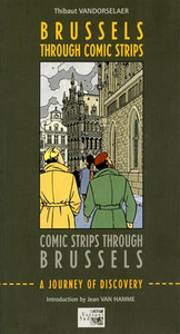
Brussels - Through Comic Strips

This unique travel guide outlines a walking tour round the heart of the Belgian capital, Brussels. But the inspiration for this guide is comic strips - The walk takes you round the most famous views in the city centre, and it also introduces you to murals created by comic strip artists on the city`s buildings which celebrate comic book heroes and the cultural life of the city itself. It also leads you to specialist shops and locations which feature in comic book art. If you are a lover of comic books visiting Brussels, you will be enchanted by this unique opportunity to enjoy the city in a way simply not covered by any other guidebook.
RIP - This product is no longer available on our network. It was last seen on 25.09.2019

This page now acts as a permanent archive for this product. Add more information using the comments box below to ensure it can still be found by future generations.

Use our search facility to see if it is available from an alternative contributor.
  • External links may include paid for promotion
  • Availability: Out Of Stock
  • Supplier: Stanfords
  • SKU: 9782930358246
Availability: In Stock
£14.95

Product Description

This unique travel guide outlines a walking tour round the heart of the Belgian capital, Brussels. But the inspiration for this guide is comic strips
- The walk takes you round the most famous views in the city centre, & it also introduces you to murals created by comic strip artists on the city`s buildings which celebrate comic book heroes & the cultural life of the city itself. It also leads you to specialist shops & locations which feature in comic book art. If you are a lover of comic books visiting Brussels, you will be enchanted by this unique opportunity to enjoy the city in a way simply not covered by any other guidebook.

Reviews/Comments

Add New

Intelligent Comparison

Oooops!
We couldn't find anything!
Perhaps this product's unique.... Or perhaps we are still looking for comparisons!
Click to bump this page and we'll hurry up.

Price History

Vouchers

No voucher codes found.
Do you know a voucher code for this product or supplier? Add it to Insights for others to use.

Facebook

Jargon Buster

Heart - An organ that pumps blood around the body. Usually related to love.
Feature - An attribute that makes something stand out.

Supplier Information

Stanfords
Stanfords was established in 1853 and opened their iconic Covent Garden flagship store in 1901. They have become the top retailer of maps, travel books and accessories in the UK and arguably offer the largest selection of maps and travel books worldwide. Famous names such as Captain Robert Falcon Scott, Ranulph Fiennes and Michael Palin have purchased from Stanfords. They now have a shop in Bristol and both stores together with other venues operate a calendar of events including talks, book signings and exhibitions. As a specialist map retailer, the map selection is comprehensive and includes road maps, street maps and walking maps from worldwide destinations, as well as a selection of world atlases and wall maps. Books include travel guides and travel literature. Stanfords also stock globes, from miniatures made of blue marble to magnificent floor-standing globes. The website features a selection of interesting articles on travel topics.
Page Updated: 2023-11-12 20:15:36

Community Generated Product Tags

Oh No! The productWIKI community hasn't generated any tags for this product yet!
Menu