
 United Kingdom
 France
 Germany
 Netherlands
 Sweden
 USA
USA
 Italy
Italy
 Spain
Spain
More From Contributor


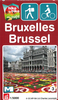

Brussels Flexi Map
Brussels on a laminated, tear-resistant Insight Flexi Map with an indexed street plan of the city, a more detailed enlargement of its central area, a road map of the environs, a metro diagram, plus extensive tourist information.The main plan covers the capital with some of its outer districts, extending north to include the Atomium and Mini-Europe, plus south just beyond the Victor Horta Museum. The plan clearly shows metro stations, one way streets and car parks. Main public buildings, places of interest and selected hotels are prominently highlighted and named. An enlargement shows central Brussels in greater detail at 1:10, 000. Both plans are indexed for streets, points of interest and public buildings. Also included is a diagram of the city
Product Description
Reviews/Comments
Add New
Vouchers
No voucher codes found.
Do you know a voucher code for this product or supplier? Add it to Insights for others to use.
Do you know a voucher code for this product or supplier? Add it to Insights for others to use.
 Denmark