More From Contributor
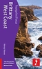
£14.99
Brittany Green Guide *ENGLISH Edition* in Michelin’s Green Guide series covering France, with all the regions available either in English editions or in French versions. Drawing on Michelin’s long experience, the guides are renowned for their individual ‘star rating’ of sights & attractions. Listings in each guide are organized alphabetically, allowing readers to access information quickly. Towns are given overall star rating, with their sights & attractions also rated individually. Where appropriate, a street plan of the town centre is provided, indicating car parks & accompanied by an index of main streets & a list of sights highlighted on it. For many towns a recommended sightseeing tour is also marked on the plan. Entries for important churches are accompanied by detailed plans. Recommended car tours have overview maps showing road numbers & locations of the sights. Where necessary, the guides give opening hours & contact details. Many entries have an “ Address Book” section with Michelin’s recommendations for where to stay & where to eat. Each guide has a very extensive introductory section with practical information & pre-trip tips, chapters on history, art & culture (particularly strong on architectural styles, explained by excellent drawings), fauna & flora, etc. Fold-out flaps in the book covers provide an overview of the recommended sights and/or car tours.* * French language guides* have a larger number of individual entries than included in the corresponding English titles, as well as more exhaustive descriptions, with wider coverage of local history and/or famous people connected with a given location.* * English language guides* have more recommendations for car tours. The “ Address Book” sections often include shopping suggestions. ...
Archived Product
£5.99
Brittany at 1:200, 000 in a series of double-sided touring maps from Michelin. The map

Includes::
city centre

...
Archived Product
£35.00
The new edition of the RCC Pilotage Foundation's pilot for North Brittany
- Cherbourg to Ouessant & the Channel Islands
- has

...
Archived Product
£17.99
Wall map of the French administrative region of Brittany at 1:250, 000 from the IGN, size 130 x 100cm (51” x 39.5” approx) & encapsulated for durability & for adding customized information by marker pens. An inset presents the division of the region into departments & communes, each shown with its administrative capital. Cartography is the same as in IGN’s folded map of Brittany in their popular Regional Road Maps series of France, with very clear presentation of the road network, including junctions numbers, services & rest area on motorways, driving distances shown from main to selected small local roads, etc. Railway lines are shown with stations, ferry lines are included & local airports/aerodromes are marked. Various places of interest are prominently highlighted. The map also clearly shows departmental numbers & boundaries. Topography is indicated by light relief shading & boundaries of national/natural parks are marked. Unlike the corresponding folded map, this wall map version has no geographical coordinates, no index & no map legend, but all the information is self-explanatory. Current edition of this title was published in spring 2014.LAMINATED & ENCAPSULATED WALL MAPS:- LAMINATED wall maps have a thin layer of plastic usually applied to the printed side only. They can be written on with suitable marker pens without any damage to the map but, unless laminated on both sides, they are not damp-proof.- ENCAPSULATED wall maps are sealed between two sheets of plastic. They are more rigid & heavier than laminated maps of the same size. They are damp-proof & do not crinkle in humid conditions. Encapsulation gives the map a shiny surface, similar to being displayed behind glass.- PLEASE NOTE: many publishers & retailers often use these two terms interchangeably. Our map titles & descriptions follow the definitions provided above. ...
Archived Product
£7.99
Brittany West Coast in the Footprint Focus Guides, which are targeted at cities, regions & countries worldwide that have no, or very limited, coverage from other publishers. Widely recognised for their reliability & independent writing style, Footprint Focus guides all have the same layout. Smaller than their sister Handbooks, the Focus guides are intended to streamline the information contained so that you have more of what you need, without losing Footprint’s signature unrestrictive editorial style that gives authors the freedom to capture & explore local cultures, sights & areas that are often not covered in other guides. An introductory section introduces the reader to the destination, with chapters on planning on your trip & essentials, including practical information & guidance on subjects such as when & where to go, itineraries, sport & activities, arts, getting there & around, eating & drinks, sleeping & a dedicated section on the anticipated carbon footprint involved in travelling to the destination. Essentially a condensed, straight-to-the-point version of their Handbook series. “ Sets the pace for all the rest to follow” Michael Palin. ...
Archived Product
£12.00
Brittany`s richly layered landscape has contributed depth & character to the region`s traditional oral culture, from stories of the sea & shore to tales of misty moors, sacred hill-tops & secretive forests. Evangelizing Dark Age saints from Britain laid the foundations of Breton language & society, imposing Christianity on the landscape & in the minds of the people. Their legacy rests visually in the prolific spread of chapels, churches & cathedrals, & the Celtic language still preserved with pride. Right on the edge of Europe, the region has been vulnerable to assault & exploitation. Franks, Vikings, English, Germans have all made their mark, resisted at every turn with resilience. The problematic relationship with neighbouring France before & after Union in 1532 has left wounds to this day. The rapacity of the ancien regime was followed by deprivation of privileges during the Revolution, attacks on religion & subsequent suppression of the Breton language which struck at the very heart of Brittany. The nineteenth century combined economic stagnation with growing interest in Celtic roots, fuelling the search for that ultimate chimera
- Breton identity. Historians & poets began to assert the distinct character of the region, while foreign travellers also left accounts of a people speaking an unfathomable language & appearing a race apart. This ”primitivism” coupled with the lure of the mysterious megaliths created an image of wild exoticism, & made Brittany a prime target for tourists & artists. Today the past is perpetuated & the future welcomed in a packed festival calendar of Celtic music & Breton culture. Yet for all its modernity, Brittany remains as intensely complex & challenging to preconceived notions as ever. LANDSCAPE & LEGENDS: Marches of Brittany; Druids & megaliths; St-Malo & sea adventures; mysteries of the Monts d` Arree; Merlin in the Foret de Broceliande. COMPLEXITY & AMBIGUITY: part of France yet a separate world; nationalism, regionalism, resistance, unity & division of language; four departments or five? WRITERS & ARTISTS: Chaucer, Balzac, Hugo, Flaubert, Ernest Renan, Thomas Adolphus Trollope, Arthur de la Borderie, Mathurin Meheut, Max Jacob, Yves Tanguy.
...
Archived Product
£8.99
Free & fee-charging service areas in Brittany providing motorhome service points, campsites and/or parking only facilities, overprinted on Michelin’s double-sided road map of the region at 1:200, 000. Accompanying table, listing all the highlighted sites alphabetically by department, shows their location with full address & GPS coordinates, plus indicates which of these facilities are provided & if a fee is charged. Also included is a distance/driving times table for Brittany.PLEASE NOTE: Les Editions Trailer’s Park also publish a map showing free motorhome stopovers in the whole of France. ...
Archived Product
£12.99
Brittany on a waterproof & tear-resistant, indexed road map from the Hallwag Kümmerly + Frey. To present the whole region at 1:175, 000, the map is double-sided, dividing Brittany east/west & presenting it on three panels
- on one side coverage along Brittany’s coastline extends from west of St. Malo to Lorient on the southern coast; the rest of the region is on the reverse, shown on two overlapping panels. Road network is shown on a clear base, with colouring indicating regional parks & other protected areas. Scenic routes are highlighted & driving distances are marked on main & connecting secondary routes. Railway lines & ferry connections are included & local airports are marked. A range of small symbols shows various places of interest, including campsites. The map is indexed & has latitude & longitude lines at 10’ intervals. Map legend

Includes::
English.


...
Archived Product
£7.99
Hugh Dennis has secretly been worrying about what being ” British” meant for nearly a decade, ever since his friend Ardal O` Hanlon had told him in passing that he was the most British person he had ever met. Hugh was unclear whether he was being praised, teased, vaguely insulted or possibly all three
- because it has always been very difficult to know how to feel about being British. & then the London Olympics came along. We gave the world a gleaming new vision of Britain; a smiling Britain of achievement, a Britain responsible for leading the world into the modern era through the Agrarian & Industrial revolutions, a nation proud to embrace multi-culturalism, individuality, & eccentricity. A country where a major politician can dangle helplessly from a zip wire like a discarded straw dolly & gain in popularity, & whose Queen can send herself up & then descend by parachute. The unexpected legacy of the Games has been a Britain with a new found self-confidence in which we all know how to be British.A Britain which should be embarrassed by nothing & proud of everything, from sheep to chimneys to the Spice Girls to industrial action & what had always previously been described as our ”ailing transport network”. A Britain which having been pinned firmly in its own half, has dribbled the length of the field, nutmegged the defenders, unleashed a curling dipping shot into the top right hand corner, scored a wonder goal & is now kissing the badge. This is Hugh Dennis` exploration of the changing image of Britain & Britishness.
...
Archived Product
£6.99
Street plan of Brive-la-Gaillarde, part of an extensive series covering French cities & towns from Blay-Foldex, the country’s largest, oldest & most experienced publisher of urban mapping. Blay plans include outer suburbs &, where appropriate, adjoining localities forming part of the urban agglomeration & provide brief descriptions of the town’s main sights, contact details for hotels & other places of interest, etc. The plans show one way streets, car parks & pedestrian zones. Important public buildings are clearly marked & identified. Blay street maps are usually double-sided & include an enlargement for the town centre & a street index with separate lists of “edifices publics”: main public buildings, places of worship, schools, sport facilities, stations, etc. Each of the outer suburbs or the adjoining localities, identified with its postcode, has a separate index. Many titles also provide a road map of the environs. All the text is in French only.PLEASE NOTE: to see the list of Blay-Foldex street plans of French towns & cities please click on the series link – the series description also

Includes::
a comparison between Blay & IGN street plans.

...
Archived Product

Brittany With Kids

Brittany in Footprint’s ‘With Kids’ series; covering a range of guides dedicated to travelling with children in Britain and Europe and incorporating child-friendly days out, activities, places to stay, accommodation and restaurants. Each of the guides in the series provides a comprehensive survey of the region and includes a large selection of recommendations for parents planning a trip away with their children. Footprint guides have an established reputation, publishing guides since 1921 and have an unrestrictive editorial style that gives authors the freedom to capture and explore the best of each region for children.All of the With Kids guides are arranged geographically by chapter, allowing readers to identify easily areas of interest. A Family Favourites section at the
start of individual titles profile must-see attractions that are suitable for the whole family and a Kids’ Stuff section also includes ideas for beach and travel games, recommended children’s books, lists of things to spot and 10 things to try on holiday. Each regional section opens by describing the destination and giving a sample of the range of attractions and activities that are available. There is also information on accommodation, restaurants, and notable local towns or villages, all included with children in mind and designed to make planning easier for parents. A Grown-ups’ stuff section at the back of each guide also provides practical guidance on getting there, public transport, recommended maps, online resources, recommendations for accommodation based on
children’s ages. Details of baby supplies, camping equipment, doctors and medical centres, hospitals, pharmacies, supermarkets, tourist information centres and toys and beach gear are also included.
RIP - This product is no longer available on our network. It was last seen on 25.09.2019

This page now acts as a permanent archive for this product. Add more information using the comments box below to ensure it can still be found by future generations.

Use our search facility to see if it is available from an alternative contributor.
  • External links may include paid for promotion
  • Availability: Out Of Stock
  • Supplier: Stanfords
  • SKU: 9781907263385
Availability: In Stock
£13.99

Product Description

Brittany in Footprint’s ‘ With Kids’ series; covering a range of guides dedicated to travelling with children in Britain & Europe & incorporating child-friendly days out, activities, places to stay, accommodation & restaurants. Each of the guides in the series provides a comprehensive survey of the region &

Includes::
a large selection of recommendations for parents planning a trip away with their children. Footprint guides have an established reputation, publishing guides since 1921 & have an unrestrictive editorial style that gives authors the freedom to capture & explore the best of each region for children. All of the With Kids guides are arranged geographically by chapter, allowing readers to identify easily areas of interest. A Family Favourites section at the start of individual titles profile must-see attractions that are suitable for the whole family & a Kids’ Stuff section also

Includes::
ideas for beach & travel games, recommended children’s books, lists of things to spot & 10 things to try on holiday. Each regional section opens by describing the destination & giving a sample of the range of attractions & activities that are available. There is also information on accommodation, restaurants, & notable local towns or villages, all included with children in mind & designed to make planning easier for parents. A Grown-ups’ stuff section at the back of each guide also provides practical guidance on getting there, public transport, recommended maps, online resources, recommendations for accommodation based on children’s ages. Details of baby supplies, camping equipment, doctors & medical centres, hospitals, pharmacies, supermarkets, tourist information centres & toys & beach gear are also included.

Reviews/Comments

Add New

Intelligent Comparison

Oooops!
We couldn't find anything!
Perhaps this product's unique.... Or perhaps we are still looking for comparisons!
Click to bump this page and we'll hurry up.

Price History

Vouchers

No voucher codes found.
Do you know a voucher code for this product or supplier? Add it to Insights for others to use.

Facebook

Jargon Buster

Beach - An area on the coast consisting of a sandy or pebbled area
Large - something that takes up more space than normal.
Equipment - A product or good that is tactile.
Accommodation - A room in which someone can live in, for example in a hotel
Practical - Weather a task is easy to carry out and realistically succeed.
Regional - An adjective to describe a set geographic area.
Children - A young life form within the early stages of physical development,
Individual - A single separate item or person.
Transport - Something that carries people or goods.
Kids - A young child.
Family - A group of people that live together made up from parents and children.

Supplier Information

Stanfords
Stanfords was established in 1853 and opened their iconic Covent Garden flagship store in 1901. They have become the top retailer of maps, travel books and accessories in the UK and arguably offer the largest selection of maps and travel books worldwide. Famous names such as Captain Robert Falcon Scott, Ranulph Fiennes and Michael Palin have purchased from Stanfords. They now have a shop in Bristol and both stores together with other venues operate a calendar of events including talks, book signings and exhibitions. As a specialist map retailer, the map selection is comprehensive and includes road maps, street maps and walking maps from worldwide destinations, as well as a selection of world atlases and wall maps. Books include travel guides and travel literature. Stanfords also stock globes, from miniatures made of blue marble to magnificent floor-standing globes. The website features a selection of interesting articles on travel topics.
Page Updated: 2023-11-12 20:15:36

Community Generated Product Tags

Oh No! The productWIKI community hasn't generated any tags for this product yet!
Menu