More From Contributor

£20.99
Counties, Districts & Unitary Authorities Wall Map of the British Isles, size 83 x 120cm (33” x 48” approx) – paper version, from Map Marketing showing county, district & unitary authorities names & boundaries plus, for United Kingdom only, additional information on population & post codes. The map shows the UK at 1:800, 000, with the whole of Ireland included as an inset at half the scale (1:1, 600, 000). Boundaries & names of counties, districts & unitary authorities are overprinted on a base showing the network of motorways & A roads, with domestic & international airports also marked. London area is presented in greater detail on an enlargement. Additional information is provided only for the United Kingdom (i.e. the Republic of Ireland is not covered):- separate lists with population figures for unitary authorities, counties & districts in Engl&, Scotl&, Wales & Northern Irel&- a map plus a list of postcode areas PLEASE NOTE: this map is also available encapsulated ...
Archived Product
£28.99
Route Planning Wall Map of the British Isles, size 84 x 121cm (33” x 47.5” approx) – encapsulated version, from Map Marketing showing the network of motorways, primary routes & other A roads, plus B roads on a base presenting the topography by altitude colouring with names of mountain ranges. The map shows the UK at 1:800, 000, with the whole of Ireland included as an inset at half the scale (1:1, 600, 000). Boundaries & names of counties & unitary authorities are also marked or, where appropriate given the amount of other information, the names are shown on accompanying panels. London area is presented in greater detail on an enlargement. Additional information is provided only for the United Kingdom (i.e. the Republic of Ireland is not covered):- a map plus a list of postcode areas- a mileage chart PLEASE NOTE: this map is also available on paper without the encapsulation.LAMINATED & ENCAPSULATED WALL MAPS:- LAMINATED wall maps have a thin layer of plastic usually applied to the printed side only. They can be written on with suitable marker pens without any damage to the map but, unless laminated on both sides, they are not damp-proof.- ENCAPSULATED wall maps are sealed between two sheets of plastic. They are more rigid & heavier than laminated maps of the same size. They are damp-proof & do not crinkle in humid conditions. Encapsulation gives the map a shiny surface, similar to being displayed behind glass.- PLEASE NOTE: many publishers & retailers often use these two terms interchangeably. Our map titles & descriptions follow the definitions provided above. ...
Archived Product
£20.99
Route Planning Wall Map of the British Isles, size 83 x 119.5cm (33” x 47” approx) – paper version, from Map Marketing showing the network of motorways, primary routes & other A roads, plus B roads on a base presenting the topography by altitude colouring with names of mountain ranges. The map shows the UK at 1:800, 000, with the whole of Ireland included as an inset at half the scale (1:1, 600, 000). Boundaries & names of counties & unitary authorities are also marked or, where appropriate given the amount of other information, the names are shown on accompanying panels. London area is presented in greater detail on an enlargement. Additional information is provided only for the United Kingdom (i.e. the Republic of Ireland is not covered):- a map plus a list of postcode areas- a mileage chart PLEASE NOTE: this map is also available encapsulated. ...
Archived Product
£28.99
Sales & Marketing Wall Map of the British Isles, size 84 x 122cm (33” x 48” approx) – encapsulated version, from Map Marketing showing county & unitary authorities names & boundaries, plus additional information for the United Kingdom on postcode areas, TV coverage, etc. The map shows the UK at 1:800, 000, with the whole of Ireland included as an inset at half the scale (1:1, 600, 000). Boundaries & names of counties & unitary authorities are overprinted on a base showing the network of motorways & A roads, with domestic & international airports also marked. London area is presented in greater detail on an enlargement. Additional maps & lists provide information only for the United Kingdom (i.e. the Republic of Ireland is not covered):- a map plus a list of postcode areas- a map showing TV regions listing the number of homes in each area- a list of counties & unitary authorities with population figures PLEASE NOTE: this map is also available on paper without the encapsulation LAMINATED & ENCAPSULATED WALL MAPS:- LAMINATED wall maps have a thin layer of plastic usually applied to the printed side only. They can be written on with suitable marker pens without any damage to the map but, unless laminated on both sides, they are not damp-proof.- ENCAPSULATED wall maps are sealed between two sheets of plastic. They are more rigid & heavier than laminated maps of the same size. They are damp-proof & do not crinkle in humid conditions. Encapsulation gives the map a shiny surface, similar to being displayed behind glass.- PLEASE NOTE: many publishers & retailers often use these two terms interchangeably. Our map titles & descriptions follow the definitions provided above. ...
Archived Product
£20.99
Sales & Marketing Wall Map of the British Isles, size 83 x 120cm (33” x 47” approx) – paper version, from Map Marketing showing county & unitary authorities names & boundaries, plus additional information for the United Kingdom on postcode areas, TV coverage, etc. The map shows the UK at 1:800, 000, with the whole of Ireland included as an inset at half the scale (1:1, 600, 000). Boundaries & names of counties & unitary authorities are overprinted on a base showing the network of motorways & A roads, with domestic & international airports also marked. London area is presented in greater detail on an enlargement. Additional maps & lists provide information only for the United Kingdom (i.e. the Republic of Ireland is not covered):- a map plus a list of postcode areas- a map showing TV regions listing the number of homes in each area- a list of counties & unitary authorities with population figures PLEASE NOTE: this map is also available encapsulated ...
Archived Product
£9.99
British Isles Physical Wall Map at 1:1, 000, 000 from the Ordnance Survey, size 93.5 x 104cm (3ft 1 x 3ft 5 approx), with a laminated surface which can be written on with suitable marker pens without damaging the map. The map shows the physical geography of Great Britain & Ireland by relief shading & altitude colouring, with numerous spot heights (in metres), plus names of peaks, mountain chains, forests & other natural features, etc. Larger towns are marked, but the map does not show the road network. LAMINATED & ENCAPSULATED WALL MAPS:- laminated wall maps have a thin layer of plastic usually applied to the printed side only. They can be written on with suitable marker pens without any damage to the map but, unless laminated on both sides, they are not damp-proof.- encapsulated wall maps are sealed between two sheets of plastic. They are more rigid & heavier than laminated maps of the same size. They are damp-proof & do not crinkle in humid conditions. Encapsulation gives the map a shiny surface, similar to being displayed behind glass.- please note: many publishers & retailers often use these two terms interchangeably. Our map titles & descriptions follow the definitions provided above. ...
Archived Product
£20.00
The British Isles with their old historic counties on a cloth-backed reproduction from the Old Folding Maps of a beautiful map published by the Stanford’s Geographic Establishment around 1859. Bright colours highlight the boundaries of the old counties as they were before the nonsensical / much needed (delete as you feel appropriate) changes in 1974. The pale background makes all the place names easy to read. In common with other maps published by Stanfords at that time, an unusually large number of small rivers are named, even the lovely Cuckmere is there. Ironically perhaps, the map provides an interesting contrast between the significant administrative changes within Great Britain & the retention of the county borders within Irel&, with just the change of the names from King’s & Queen’s to Offaly & Laois respectively – it’s the international border that has been added there. Each individual cloth-backed map is sold folded in a colourful case covered with a unique design marbled paper – no two cases are identical.PLEASE NOTE: this title is also available as a wall map in two different sizes in the “ Stanfords Classics Collection of Historical Maps”. To see the list of all the titles in this series from the Old Folding Maps please click on the series link. ...
Archived Product
£10.00
Joe Hayman travels across the UK in the wake of the Brexit vote, speaking to Leave & Remain voters about the attitudes & experiences which made them vote the way they did & using those views to explore the political economy of post-referendum Britain. From Sunderland to Belfast, from Aberystwyth to Glasgow, Hayman uses sixteen chapters of interviews & analysis to knit together a picture of a nation where divisions of class, culture & faith bubble dangerously close to the surface. Pulling no punches & refusing to ignore divisions, Hayman`s book explores some of the major fault-lines in British society, from identity, immigration & integration to Britain`s complex relationship with its past, & calls for urgent efforts to build a new political economy for the UK, with a stronger sense of social solidarity, shared identity & common values at its heart. The book is based on conversations with members of the public all around the country & gets deep under the skin of British society, exploring tough attitudes & cultural divisions which can be swept under the carpet no longer. ...
Archived Product
£3.99
British in the Language & Culture series from Lonely Planet, providing an irreverent view of a selection of languages & revealing the meanings behind everyday native expressions. Written in a humorous style, these pocket-sized guides present a thematic guide to each language through descriptions of vocabulary, colloquiums & slang. Each guide begins with a short history of the language, including unique features & origins. There is also guidance on pronunciation, grammar, phrasing, greetings, etiquette & body language. Individual sections are dedicated to lifestyle & society, travel & transport, food & drink, sport, entertainment, slang, misunderstandings & regional variations or languages. Extensive descriptions of each area are interlaced with humorous anecdotes, common misunderstandings & other words & phrases which may confuse visitors. Outline maps of different regions are accompanied by commentary on regional variations & any notable local vocabulary. There is also a useful ...
Archived Product
£12.99
The British Library Desk Diary 2018 gathers together beautiful & fascinating images from the library`s collection of natural history illustrations. Sourced from manuscripts, journals & rare books, the range of nature`s beauty is represented, &

Includes::
birds, butterflies, insects, mammals, reptiles & fish. Artists include John J. Audubon, Maria Sybilla Merian, Archibold Thorburn & George Edwards.

...
Archived Product

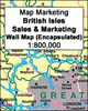
British Isles: Ordnance Survey Communications Wall Map

British Isles Communications Wall Map at 1:1, 000, 000 from the Ordnance Survey, size 93.5 x 104cm (3ft 1 x 3ft 5 approx), with a laminated surface which can be written on with suitable marker pens without damaging the map.The map shows the network of motorways, plus: A roads in Great Britain, A and B roads in Northern Ireland, and N and R roads in the Republic of Ireland. The map also shows railway lines, ferry routes with approx. times, airports (scheduled flights with or without customs and non-scheduled flights with customs) and heliports. The base map has colouring for national parks and area of scenic beauty. Map legend includes French and German.LAMINATED and ENCAPSULATED WALL MAPS:- laminated wall maps have a thin layer of plastic usually applied to the printed side only.
They can be written on with suitable marker pens without any damage to the map but, unless laminated on both sides, they are not damp-proof.- encapsulated wall maps are sealed between two sheets of plastic. They are more rigid and heavier than laminated maps of the same size. They are damp-proof and do not crinkle in humid conditions. Encapsulation gives the map a shiny surface, similar to being displayed behind glass.- please note: many publishers and retailers often use these two terms interchangeably. Our map titles and descriptions follow the definitions provided above.
RIP - This product is no longer available on our network. It was last seen on 25.09.2019

This page now acts as a permanent archive for this product. Add more information using the comments box below to ensure it can still be found by future generations.

Use our search facility to see if it is available from an alternative contributor.
  • Availability: Out Of Stock
  • Supplier: Stanfords
  • SKU: 9780319148358
Availability: In Stock
£9.99

Product Description

British Isles Communications Wall Map at 1:1, 000, 000 from the Ordnance Survey, size 93.5 x 104cm (3ft 1 x 3ft 5 approx), with a laminated surface which can be written on with suitable marker pens without damaging the map. The map shows the network of motorways, plus: A roads in Great Britain, A & B roads in Northern Irel&, & N & R roads in the Republic of Irel&. The map also shows railway lines, ferry routes with approx. times, airports (scheduled flights with or without customs & non-scheduled flights with customs) & heliports. The base map has colouring for national parks & area of scenic beauty. Map legend

Includes::
French & German.LAMINATED & ENCAPSULATED WALL MAPS:- laminated wall maps have a thin layer of plastic usually applied to the printed side only. They can be written on with suitable marker pens without any damage to the map but, unless laminated on both sides, they are not damp-proof.- encapsulated wall maps are sealed between two sheets of plastic. They are more rigid & heavier than laminated maps of the same size. They are damp-proof & do not crinkle in humid conditions. Encapsulation gives the map a shiny surface, similar to being displayed behind glass.- please note: many publishers & retailers often use these two terms interchangeably. Our map titles & descriptions follow the definitions provided above.

Reviews/Comments

Add New

Price History

Vouchers

No voucher codes found.
Do you know a voucher code for this product or supplier? Add it to Insights for others to use.

Facebook

Jargon Buster

Plastic - A generic term for a synthetic product used in the manufacture of products
Glass - A solid, typically transparent. Brittle and used in windows. The first patent granted in the UK was for Glass.
Wall - A physical barrier between two areas
Size - is the measurement of how big an object is in space.
Network - A link and communication between things. Often computers or people.
Layer - Adding extra quantities of materials for extra practical benefits, e.g. warmth.
Laminated - A thin layer of plastic that gives a coating and shine to a material.
Shiny - A smooth reflective surface, e.g. a metal spoon.
Humid - When water vapour is high in the atmosphere making it feel stuffy.

Supplier Information

Stanfords
Stanfords was established in 1853 and opened their iconic Covent Garden flagship store in 1901. They have become the top retailer of maps, travel books and accessories in the UK and arguably offer the largest selection of maps and travel books worldwide. Famous names such as Captain Robert Falcon Scott, Ranulph Fiennes and Michael Palin have purchased from Stanfords. They now have a shop in Bristol and both stores together with other venues operate a calendar of events including talks, book signings and exhibitions. As a specialist map retailer, the map selection is comprehensive and includes road maps, street maps and walking maps from worldwide destinations, as well as a selection of world atlases and wall maps. Books include travel guides and travel literature. Stanfords also stock globes, from miniatures made of blue marble to magnificent floor-standing globes. The website features a selection of interesting articles on travel topics.
Page Updated: 2023-11-12 20:15:36

Community Generated Product Tags

Oh No! The productWIKI community hasn't generated any tags for this product yet!
Menu