
 United Kingdom
 France
 Germany
 Netherlands
 Sweden
 USA
USA
 Italy
Italy
 Spain
Spain
More From Contributor


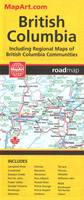
British Columbia MapArt
British Columbia, with coverage extending to Calgary to include the Banff and Jasper National Parks, on an indexed, double-sided road map presenting the whole province at 1:1, 500, 000, plus numerous enlargement and street plans providing more detailed mapping of the Vancouver - Fraser Valley area and several towns.The map divides the province north/south with a generous overlap between the sides. Along the coast coverage extends south to include Seattle and the Olympic NP in USA (main roads only). Enlargement at 1:375, 000 show in greater detail the Fraser Valley area and Greater Victoria. Street plans at scales from 50K to 75K cover Nanaimo, Port Alberni, Whistler, Campbell River, Vernon, Williams, Lake, Cranbrook, Kamloops, Penticton, Kelowna and Powell River, Prince
George, Prince Rupert, Smithers, Terrace, Dawson Creek, Fort St. John and Kitimat. Also provided is an overview map of Yukon with most of Northwest Territories and Nunavut.On the mapping at 1:1, 500, 000 road and rail networks are presented on a base with colouring highlighting national/provincial parks, plus plenty of names of mountain ranges, plateaux, peaks, smaller rivers and lakes, etc. Road network indicates paved, loose surface and unimproved roads plus seasonal routes, and shows driving distances on main and secondary roads. Symbols indicate campsites, ski areas and various places of interest. The map has no geographical coordinates. Also provided is a list of ferry operators.To see the list of currently available Canadian province and regional maps form the MapArt /
Canadian Cartographics Corporation / JDM Géo publishing group, including waterproof and tear-resistant FastTrack titles, please click on the series link.

Product Description
Reviews/Comments
Add New
Vouchers
No voucher codes found.
Do you know a voucher code for this product or supplier? Add it to Insights for others to use.
Do you know a voucher code for this product or supplier? Add it to Insights for others to use.
 Denmark