More From Contributor

£11.99
PHILIP`S
- THE FASTEST GROWING BRAND OF UK ROAD ATLASES No. 1 in the UK for clear maps ` Good balance between detail & clarity
...
Archived Product
£14.99
This book offers a completely new quick & easy way to identify almost any wildflower you may come across in Britain or Irel&. It is unique in the simplicity of its method of identification, using the colour & shape of the flower & the characteristics of the leaf, & has been extensively researched to offer a greater collection of wildflower particulars than ever before published in one portable volume. 563 species are illustrated, grouped according to characteristics, with notes to distinguish between them
- including keys to size, & place & time of flowering
- as well as additional material on superstition & folklore, & medicinal, culinary & other uses.

...
Archived Product
£6.95
Britain in the Culture Smart range of pocket-sized guide books; providing detailed information on local customs, culture, etiquette & manners & ensuring that visitors are prepared for a diverse range of social environments. The series covers an extensive number of countries worldwide & are designed both for those working & living abroad, as well as for visitors who do not want to offend, either intentionally or inadvertently. Their aim is to prevent readers from making embarrassing mistakes & feel confident in unfamiliar situations, while preparing them before arrival on what to expect & how to behave. Each guide is arranged thematically, with dedicated individual chapters on land & people, values & attitudes, customs & traditions, making friends, people at home, ‘time-out’, travelling & communicating. There is also a separate chapter for business travelers, with important information on subjects such as business culture, meetings & making appointments. A Further Reading section also offers a list of recommended other history, travel literature & language titles available on the country. ...
Archived Product
£14.99
Countryside, seaside or city break, whatever you & your children want from a holiday can be found in this new guide from Time Out. A companion to Weekend Breaks in Great Britain & Irel&, & with the same attention to detail, this book answers your getaway needs. Accommodation options run from luxury hotels to well-appointed campsites; the breaks cover the excitement of a city weekend, complete with child-friendly restaurants & museums, as well as the glories of the great outdoors. Whether you're interested in theme parks, castles, zoos or animal sanctuaries, riding stables or swimming pools
- you'll find them here. Your family holidays will never be the same again.
...
Archived Product
£9.99
Few small islands play host to as much variety of landscape as Britain, from towering mountain ranges in the north, across rolling hills, cities of architectural splendour & picturesque villages, to sandy beaches & rugged coves in the south. Shown here in all its majestic beauty, the stunning photographs & fascinating text cover Loch Lomond, the Yorkshire Dales, Brighton Pavilion & much more. The desirable, chunky format makes this an ideal gift for any lover of Britain & travel in general. ...
Archived Product
£14.99
This A3 format atlas provides giant scale mapping & type throughout. It is available in two binding styles, softback & spiral bound. Each page has been titled with its geographical location so you can turn to the page you need more easily. Wide minor roads (more than & less than 4m wide), National Trust, English & World Heritage sites, crematorium locations & other hard-to-find places are indicated on the mapping. There are 72 city, town & port plans including a central district map of London & a full-colour admin map showing all the latest unitary authority areas. Plus, scenic routes & tourist sites with satnav friendly post codes. ...
Archived Product
£9.99
This best-selling A3 format atlas is available in two binding styles, softback & spiral bound. Each page has been titled with its geographical location so you can turn to the page you need more easily. Wide minor roads (more than & less than 4m wide), National Trust, English & World Heritage sites, crematorium locations & other hard-to-find places are indicated on the mapping. There are 67 city, town & port plans including central London. Plus, scenic routes, tourist sites with satnav friendly post codes & caravan & camping sites symbolised on the maps. ...
Archived Product
£11.99
This best-selling A3 format atlas is available in two binding styles, softback & spiral bound. Each page has been titled with its geographical location so you can turn to the page you need more easily. Wide minor roads (more than & less than 4m wide), National Trust, English & World Heritage sites, crematorium locations & other hard-to-find places are indicated on the mapping. There are 67 city, town & port plans including central London. Plus, scenic routes, tourist sites with satnav friendly post codes & caravan & camping sites symbolised on the maps. ...
Archived Product
£9.99
A handy, flexibound glovebox sized road atlas, in an A5 format. Each page has been titled with its geographical location so you can turn to the page you need more easily. There is also a full-colour, admin map showing all the latest unitary authority areas, easy-to-use mileage chart & clear easy-to-read index with more than 23, 000 place names including airports, top tourist sites & motorway services listed. Wide minor roads (more than & less than 4m wide), National Trust, English & World Heritage sites, crematorium locations & other hard-to-find places are also shown. ...
Archived Product
£14.99
This A4 format atlas provides giant scale mapping & type throughout making it very easy to use. Each page has been titled with its geographical location so you can turn to the page you need more easily. Wide minor roads (more than & less than 4m wide), National Trust, English & World Heritage sites, crematorium & other hard-to-find places are shown. There is also a full-colour admin map showing all the latest unitary authority areas & a 6 page route-planning map. ...
Archived Product

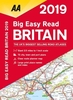
Britain AA Big Easy Read Atlas 2019 PAPERBACK

This A3 format atlas provides giant scale mapping and type throughout. It is available in two binding styles, softback and spiral bound. Each page has been titled with its geographical location so you can turn to the page you need more easily. Wide minor roads (more than and less than 4m wide), National Trust, English and World Heritage sites, crematorium locations and other hard-to-find places are indicated on the mapping. There are 72 city, town and port plans including a central district map of London and a full-colour admin map showing all the latest unitary authority areas. Plus, scenic routes and tourist sites with satnav friendly post codes.
RIP - This product is no longer available on our network. It was last seen on 25.09.2019

This page now acts as a permanent archive for this product. Add more information using the comments box below to ensure it can still be found by future generations.

Use our search facility to see if it is available from an alternative contributor.
  • Availability: Out Of Stock
  • Supplier: Stanfords
  • SKU: 9780749579487
Availability: In Stock
£14.99

Product Description

This A3 format atlas provides giant scale mapping & type throughout. It is available in two binding styles, softback & spiral bound. Each page has been titled with its geographical location so you can turn to the page you need more easily. Wide minor roads (more than & less than 4m wide), National Trust, English & World Heritage sites, crematorium locations & other hard-to-find places are indicated on the mapping. There are 72 city, town & port plans including a central district map of London & a full-colour admin map showing all the latest unitary authority areas. Plus, scenic routes & tourist sites with satnav friendly post codes.

Reviews/Comments

Add New

Intelligent Comparison

Oooops!
We couldn't find anything!
Perhaps this product's unique.... Or perhaps we are still looking for comparisons!
Click to bump this page and we'll hurry up.

Price History

Vouchers

No voucher codes found.
Do you know a voucher code for this product or supplier? Add it to Insights for others to use.

Facebook

Jargon Buster

World - A physical grouping, commonly used to describe earth and everything associated with ti
Colour - The categorised spectrum of light visable to humans
Wide - Something with a large width.

Supplier Information

Stanfords
Stanfords was established in 1853 and opened their iconic Covent Garden flagship store in 1901. They have become the top retailer of maps, travel books and accessories in the UK and arguably offer the largest selection of maps and travel books worldwide. Famous names such as Captain Robert Falcon Scott, Ranulph Fiennes and Michael Palin have purchased from Stanfords. They now have a shop in Bristol and both stores together with other venues operate a calendar of events including talks, book signings and exhibitions. As a specialist map retailer, the map selection is comprehensive and includes road maps, street maps and walking maps from worldwide destinations, as well as a selection of world atlases and wall maps. Books include travel guides and travel literature. Stanfords also stock globes, from miniatures made of blue marble to magnificent floor-standing globes. The website features a selection of interesting articles on travel topics.
Page Updated: 2023-11-12 20:15:36

Community Generated Product Tags

Oh No! The productWIKI community hasn't generated any tags for this product yet!
Menu