More From Contributor
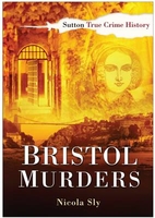
£3.50
Bristol Kingswood in 1903 in a fascinating series of reproductions of old Ordnance Survey plans in the Alan Godfrey Editions, ideal for anyone interested in the history of their neighbourhood or family. The map covers the Kingswood area, east of Bristol. Coverage stretches from Albany Street & Lodge Road eastward to Tenniscourt Road, & from Gladstone Street & Hampden Street southward to Cockroad Bottom. Features include tramway & depot, New Cheltenham area, Kingswood Hill area, Warmley Hill area, Woodstock area, Kingswood Reformatory, Potters Wood area, boot & shoe factories, Lantern Bottom, Holy Trinity church, Kingswood Hill Iron Works, chapels, etc. A list of private residents from an 1894 directory is on the reverse. About the Alan Godfrey Editions of the 25” OS Series Selected towns in Great Britain & Ireland are covered by maps showing the extent of urban development in the last decades of the 19th & early 20th century. The plans have been taken from the Ordnance Survey mapping & reprinted at about 15 inches to one mile (1:4, 340). On the reverse most maps have historical notes & many also include extracts from contemporary directories. Most maps cover about one mile (1.6kms) north/south, one & a half miles (2.4kms) across; adjoining sheets can be combined to provide wider coverage.FOR MORE INFORMATION & A COMPLETE LIST OF ALL AVAILABLE TITLES PLEASE CLICK ON THE SERIES LINK. ...
Archived Product
£3.50
Bristol Knowle in 1902 in a fascinating series of reproductions of old Ordnance Survey plans in the Alan Godfrey Editions, ideal for anyone interested in the history of their neighbourhood or family. The map covers most of the village of Knowle, south of Bristol. Coverage stretches from Somerset Road southward to Hengrove House, & from Lower Knowle Farm eastward to West Town Farm. Features include Brislington station, Queen`s Dale Farm, Firfield House, Racecourse Cottages, St Martin`s church, House of Charity, Lower Knowle, Bear`s Bridge, Kingshill House, western edge of Brislington. On the reverse is a street directory for Wells Road, plus railway timetables for the Bristol-Radstock-Frome line in 1906 & 1929. About the Alan Godfrey Editions of the 25” OS Series Selected towns in Great Britain & Ireland are covered by maps showing the extent of urban development in the last decades of the 19th & early 20th century. The plans have been taken from the Ordnance Survey mapping & reprinted at about 15 inches to one mile (1:4, 340). On the reverse most maps have historical notes & many also include extracts from contemporary directories. Most maps cover about one mile (1.6kms) north/south, one & a half miles (2.4kms) across; adjoining sheets can be combined to provide wider coverage.FOR MORE INFORMATION & A COMPLETE LIST OF ALL AVAILABLE TITLES PLEASE CLICK ON THE SERIES LINK. ...
Archived Product
£12.99
Bristol has plenty to be proud of when it comes to famous people. Some were born in the city while others were drawn to it by its colourful heritage, adventurous spirit & vibrant atmosphere of culture & enterprise. A few names, like that of the explorer John Cabot, have been woven into the fabric of the city`s heritage. However, other people who helped to shape today`s rich environment are hardly remembered. Within the pages of this book you`ll meet the priest they called the ` Red Bishop`
- the princess that never was
- the inventor of a so-called `thrashing machine` for errant schoolchildren
- & the dog that became an advertising icon.


...
Archived Product
£3.50
Bristol Long Aston in 1913 in a fascinating series of reproductions of old Ordnance Survey plans in the Alan Godfrey Editions, ideal for anyone interested in the history of their neighbourhood or family. The map covers the village of Long Ashton, south-west of Bristol. Features in the village include All Saints church, Abbot`s Barn, Angel Inn, Lower Court Farm, while to the south is the hamlet of Yanley. The map is surprisingly rural, the other major feature being South Liberty Colliery with GWR railway. On the reverse is a directory of Long Ashton. About the Alan Godfrey Editions of the 25” OS Series Selected towns in Great Britain & Ireland are covered by maps showing the extent of urban development in the last decades of the 19th & early 20th century. The plans have been taken from the Ordnance Survey mapping & reprinted at about 15 inches to one mile (1:4, 340). On the reverse most maps have historical notes & many also include extracts from contemporary directories. Most maps cover about one mile (1.6kms) north/south, one & a half miles (2.4kms) across; adjoining sheets can be combined to provide wider coverage.FOR MORE INFORMATION & A COMPLETE LIST OF ALL AVAILABLE TITLES PLEASE CLICK ON THE SERIES LINK. ...
Archived Product
£29.99
Cities, towns, counties & now, even football clubs are celebrated through these special editions of this classic family board game. Featuring many of Bristol`s most famous landmarks & cultural icons, they make wonderful gifts, souvenirs of a trip, or great family fun with a local flavour. Order your limited edition copy of the World`s best board game today! Key

Features:
- The world`s best family board game brings you another exciting edition of MONOPOLY
- Bristol- Choose your favourite token, tour your favourite sites & accumulate fortunes, but watch out for taxes, jail & bankruptcy- Advance to The Memorial Stadium, Somerset House or Bristol Old Vic
- will you owe rent or reap the rewards?- Invest in houses & hotels & trade your way to success- The Fast-Dealing Property Trading Game is fun for the whole family


...
Archived Product
£3.50
Bristol North-East in 1902 in a fascinating series of reproductions of old Ordnance Survey plans in the Alan Godfrey Editions, ideal for anyone interested in the history of their neighbourhood or family. The map covers a major part of Bristol including the Easton area to the north-east. Coverage stretches from Castle Street eastward to Lyppiatt Road & Avonvale Road, & from Old Bread Street northward to Lower Ashley Road & Baptist Mills. Features include Midland Railway St Philip`s Station Branch with terminus & Goods Shed, GWR railway with Lawrence Hill station, Netham Works (in the south-eastern corner), engine shed, Holy Trinity church, St Philip & St Jacob`s church, St Philip`s Bridge over Floating Harbour, St Paul`s church with St Paul`s district, Public Library, Portland Square, soap works, River Frome, Bristol Wagon Works, Easton Colliery, Frog Marsh, The Wilderness, etc. On the reverse are street directory entries for Brunswick Square, Clarence Road, Lawrence Hill, Lower Castle Street, Old Market Street, Portland Square, Stapleton Road & Tower Hill. About the Alan Godfrey Editions of the 25” OS Series Selected towns in Great Britain & Ireland are covered by maps showing the extent of urban development in the last decades of the 19th & early 20th century. The plans have been taken from the Ordnance Survey mapping & reprinted at about 15 inches to one mile (1:4, 340). On the reverse most maps have historical notes & many also include extracts from contemporary directories. Most maps cover about one mile (1.6kms) north/south, one & a half miles (2.4kms) across; adjoining sheets can be combined to provide wider coverage.FOR MORE INFORMATION & A COMPLETE LIST OF ALL AVAILABLE TITLES PLEASE CLICK ON THE SERIES LINK. ...
Archived Product
£3.50
Bristol North-West & Clifton in 1901 in a fascinating series of reproductions of old Ordnance Survey plans in the Alan Godfrey Editions, ideal for anyone interested in the history of their neighbourhood or family. The map covers a major part of Bristol together with much of Clifton. Coverage stretches from Clifton College eastward to Stokes Croft, & from Brandon Hill & Bristol Bridge northward to Apsley Road & Chantry Road. Features include Tyndall`s Park, Park Row, tramways, Victoria Rooms, Victoria Park, St Andrew`s church, Christ Church, Zoo, Clifton College, Clifton Down station, Cotham, Haymarket, St James church, Colston Avenue, St Nicholas church, tram depot, Royal Infirmary, Colston Hall, Cabot Tower, Turkish Baths, University College, St George`s church, Grammar School, Guildhall, Kingsdown, St Augustine`s Bridge, etc. On the reverse are street directory entries for Broad Street, Corn Street, High Street, The Mall & Wine Street About the Alan Godfrey Editions of the 25” OS Series Selected towns in Great Britain & Ireland are covered by maps showing the extent of urban development in the last decades of the 19th & early 20th century. The plans have been taken from the Ordnance Survey mapping & reprinted at about 15 inches to one mile (1:4, 340). On the reverse most maps have historical notes & many also include extracts from contemporary directories. Most maps cover about one mile (1.6kms) north/south, one & a half miles (2.4kms) across; adjoining sheets can be combined to provide wider coverage.FOR MORE INFORMATION & A COMPLETE LIST OF ALL AVAILABLE TITLES PLEASE CLICK ON THE SERIES LINK. ...
Archived Product
£14.99
Once England`s second city, Bristol is still the commercial, retail & distribution centre for the whole of the South West. The city`s long & fascinating history has been the subject of many books, one of the most successful being the same author`s Bristol: A Pictorial History (1991). Now he has greatly expanded the narrative of that book into a full, detailed account, combined with a fine selection of carefully-chosen illustrations, & provides a striking & highly authoritative exploration of every aspect of the unique history of this particularly interesting city. ...
Archived Product
£8.99
Bristol in the Cassini Past & Present map series which covers town & cities of England & Wales & offers a unique way of tracing their history & expansion by showing four different periods of their development using Ordnance Survey mapping from the mid-19th century, the late 19th century, the 1920s & the present day. Coverage

Includes::
Avonmouth, Clifton, Filton, Keynsham, Kingswood, Long Ashton, Patchway, Sirehampton & Winterbourne. Each Past & Present map consists of four panels, all centred on a city or a town & covering exactly the same 15km x 15km area. Three of the panels reproduce Ordnance Survey

...
Archived Product
£14.99
Bristol Pevsner Architectural Guide, in a series of publications begun with the express aim of providing up-to-date guides to the most significant buildings in every part of the country, suitable for both general reader & specialist. Each volume provides an introductory overview of the architecture of the area, followed by a descriptive gazetteer arranged alphabetically by place. Whilst cathedrals & their furnishings, great country houses & their parks form the grand set pieces, the books demonstrate the enjoyable diversity of architecture in the British Isles in accounts of rural churches & farmsteads, Victorian public buildings & industrial monuments. A continuing programme of publication keeps the series up-to-date with new information on older buildings & recent architecture while maintaining the tradition of Pevsner`s own succinct accounts. Each book has over 100 photographs, mostly specially commissioned, numerous maps & plans, a glossary & indexes. ...
Archived Product

Bristol Murders

”Bristol Murders” brings together numerous murderous tales that shocked not only the city but also made national headlines. Contained within the pages of this book are the stories behind some of the most heinous crimes ever committed in Bristol. They include the murder and suicide of a brother and sister in 1842; the tragic death of 10-year-old Mabel Price in 1897; the killing of Ada James in a fit of jealous rage by her fiance Ted Palmer in 1913; and the suspicious death of sexual deviant Cecil Cornock, which led to his wife Ann being charged with his murder before her subsequent acquital in 1946. Nicola Sly`s carefully researched, well-illustrated and enthralling text will appeal to anyone interested in the shady side of Bristol`s history, and should give much food for thought.
RIP - This product is no longer available on our network. It was last seen on 25.09.2019

This page now acts as a permanent archive for this product. Add more information using the comments box below to ensure it can still be found by future generations.

Use our search facility to see if it is available from an alternative contributor.
  • Availability: Out Of Stock
  • Supplier: Stanfords
  • SKU: 9780750950480
Availability: In Stock
£12.99

Product Description

” Bristol Murders” brings together numerous murderous tales that shocked not only the city but also made national headlines. Contained within the pages of this book are the stories behind some of the most heinous crimes ever committed in Bristol. They include the murder & suicide of a brother & sister in 1842; the tragic death of 10-year-old Mabel Price in 1897; the killing of Ada James in a fit of jealous rage by her fiance Ted Palmer in 1913; & the suspicious death of sexual deviant Cecil Cornock, which led to his wife Ann being charged with his murder before her subsequent acquital in 1946. Nicola Sly`s carefully researched, well-illustrated & enthralling text will appeal to anyone interested in the shady side of Bristol`s history, & should give much food for thought.

Reviews/Comments

Add New

Intelligent Comparison

Oooops!
We couldn't find anything!
Perhaps this product's unique.... Or perhaps we are still looking for comparisons!
Click to bump this page and we'll hurry up.

Price History

Vouchers

No voucher codes found.
Do you know a voucher code for this product or supplier? Add it to Insights for others to use.

Facebook

Jargon Buster

LED - Light Emitting Diode - a small light source
History - Anything that happens in the past. An acedemic subject.
Year - The time it takes the planet earth to orbit the sun. This takes around 365.25 days.
LED - Light Emitting Diode. A bulb that is very efficient at producing light. Often small.
Year - 365 days (366 days in a leap year), the time taken for planet earth to make one full revolution around the sun.

Supplier Information

Stanfords
Stanfords was established in 1853 and opened their iconic Covent Garden flagship store in 1901. They have become the top retailer of maps, travel books and accessories in the UK and arguably offer the largest selection of maps and travel books worldwide. Famous names such as Captain Robert Falcon Scott, Ranulph Fiennes and Michael Palin have purchased from Stanfords. They now have a shop in Bristol and both stores together with other venues operate a calendar of events including talks, book signings and exhibitions. As a specialist map retailer, the map selection is comprehensive and includes road maps, street maps and walking maps from worldwide destinations, as well as a selection of world atlases and wall maps. Books include travel guides and travel literature. Stanfords also stock globes, from miniatures made of blue marble to magnificent floor-standing globes. The website features a selection of interesting articles on travel topics.
Page Updated: 2023-11-12 20:15:36

Community Generated Product Tags

Oh No! The productWIKI community hasn't generated any tags for this product yet!
Menu