More From Contributor
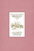
£11.19
Laminated waterproof edition of a detailed topographic map from the Ordnance Survey Explorer series, covering Lewes & Burgess Hill (showing part of the South Downs Way). Edition B2 with minor changes; Publication date January 2011 About this series: These highly detailed maps show all the administrative boundaries, settlements as small as isolated farms, the road network down to unfenced roads & country tracks, & field boundaries (hedges & drystone walls) which make navigation across the countryside much easier. Steep gradients on roads are indicated. Various landmarks, e.g. powerlines, archaeological sites, windmills, churches & lighthouses are shown & additional graphics indicate natural terrain features such as cliffs, scree, mud & vegetation variations. The contour interval is 5 metres in the lower parts of the country & 10 metres in the uplands, & spot heights are marked. Each map covers an area of 30 x 20km (i.e. approx. 19 x 12 miles), with some double-sided maps covering more, as indicated in the individual descriptions. The maps are fully GPS compatible, with the National Grid shown at 1km intervals & latitude & longitude indicated by margin ticks at 1'. The Explorer series has replaced the earlier, green-cover Pathfinder maps. The Explorer series is now complete & covers all of Engl&, Wales & Scotl&. Some sheets for popular areas like the National Parks are still branded as Outdoor Leisure (OL) maps, but are now included in this series as the cartography is the same as that in the Explorer Maps. The Explorer maps offer a substantial improvement on the Pathfinder series, with greater use of colour, larger area per map, & stronger emphasis on information for ramblers & tourists. This series is ideal for walking & other outdoor pursuits & each map shows a large amount of information for ramblers & tourists. Public rights of way are shown (except in Scotland), together with other routes with public access: National Trails & Recreational Paths, permitted paths & bridleways, & selected cycle routes. Open access land created under the Countryside & Rights of Way Act 2000 is marked. Tourist information

Includes::
caravan & camp sites, Park & Ride locations, recreation/leisure/sport centres, museums, historic buildings, English Heritage & National Trust sites, rural pubs, etc. The map legend is in English only, except for the tourist information content which is also in French & German.

...
Archived Product
£5.99
Did you know? * The young George IV liked to go dancing until 4 a.m. * Brighton is home to the UK`s oldest electric railway * There are nearly 1, 400 premises licensed to sell alcohol in Brighton & Hove * Brighton & Hove welcomes 8 million visitors annually & has been voted one of the top five cities that tourists want to visit during their stay in the UK This engaging little book is packed full of insider knowledge, facts, figures & the secrets of the vibrant city of Brighton & Hove: diversity, culture, the arts, history, comedy & creativity in bucket-&-spade-loads. ...
Archived Product
£7.99
Brighton & The South Downs at 1:25, 000 in a series of Walker’s Maps published by the AA with the cartography from the Ordnance Survey’s Explorer series. Coverage

Includes::
Hove, Shorehan-by-Sea, Upper Beeding, Henfield, Hickstead, Hurstpierpoint, Burgess Hill, Ditchling, Plumpton, Lewes, Glynde, Ringmer, Newhaven, etc. Maps in the AA Walker’s series are identical to the OS Explorer maps & provide plenty of recreational & tourist information, indicating in England & Wales the traditional public rights of way paths, including bridleways & byways restricted or open to motorized traffic. Also shown are other routes with public access, including permissive footpaths & bridleways. For Scotl&, where different access rights apply, the maps provide an additional note explaining the regulations. Special marking indicates National Trails & Recreational Routes & for cyclists the maps show traffic-free routes & the National Cycle Network. A wide range of symbols highlights locations of special tourist interest: camping & caravanning sites, youth hostels, information offices & visitors’ centres, parking & picnicking places, historic buildings (indicating where appropriate National Trust, English Heritage, Historic Scotland or Cadw), sites for various recreational pursuits, country pubs, public toilets, etc. The maps provide detailed presentation of the topography with contours at 5 or 10m intervals, numerous spot heights & colouring and/or graphics for different types of vegetation. Additional colouring shows access l&, including areas managed by the National Trust, Forestry Commission & Woodland Trust. All the standard information expected of high quality survey mapping at this scale is included: finely graded road network, railway lines with stations, cuttings or embankments, individual isolated buildings, etc. For GPS users the British National Grid is drawn at 1km intervals.

...
Archived Product
£5.99
What was Brighton called in the Domesday Book? What are 'twittens'? Who was Martha Gunn? What waist measurement are the Prince Regent's breeches? Who were the Brighton Tigers? All these questions & many, many more are answered in Brighton, A Very Peculiar History Quiz Book. Have fun with this wide selection of questions & answers about Brighton (and Hove), featuring famous"es, quirky stories & detailed answers. Challenge yourself by testing your knowledge of the popular seaside resort. ...
Archived Product
£4.95
Brighton, Worthing, Lewes & Newhaven Street Atlas from the Geographers` A-Z Map Company in an A5 paperback format at 1:15, 840 (4” to a mile), with an enlargement showing the town centre of Brighton in greater detail at 1:7, 920 (8” to 1 mile). Coverage

Includes::
Hove, Seaford, Shoreham-by-Sea, Falmer, Ferring, Findon, Lancing, Peacehaven, Portslade-by-Sea, Rottingdean, Southwick & Steyning, Current edition of this title was published in 2012. To see other titles in this series of A-Z street atlases of towns & cities please click on the series link. A-Z also publish a series of County Street Atlases, for a list of titles in that series please search for SI00000917.A-Z street atlases present motorways plus A & B roads highlighted by colouring & shown with route numbers. One way or restricted access streets & car parks are marked, as are in more recently published titles locations of speed cameras. Also shown are selected cycleway routes. Where appropriate, A & B roads are annotated with selected house numbers for easier identification of addresses. Railway lines are shown with stations & level crossings. Colouring indicates different types of buildings: educational, hospitals & healthcare, industrial, leisure & recreational, shopping centres & markets, public buildings, & places of interest. Symbols mark locations of facilities usually indicated on street mapping: post offices, emergency services, public toilets, etc. Also marked are postcode & local authority boundaries. Each page has the lines & coordinates of the British National Grid. The indexes list streets, places & areas, hospitals, industrial estates, blocks of flats on housing estates, railway stations, & selected places o interest; the latter are printed in contrasting colouring to make them easier to find.

...
Archived Product
£1.99
Found in our archives, the Black`s Sketchbooks are a series of books produced in the early 20th century by a group of well-known artists. Each book contains pen sketches of iconic English & Scottish cities & counties. There are also some books on Continental cities such as Paris & Venice. The result is a charming series of books that present a fascinating look at British & European locations as they were almost a century ago. This title is a delightful look at Brighton & its environs in 1919. ...
Archived Product
£8.99
Brighton & Hove in the Cassini Past & Present map series which covers town & cities of England & Wales & offers a unique way of tracing their history & expansion by showing four different periods of their development using Ordnance Survey mapping from the mid-19th century, the late 19th century, the 1920s & the present day. Coverage

Includes::
Ditchling, Hassocks, Henfield, Hurstpierpoint, Portslade-by-Sea, Shoreham-by-Sea, Southwick & Upper Beeding. Each Past & Present map consists of four panels, all centred on a city or a town & covering exactly the same 15km x 15km area. Three of the panels reproduce Ordnance Survey

...
Archived Product
£14.99
Brighton & Hove Pevsner Architectural Guide, in a series of publications begun with the express aim of providing up-to-date guides to the most significant buildings in every part of the country, suitable for both general reader & specialist. Each volume provides an introductory overview of the architecture of the area, followed by a descriptive gazetteer arranged alphabetically by place. Whilst cathedrals & their furnishings, great country houses & their parks form the grand set pieces, the books demonstrate the enjoyable diversity of architecture in the British Isles in accounts of rural churches & farmsteads, Victorian public buildings & industrial monuments. A continuing programme of publication keeps the series up-to-date with new information on older buildings & recent architecture while maintaining the tradition of Pevsner`s own succinct accounts. Each book has over 100 photographs, mostly specially commissioned, numerous maps & plans, a glossary & indexes. ...
Archived Product
£5.59
Map No. 198, Brighton & Lewes, in the Ordnance Survey Landranger series at 1:50, 000, including Worthing, Horsham, Haywards Heath, Crawley, Burgess Hill, Uckfield, Newhaven, Seaford, Shoreham-by-Sea, Turners Hill, Forest Row, Sinfold, Balcombe, Sharpthorne, Nutley, Ardingly, Handcross, Slinfold, Southwater, Broadford Bridge, Cowfold, Partridge Green, Hurstpierpoint, South Chailey, Ashington, Henfield, Clayton, Ringmer, Glyndebourne, Woodingdean, Stayning, Findon, & part of the Low Weald. Edition E2; Publication Date May 2011 This title is also available on our website in a waterproof & tear-resistant version. Maps in this series are only published folded. Stanfords can also print flat versions of Ordnance Survey maps through the OS Select system, centring the map on a location of your choice & with a picture provided by you on the cover. For more information please click on the link at the bottom of this description. About Ordnance Survey ...
Archived Product
£9.99
Map No. 198, Brighton & Lewes 1813-1819, in the Cassini Historical Series of old Ordnance Survey mapping of England & Wales at 1:50, 000 in a format designed to offer a convenient comparison with the present day coverage from the OS, & most locations in three different editions. Old historical maps have been combined so that the sheet lines correspond to the current Landranger series & reproduced with the scale changed from one inch to one mile to 1:50, 000. Most locations are covered by three separate maps, showing how the area has changed over the decades, with selected major cities also presented in a fourth edition. * Old Series: the first detailed survey mapping dating for most areas from the first half of the 19th century, in black & white & with relief shown by hachuring.* Revised New Series from 1880s/1900s, with some colouring & a mixture of hachuring & contour lines.* Popular Edition from the inter-war years, with contour lines & colouring to indicate woodlands, parks, etc.* New Popular Edition from the late 1940s, reproduced in the Cassini series for the major cities. Each map

Includes::
notes on the development of Ordnance Survey & the various series produced by them. For those interested in maps & cartography in general, the Cassini series also provides a fascinating insight into how Ordnance Survey cartographic style has developed over a period of over 100 years. Coverage in this title

Includes::
present day Worthing, Horsham, Haywards Heath, Crawley, Burgess Hill, Uckfield, Newhaven, Seaford, Shoreham-by-Sea, Turners Hill, Forest Row, Sinfold, Balcombe, Sharpthorne, Nutley, Ardingly, Handcross, Slinfold, Southwater, Broadford Bridge, Cowfold, Partridge Green, Hurstpierpoint, South Chailey, Ashington, Henfield, Clayton, Ringmer, Glyndebourne, Woodingdean, Stayning, Findon, & part of the Low Weald.* PLEASE NOTE: Stanfords can also print on request mapping from all four series *centring the map on a location of your choice.* For more information please click on the link below.


...
Archived Product

Brighton 1909

Brighton in 1909 in a fascinating series of reproductions of old Ordnance Survey plans in the Alan Godfrey Editions, ideal for anyone interested in the history of their neighbourhood or family. The map covers much of central and west Brighton, together with a large part of Hove. Coverage stretches from Old Steine and Grand Parade westward to Second Avenue and Wilbury Road, and from Old Shoreham Road southward to the seafront. Major features include the station, engine shed, locomotive and carriage works, Holland Road Halt, and railway lines and tramways; St Nicholas church, St Peter`s church, Hotel Metropole, Grand Hotel, Bedford Hotel, part of West Pier, Brunswick Lawns, Adelaide Crescent, Brunswick Square, Regency Square, Montpelier Crescent, St Anns Wells Gardens, All
Saints church Hove, cricket ground, St Thomas church, The Wick, Wick Hall, Gloucester Place, Royal Pavilion, The Lanes (not all named), the Dome, etc. On the reverse are street directory entries for Brunswick Place, Kings Road and Western Road.West Worthing in 1896 in a fascinating series of reproductions of old Ordnance Survey plans in the Alan Godfrey Editions, ideal for anyone interested in the history of their neighbourhood or family. Worthing is covered on two maps. The West Worthing map covers the area from Christchurch Road westward to Elm Grove and to the boundary with Goring parish. Much of this map is in the parish of Heene and includes St Botolph`s church there. Features include West Worthing and Worthing stations, Heene Windmill, numerous nursery greenhouses,
Westbrooke, Park Crescent, Marine Parade, Shelley Road, Holy Trinity church, St Andrew`s church, Christ Church. Street directory extracts on the reverse show entries for Clifton Road, Crescent Road, Heene Road, Marine Parade, Montague Street and Richmond Road. The Worthing map continues coverage eastward and stretches to the end of Brougham Road and to Seamill Farm. Features include the pier, Chapel Road, South Street, St Paul`s church, Brighton Road (where Oscar Wilde wrote The Importance of Being Earnest), Infirmary, Homefield Park, more nursery greenhouses, Poors Ten Acres, St Georges church. Directory extracts on the reverse show street entries for Brighton Road, Chapel Road, Marine Parade, Marine Place, South Street, Warwick Road and Warwick Street. About the
Alan Godfrey Editions of the 25” OS SeriesSelected towns in Great Britain and Ireland are covered by maps showing the extent of urban development in the last decades of the 19th and early 20th century. The plans have been taken from the Ordnance Survey mapping and reprinted at about 15 inches to one mile (1:4, 340). On the reverse most maps have historical notes and many also include extracts from contemporary directories. Most maps cover about one mile (1.6kms) north/south, one and a half miles (2.4kms) across; adjoining sheets can be combined to provide wider coverage.FOR MORE INFORMATION AND A COMPLETE LIST OF ALL AVAILABLE TITLES PLEASE CLICK ON THE SERIES LINK.
RIP - This product is no longer available on our network. It was last seen on 25.09.2019

This page now acts as a permanent archive for this product. Add more information using the comments box below to ensure it can still be found by future generations.

Use our search facility to see if it is available from an alternative contributor.
  • External links may include paid for promotion
  • Availability: Out Of Stock
  • Supplier: Stanfords
  • SKU: 9781847840851
Availability: In Stock
£3.50

Product Description

Brighton in 1909 in a fascinating series of reproductions of old Ordnance Survey plans in the Alan Godfrey Editions, ideal for anyone interested in the history of their neighbourhood or family. The map covers much of central & west Brighton, together with a large part of Hove. Coverage stretches from Old Steine & Grand Parade westward to Second Avenue & Wilbury Road, & from Old Shoreham Road southward to the seafront. Major features include the station, engine shed, locomotive & carriage works, Holland Road Halt, & railway lines & tramways; St Nicholas church, St Peter`s church, Hotel Metropole, Grand Hotel, Bedford Hotel, part of West Pier, Brunswick Lawns, Adelaide Crescent, Brunswick Square, Regency Square, Montpelier Crescent, St Anns Wells Gardens, All Saints church Hove, cricket ground, St Thomas church, The Wick, Wick Hall, Gloucester Place, Royal Pavilion, The Lanes (not all named), the Dome, etc. On the reverse are street directory entries for Brunswick Place, Kings Road & Western Road. West Worthing in 1896 in a fascinating series of reproductions of old Ordnance Survey plans in the Alan Godfrey Editions, ideal for anyone interested in the history of their neighbourhood or family. Worthing is covered on two maps. The West Worthing map covers the area from Christchurch Road westward to Elm Grove & to the boundary with Goring parish. Much of this map is in the parish of Heene &

Includes::
St Botolph`s church there. Features include West Worthing & Worthing stations, Heene Windmill, numerous nursery greenhouses, Westbrooke, Park Crescent, Marine Parade, Shelley Road, Holy Trinity church, St Andrew`s church, Christ Church. Street directory extracts on the reverse show entries for Clifton Road, Crescent Road, Heene Road, Marine Parade, Montague Street & Richmond Road. The Worthing map continues coverage eastward & stretches to the end of Brougham Road & to Seamill Farm. Features include the pier, Chapel Road, South Street, St Paul`s church, Brighton Road (where Oscar Wilde wrote The Importance of Being Earnest), Infirmary, Homefield Park, more nursery greenhouses, Poors Ten Acres, St Georges church. Directory extracts on the reverse show street entries for Brighton Road, Chapel Road, Marine Parade, Marine Place, South Street, Warwick Road & Warwick Street. About the Alan Godfrey Editions of the 25” OS Series Selected towns in Great Britain & Ireland are covered by maps showing the extent of urban development in the last decades of the 19th & early 20th century. The plans have been taken from the Ordnance Survey mapping & reprinted at about 15 inches to one mile (1:4, 340). On the reverse most maps have historical notes & many also include extracts from contemporary directories. Most maps cover about one mile (1.6kms) north/south, one & a half miles (2.4kms) across; adjoining sheets can be combined to provide wider coverage.FOR MORE INFORMATION & A COMPLETE LIST OF ALL AVAILABLE TITLES PLEASE CLICK ON THE SERIES LINK.

Reviews/Comments

Add New

Price History

Vouchers

No voucher codes found.
Do you know a voucher code for this product or supplier? Add it to Insights for others to use.

Facebook

Jargon Buster

Contemporary - Modern era design
Engine - A machine designed to convert fuel into motion
Contemporary - A design reference to indicate post war modern design
Hotel - An establishment which provides lodging for a fee
Locomotive - Or Loco is the powered vehicle at the front of a train
History - Anything that happens in the past. An acedemic subject.
Large - something that takes up more space than normal.
Road - a manmade lane or a path that is used to speed up travel.
Contemporary - An object that is living in the same time.
Hall - A room at the inside of an entrance of a house.
Dome - A curved shape usually seen on building structures.
Ideal - Something that satisfies a perfect criteria.
Family - A group of people that live together made up from parents and children.

Supplier Information

Stanfords
Stanfords was established in 1853 and opened their iconic Covent Garden flagship store in 1901. They have become the top retailer of maps, travel books and accessories in the UK and arguably offer the largest selection of maps and travel books worldwide. Famous names such as Captain Robert Falcon Scott, Ranulph Fiennes and Michael Palin have purchased from Stanfords. They now have a shop in Bristol and both stores together with other venues operate a calendar of events including talks, book signings and exhibitions. As a specialist map retailer, the map selection is comprehensive and includes road maps, street maps and walking maps from worldwide destinations, as well as a selection of world atlases and wall maps. Books include travel guides and travel literature. Stanfords also stock globes, from miniatures made of blue marble to magnificent floor-standing globes. The website features a selection of interesting articles on travel topics.
Page Updated: 2023-11-12 20:15:36

Community Generated Product Tags

Oh No! The productWIKI community hasn't generated any tags for this product yet!
Menu