More From Contributor
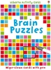
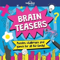
£17.99
Topographic survey of Portugal at 1:100, 000 from the Instituto Geográfico Português, the country’s civilian survey organisation. The maps have contours at 50m intervals & in addition to the standard features shown on topographic mapping at this scale also indicate various types of vegetation (vineyards, olive groves, etc). Each sheet covers an area of 64 x 40km (40 x 25 miles approx). The maps have latitude & longitude margin ticks at 1’ intervals, plus show UTM coordinates for the map corners. Map legend is in Portuguese only.PLEASE NOTE
- EDITION DATES: some sheets at this scale date back to the 1950s or 1960s. For more recent editions please see IGP’s 1:25, 000 series where each 50K map is divided into four quarters. To see all the titles in the 1:100, 000 series please click on the series link.
...
Archived Product
£17.99
One of the titles in the topographic survey of the Svalbard group published in a colour version, available for the western coast, central & southern part of Spitzbergen, plus two small islands of Svenskøya & Kongsøya. The map has contours at 25-metre intervals, bold relief shading & spot heights, & shows settlements, roads & tracks, working & disused mines, airfields, lighthouses & radio beacons, etc. A grid gives UTM co-ordinates plus latitude in steps of 10` & longitude in 20’. The rest of Spitzbergen, Nordaustlandet, Edgeøya & other small islands are covered by black & white maps with contours only. Most of these maps show no geographical names, as indicated in the individual descriptions of each title. ...
Archived Product
£11.95
Bragg Creek & Sheep Valley in a series of detailed hiking maps of the Canadian Rockies, covering the most popular areas of the Banff, Jasper, Kootenay & Yoho National Parks, as well as Waterton Lakes NP further south & the adjoining Goat Haunt area of Montana. The maps are contoured (50m or 25m interval in most titles) & some titles also have relief shading. Extensive overprint highlights hiking trails, many with detailed descriptions provided on the reverse. Most titles also include mountain bike, equestrian & ski routes. Symbols indicate various facilities, including camping grounds, hostels, lodges, visitors ...
Archived Product
£6.99
This is a pack of colourfully illustrated cards bursting with puzzles that will put children & adult`s brainpower to the test. Each brain-teasing puzzle sorts out the brainiacs from the bozos by testing their observation, memory, arithmetic & logic skills. The cards are wipe clean & the pack

Includes::
a special pen, making the pack entirely self contained, easily portable & a great gift.

...
Archived Product
£13.99
In which city would you cross the Bosphorus Bridge linking Europe & Asia? Ride a cable car to Table Mountain? Brain Box Cities is designed for you to play with your family & friends. It will help improve obsertation & memory skills as well as knowledge about some of the most iconic cities in the world. Each card shows images, foods, people & facts from cities all around the world. The object of the game is to study a card for 10 seconds & then answer a question based on the roll of a die. If the question is answered correctly, the card is kept & the person with the most number of cards after 5 or 10 minutes is the winner. Made from a minimum of 70% recycled material & designed in the UK. Box contains 71 cards, 1 rules card, 1 sand timer & 1 die. Suitable for ages 8+. ...
Archived Product
£13.99
Learning French has never been more useful, as languages now play an increased role in the National Curriculum. This Brain Box game will help improve Observation & Memory skills as well as introduce French vocabulary. Each of the cards shows a scene with words in both French & English. The Reverse of each card has two levels of questions, one for beginners, the other for the more confident. This Brian Box game is great fun & a valuable learning tool. ...
Archived Product
£13.99
Do you know where Machu Pichu is? Or what bird New Zealanders are named after? Brain Box World contains 71 beautifully-illustrated cards showing the very best this world has to offer, & then some! The object of the game is to study a card for 10 seconds & then answer a question based on the roll of a die. If the question is answered correctly, the card is kept & the person with the most number of cards after 5 or 10 minutes is the winner. Made from a minimum of 70% recycled material & designed in the UK. Box contains 55 cards, 1 rules card, 1 sand timer & 1 die. Suitable for ages 8+. ...
Archived Product
£11.50
Map No. 2611E, Braine, in IGN’s excellent, detailed topographic survey of France at 1:25, 000. The map covers the western section of the crossing of the Aisne at Vailly-sur-Aisne by the British Expeditionary Force on 13th September 1914 during the First Battle of the Aisne. Please note: Vénizel is just off this map on the adjoining sheet to the west 2611O – Soissons. Although not specifically designed to show WWI memorial sites & best used in conjunctions with one of the specialist maps on the Western Front, maps in the IGN 1:25, 000 series are ideal for locating access to the numerous smaller war cemeteries & memorials scattered across northern France. The map is contoured, GPS compatible & shows all the features expected of topographic mapping at this scale. Map legend is in French only. To see the full description of IGN’s 1:25, 000 topographic survey of France & the list of all the titles in this series please click on the series link. ...
Archived Product
£9.50
Topographical survey of Belgium at 1:20, 000 from Nationaal Geografisch Instituut / Institut Géographique National, the country’s national survey organization. Each 20K map covers one quarter of the corresponding 1:50, 000 map (with adjustments in the border & coastal areas). The maps provide all the information expected of topographic mapping at this scale & in addition have an unusually large amount of vegetation and/or land use information (different types of woodlands, gardens, orchards, heath, etc). The maps have a 1-km UTM grid, with margin ticks for latitude & longitude at intervals of 1`. Map legend & a glossary of terms used on the maps include English. Stanfords keeps as regular stock 20K maps for the World War I battlefields around the Ypres, Messines & Passchendaele, & for the area of the Battle of Waterloo. The 1:20, 000 survey covers the whole of Belgium & maps for other regions can be supplied as special orders. To see the list of titles in this series please click on the series link.PLEASE NOTE: the Long-Distance Footpaths Map of Belgium at 1:300, 000 which shows the division of Belgium into the 50K survey sheets can also be used to see in more detail coverage by the 20K maps. ...
Archived Product

Brain Teasers

Who`s the smarty pants in your family? Packed with number and logic puzzles, riddles, dingbats, codes and much more, this fun and challenging travel-themed activity book is perfect for car journeys, holidays and rainy days - and provides a great test for both kids and adults.Designed for children aged 7+.Brain teasers include:Scrambled Cities - anagrams of famous placesCode breaker - morse code messages to decipherFlagtastic - match the country to its flagWorld traveller, desert and jungle word searchesSay what you see - solve the visual word puzzlesFlag finder - crack a series of semaphore messagesRiddles of the Sphinx - crafty cryptic questionsArctic explorer crossword and airport sudoku
RIP - This product is no longer available on our network. It was last seen on 25.09.2019

This page now acts as a permanent archive for this product. Add more information using the comments box below to ensure it can still be found by future generations.

Use our search facility to see if it is available from an alternative contributor.
  • External links may include paid for promotion
  • Availability: Out Of Stock
  • Supplier: Stanfords
  • SKU: 9781787013148
Availability: In Stock
£7.99

Product Description

Who`s the smarty pants in your family? Packed with number & logic puzzles, riddles, dingbats, codes & much more, this fun & challenging travel-themed activity book is perfect for car journeys, holidays & rainy days
- & provides a great test for both kids & adults. Designed for children aged 7+. Brain teasers include: Scrambled Cities
- anagrams of famous places Code breaker
- morse code messages to decipher Flagtastic
- match the country to its flag World traveller, desert & jungle word searches Say what you see
- solve the visual word puzzles Flag finder
- crack a series of semaphore messages Riddles of the Sphinx
- crafty cryptic questions Arctic explorer crossword & airport sudoku

Reviews/Comments

Add New

Intelligent Comparison

Oooops!
We couldn't find anything!
Perhaps this product's unique.... Or perhaps we are still looking for comparisons!
Click to bump this page and we'll hurry up.

Price History

Vouchers

No voucher codes found.
Do you know a voucher code for this product or supplier? Add it to Insights for others to use.

Facebook

Jargon Buster

Fun - Something that provides amusement or enterainment
Car - A machine used for transport which runs on roads
Children - A young life form within the early stages of physical development,
Kids - A young child.
Family - A group of people that live together made up from parents and children.

Supplier Information

Stanfords
Stanfords was established in 1853 and opened their iconic Covent Garden flagship store in 1901. They have become the top retailer of maps, travel books and accessories in the UK and arguably offer the largest selection of maps and travel books worldwide. Famous names such as Captain Robert Falcon Scott, Ranulph Fiennes and Michael Palin have purchased from Stanfords. They now have a shop in Bristol and both stores together with other venues operate a calendar of events including talks, book signings and exhibitions. As a specialist map retailer, the map selection is comprehensive and includes road maps, street maps and walking maps from worldwide destinations, as well as a selection of world atlases and wall maps. Books include travel guides and travel literature. Stanfords also stock globes, from miniatures made of blue marble to magnificent floor-standing globes. The website features a selection of interesting articles on travel topics.
Page Updated: 2023-11-12 20:15:36

Community Generated Product Tags

Oh No! The productWIKI community hasn't generated any tags for this product yet!
Menu