
 United Kingdom
 France
 Germany
 Netherlands
 Sweden
 USA
USA
 Italy
Italy
 Spain
Spain
More From Contributor


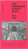
Box 1936
Box in 1936 in a fascinating series of reproductions of old Ordnance Survey plans in the Alan Godfrey Editions, ideal for anyone interested in the history of their neighbourhood or family. The map covers the village of Box, probably best known for Brunel`s railway tunnel. The railway runs through the map and includes the western portal to the tunnel and both Box station and Box Mill Lane Halt. Other railway features are sidings and the engine shed used until 1919 for a banking engine, said to be the inspiration for the Rev Awdrey`s Thomas the Tank Engine (the author lived in Box). Other features include the church, cemetery, pubs, The Bassetts, stone yard, Fogleigh House to the north. To the west the map covers part of Ashley including Ashley Manor, Ashley Green, Middlehill, and
the small village of Ditteridge (or Ditcheridge) including St Christopher`s church. Directories of Box and Ditteridge are on the reverse. About the Alan Godfrey Editions of the 25” OS SeriesSelected towns in Great Britain and Ireland are covered by maps showing the extent of urban development in the last decades of the 19th and early 20th century. The plans have been taken from the Ordnance Survey mapping and reprinted at about 15 inches to one mile (1:4, 340). On the reverse most maps have historical notes and many also include extracts from contemporary directories. Most maps cover about one mile (1.6kms) north/south, one and a half miles (2.4kms) across; adjoining sheets can be combined to provide wider coverage.FOR MORE INFORMATION AND A COMPLETE LIST OF ALL AVAILABLE TITLES PLEASE
CLICK ON THE SERIES LINK.

Product Description
Reviews/Comments
Add New
Vouchers
No voucher codes found.
Do you know a voucher code for this product or supplier? Add it to Insights for others to use.
Do you know a voucher code for this product or supplier? Add it to Insights for others to use.
 Denmark