
 United Kingdom
 France
 Germany
 Netherlands
 Sweden
 USA
USA
 Italy
Italy
 Spain
Spain
More From Contributor


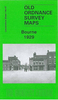
Bournbrook 1902-1911
Bournbrook in 1902-1911 in a fascinating series of reproductions of old Ordnance Survey plans in the Alan Godfrey Editions, ideal for anyone interested in the history of their neighbourhood or family. The map covers the southern fringe of Edgbaston and much of Bournbrook and Selly Park, including the University area. It is taken from the interesting `Inland Revenue Special Edition, basically a survey of 1902 with partial revision to 1911. The University is shown only as under development. Coverage stretches from Metchley Park eastward to Sir John`s Road, and from Priory Road southward to Dartmouth Road. Features include the Midland Railway (Selly Oak station is partially shown at the bottom margin), Worcester & Birmingham Canal, Sellyn Park, Bristol Road with tramway, Pebble Mill
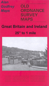
Farm, Edgbaston Pool, part of Edgbaston Park, Park House, cycle works, metal works, Selly Hill, Bourn Brook, Gun Barrels Inn, Rockingham House, small section of Dudley Canal, Selly Wick House, etc. On the reverse is a selection of street directory entries, including Bournbrook Road, Bristol Road, Dawlish Road, High Street, Oakfield Road, Tiverton Road and Upper Pershore Road. About the Alan Godfrey Editions of the 25” OS Series:Selected towns in Great Britain and Ireland are covered by maps showing the extent of urban development in the last decades of the 19th and early 20th century. The plans have been taken from the Ordnance Survey mapping and reprinted at about 15 inches to one mile (1:4, 340). On the reverse most maps have historical notes and many also include
extracts from contemporary directories. Most maps cover about one mile (1.6kms) north/south, one and a half miles (2.4kms) across; adjoining sheets can be combined to provide wider coverage.FOR MORE INFORMATION AND A COMPLETE LIST OF ALL AVAILABLE TITLES PLEASE CLICK ON THE SERIES LINK.

Product Description
Reviews/Comments
Add New
Vouchers
No voucher codes found.
Do you know a voucher code for this product or supplier? Add it to Insights for others to use.
Do you know a voucher code for this product or supplier? Add it to Insights for others to use.
 Denmark