More From Contributor

£3.50
Bothwell & Blantyre in 1897 in a fascinating series of reproductions of old Ordnance Survey plans in the Alan Godfrey Editions, ideal for anyone interested in the history of their neighbourhood or family. The map covers the town centre of Bothwell plus Blantyre on the other bank of the Clyde. Features include Blantyre Works, Low Blantyre, Bothwell Castle Colliery, southern part of Bothwell Castle, Caledonian Railway with Blantyre station, David Livingstone`s Birthplace, Madder Mill, Powerloom Factory, Caledonian Bothwell Branch with terminus, NBR railway with Bothwell station, Craighead House, Silverwells area, church, Kirkfield area, etc. On the reverse are directories of Bothwell for 1892-93 & 1911-12. About the Alan Godfrey Editions of the 25” OS Series: Selected towns in Great Britain & Ireland are covered by maps showing the extent of urban development in the last decades of the 19th & early 20th century. The plans have been taken from the Ordnance Survey mapping & reprinted at about 15 inches to one mile (1:4, 340). On the reverse most maps have historical notes & many also include extracts from contemporary directories. Most maps cover about one mile (1.6kms) north/south, one & a half miles (2.4kms) across; adjoining sheets can be combined to provide wider coverage.FOR MORE INFORMATION & A COMPLETE LIST OF ALL AVAILABLE TITLES PLEASE CLICK ON THE SERIES LINK. ...
Archived Product
£16.95
One of the maps in the topographic survey of Iceland at 1:100, 000. The series was last revised in the early eighties. Contour interval is 20 meters. In addition to the usual features shown on survey mapping, the maps also include a large amount of information indicating the type of the terrain & land use (block or smooth surfaced lava, clay, boulders, sand & dunes, cultivated area, meadows, pastures, bogs, wetlands, etc.) & details not often found on maps: physicians' residences, parsonages, etc. Each map covers an area of 44 x 40 km / 27 x 25 miles. Margin ticks give latitude & longitude in steps of 6'. Map legend

Includes::
English.

...
Archived Product
£21.95
Botswana at 1:1, 000, 000 on a large map from Tracks 4 Africa: GPS compatible, with roads & tracks showing both driving times & distances, & printed on light, waterproof & tear-resistant plastic paper. On one side is a map of the whole country, including Namibia ...
Archived Product
£9.50
Botswana on an indexed, waterproof & tear-resistant road map with topographic & tourist information & a plan of Gaborone, published by Reise Know-How as part of their highly acclaimed World Mapping Project. The map is double-sided to provide the best balance between a good scale & a convenient size sheet. Topography is indicated by altitude colouring with numerous spot heights, names of mountain ranges & passes, salt pans & swamps. Road information

Includes::
seasonal tracks & indicates intermediate driving distances on main & secondary roads. Locations of petrol stations, veterinary cordon fences & border crossings are also marked. Other transport details include railways & local airfields. Internal administrative boundaries are shown with names of the provinces. National parks & protected areas are marked & symbols highlight various places of interest: UNESCO world heritage sites, viewpoints, wells, caves, bird sanctuaries, selected accommodation including campsites & lodges, medical facilities, etc. The map has a latitude/longitude grid at intervals of 1

...
Archived Product
£10.95
Clear general map printed on heavy laminated paper, more suitable for reference & study than for use by tourists when visiting the country. Colours clearly distinguishing land use variations & hydrographic features eg. national parks, reserves, farm areas, lakes, swamps. Contour lines are 100m intervals. Other details include surfaced & gravel roads, tracks, railways, airports, airstrips, international & district boundaries, border posts, mines fences & veterinary cordon fences. Space beyond the country's boundary is left blank. Latitude & longitude lines are drawn at 1 degree intervals. ...
Archived Product
£7.99
Botswana in the Culture Smart range of pocket-sized guide books; providing detailed information on local customs, culture, etiquette & manners & ensuring that visitors are prepared for a diverse range of social environments. The series covers an extensive number of countries worldwide & are designed both for those working & living abroad, as well as for visitors who do not want to offend, either intentionally or inadvertently. Their aim is to prevent readers from making embarrassing mistakes & feel confident in unfamiliar situations, while preparing them before arrival on what to expect & how to behave. Each guide is arranged thematically, with dedicated individual chapters on land & people, values & attitudes, customs & traditions, making friends, people at home, ‘time-out’, travelling & communicating. There is also a separate chapter for business travelers, with important information on subjects such as business culture, meetings & making appointments. A Further Reading section also offers a list of recommended other history, travel literature & language titles available on the country. ...
Archived Product
£9.99
Especially in the years since it achieved Independence in 1966, Botswana has attracted a host of admirers from all over the world who have been captivated, intrigued & sometimes puzzled by it. There is, however, no non-specialist book on Botswana which provides a feel for the place & its heritage, its personality & a sense of where it is going & from where it has come. Sandy Grant has now sought to fill that gap with this easy-to-read, handsomely illustrated book. By drawing on his years of individualistic involvement with Botswana he has been able to blend together a remarkable range of disciplines & topics. His intention has been to stimulate interest by providing an informative, whirlwind snapshot. For people interested in Botswana, this book is not merely a first, it is a must. ...
Archived Product
£13.59
Botswana & Namibia in the Countries & Regions series from Lonely Planet, market-leading comprehensive guides aimed at independent travellers & serving a large range of international destinations. Frank & informal in style, the guides explore an extensive range of sights, activities, accommodation, restaurants & nightlife & are designed for practical use while travelling on the road. Written & researched by a team of experts, each book is independent in its recommendations & suggestions, often offering individual takes on individual destinations. Widely recognised for their reliability, each Lonely Planet country & region guide has the same layout. Introductory sections profile the destination with individual chapters on particular highlights, getting started, (including when to go) itineraries, history, culture, arts, food & drink & the environment. Each guide is organised geographically by region, with individual sections detailing an extensive range of sights, places of interest, attractions, restaurants, nightlife, accommodation & any local activities. The guides have detailed explanations of historical context where relevant. There is also practical guidance on ...
Archived Product
£16.99
Botswana & Namibia in the Countries & Regions series from Lonely Planet, market-leading comprehensive guides aimed at independent travellers & serving a large range of international destinations. Frank & informal in style, the guides explore an extensive range of sights, activities, accommodation, restaurants & nightlife & are designed for practical use while travelling on the road. Written & researched by a team of experts, each book is independent in its recommendations & suggestions, often offering individual takes on individual destinations. Widely recognised for their reliability, each Lonely Planet country & region guide has the same layout. Introductory sections profile the destination with individual chapters on particular highlights, getting started, (including when to go) itineraries, history, culture, arts, food & drink & the environment. Each guide is organised geographically by region, with individual sections detailing an extensive range of sights, places of interest, attractions, restaurants, nightlife, accommodation & any local activities. The guides have detailed explanations of historical context where relevant. There is also practical guidance on ...
Archived Product
£10.99
Botswana at 1:1, 100, 000 on an indexed map from Freytag & Berndt prominently highlighting the country’s national parks, game reserves & topographic features such as salt lakes, plus a street plan of central Gaborone. The map has a plan base with some relief shading in the more hilly parts of the country. Salt lakes & marshes are marked, as well as seasonal rivers & lakes. National parks & game reserves are clearly highlighted. Road network indicates cart tracks & shows distances on main routes & locations of petrol stations. Border crossing points show their opening times. Railway lines are included; local airports are marked; & veterinary cordon fences & locations of quarantine camps are prominently shown. The map also indicates internal administrative boundaries & names of the provinces. Icons highlight locations of tourist lodges & camp sites, many annotated with their names. Also marked are places of interest such as UNESCO World Heritage sites, caves, hot springs, archaeological sites, etc. Latitude & longitude lines are drawn at 1° intervals. The index is next to the map. Map legend

Includes::
English Also provided is a street plan of central Gaborone, showing locations of some of the governmental offices, embassies etc.

...
Archived Product

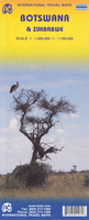
Botswana & Zimbabwe ITMB

Botswana at 1:1, 500, 000 with Zimbabwe at 1:1, 100, 000 on a double-sided map from ITMB which also includes street plans of central Gaborone, Harare and Bulawayo, plus enlargements of the Victoria Falls area and the Great Zimbabwe National Monument.On one side is an indexed road map of Botswana at 1:1, 500, 000 with altitude colouring in feet and graphics to indicate swamps, sand dunes and salt pans. National parks and other protected areas are highlighted. Road network includes tracks and shows locations of petrol stations. Railway lines are shown with stations and local airports are marked. Symbols indicate various places of interest including various types of tourist accommodation, medical facilities, etc. Also shown are the country’s internal administrative boundaries wuth
names of the provinces. Latitude and longitude lines are drawn at intervals of 1º. The map is accompanied by a large, clear street plan of central Gaborone, also annotated with sights, accommodation and facilities. On the reverse similar cartography presents Zimbabwe at 1:1, 100, 000, also indexed and accompanied by street plans of central Harare and Bulawayo, and enlargement of the Victoria Falls area and a plan of the Greater Zimbabwe National Monument.
RIP - This product is no longer available on our network. It was last seen on 25.09.2019

This page now acts as a permanent archive for this product. Add more information using the comments box below to ensure it can still be found by future generations.

Use our search facility to see if it is available from an alternative contributor.
  • External links may include paid for promotion
  • Availability: Out Of Stock
  • Supplier: Stanfords
  • SKU: 9781553411475
Availability: In Stock
£9.99

Product Description

Botswana at 1:1, 500, 000 with Zimbabwe at 1:1, 100, 000 on a double-sided map from ITMB which also

Includes::
street plans of central Gaborone, Harare & Bulawayo, plus enlargements of the Victoria Falls area & the Great Zimbabwe National Monument. On one side is an indexed road map of Botswana at 1:1, 500, 000 with altitude colouring in feet & graphics to indicate swamps, sand dunes & salt pans. National parks & other protected areas are highlighted. Road network

Includes::
tracks & shows locations of petrol stations. Railway lines are shown with stations & local airports are marked. Symbols indicate various places of interest including various types of tourist accommodation, medical facilities, etc. Also shown are the country’s internal administrative boundaries wuth names of the provinces. Latitude & longitude lines are drawn at intervals of 1º. The map is accompanied by a large, clear street plan of central Gaborone, also annotated with sights, accommodation & facilities. On the reverse similar cartography presents Zimbabwe at 1:1, 100, 000, also indexed & accompanied by street plans of central Harare & Bulawayo, & enlargement of the Victoria Falls area & a plan of the Greater Zimbabwe National Monument.

Reviews/Comments

Add New

Intelligent Comparison

Oooops!
We couldn't find anything!
Perhaps this product's unique.... Or perhaps we are still looking for comparisons!
Click to bump this page and we'll hurry up.

Price History

Vouchers

No voucher codes found.
Do you know a voucher code for this product or supplier? Add it to Insights for others to use.

Facebook

Jargon Buster

Graphics - A general term for visual aspects of an item/display
Network - A link and communication between things. Often computers or people.
Large - something that takes up more space than normal.
Road - a manmade lane or a path that is used to speed up travel.
Altitude - Something that can be quite high in relation to sea or ground level.
Accommodation - A room in which someone can live in, for example in a hotel

Supplier Information

Stanfords
Stanfords was established in 1853 and opened their iconic Covent Garden flagship store in 1901. They have become the top retailer of maps, travel books and accessories in the UK and arguably offer the largest selection of maps and travel books worldwide. Famous names such as Captain Robert Falcon Scott, Ranulph Fiennes and Michael Palin have purchased from Stanfords. They now have a shop in Bristol and both stores together with other venues operate a calendar of events including talks, book signings and exhibitions. As a specialist map retailer, the map selection is comprehensive and includes road maps, street maps and walking maps from worldwide destinations, as well as a selection of world atlases and wall maps. Books include travel guides and travel literature. Stanfords also stock globes, from miniatures made of blue marble to magnificent floor-standing globes. The website features a selection of interesting articles on travel topics.
Page Updated: 2023-11-12 20:15:36

Community Generated Product Tags

Oh No! The productWIKI community hasn't generated any tags for this product yet!
Menu