More From Contributor
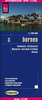
£10.50
Borneo at 1:1, 200, 000 on light, waterproof & tear-resistant plastic paper, with both topographic & tourist information. The map, part of Reise Know-How`s highly acclaimed ” World Mapping Project”, is double-sided to provide the best balance between a good scale & a convenient size sheet. On one side are the Malaysian provinces of Sarawak & Sabah, Brunei, plus the northern part of Indonesian Kalimantan, with the rest of Kalimantan on the reverse. Topography is shown by altitude colouring with spot heights & graphics indicating swamps, mangroves & coral reefs in the coastal waters. Detailed presentation of the road network

Includes::
dirt roads & local tracks; railways, local airports & ferry connections. Local administrative units are shown with their boundaries & names. National parks & other protected areas are highlighted. Symbols shows various places of interest including mosques, museums & longhouses as well as caves, coral, etc. Latitude & longitude lines are drawn at 1º intervals. The map has an extensive index of localities & the map legend

Includes::
English. To see other Reise Know-How maps covering the islands of Indonesia please click on the series link.


...
Archived Product
£14.99
Discover Borneo
Wake deckside to the whoops of gibbons on your orangutan-spotting trip, Tanjung Putting National Park
Find

...
Archived Product
£14.99
Trekking through pristine national parks, whitewater rafting on tropical rivers & some of the very best dive sites in the world, this vast jungle-covered island offers them all. The second edition of Footprint's guide to Borneo provides up-to-date recommendations of where to stay & eat, places to visit & how to get around as well as a comprehensive background section to help the traveller understand the island's rich & diverse culture. ...
Archived Product
£4.99
Racked with fever, virtually broke & earning a precarious living through sending back to London the plumes of beautiful birds, Wallace (1823-1913) ultimately became one of the most heroic & admirable of all scientist-explorers. Whether living with Hill Dyaks or hunting Orang-Utans or sailing on a junk to the unbelievably remote Aru islands, Wallace opens our eyes to a now long vanished world. Great Journeys allows readers to travel both around the planet & back through the centuries
- but also back into ideas & worlds frightening, ruthless & cruel in different ways from our own. Few reading experiences can begin to match that of engaging with writers who saw astounding things: great civilisations, walls of ice, violent & implacable jungles, deserts & mountains, multitudes of birds & flowers new to science. Reading these books is to see the world afresh, to rediscover a time when many cultures were quite strange to each other, where legends & stories were treated as facts & in which so much was still to be discovered.
...
Archived Product
£16.99
The third largest island in the world, Borneo screams adventure. Footprint`s 4th edition Borneo Handbook will guide you from the dense & pristine rainforest to the glimmering golden roofs of Brunei, with moody mountain peaks in between.
- Loaded with information & suggestions on how to get off the beaten track, from unparalleled underwater adventures to wildlife spotting & exploring caves
-

Includes::
comprehensive information on everything from transport & practicalities to history, culture & landscape
- Plus all the usual accommodation, eating & drinking listings for every budget
- Full-colour planning section to inspire & help you find the best experiences
- Personal recommendations from the authors on everything from snorkelling & birdwatching, to colonial splendours & forest longhouses From seeing orang-utans, elephants & crocodiles to relaxing on a boat along the Rejang, Footprint`s fully updated 4th edition will help you navigate this untamed destination.


...
Archived Product
£29.99
Topographic survey of Denmark at 1:100, 000 from Kort & Matrikelstyrelsen, the country’s national survey organization. The maps have contours at 5 metre intervals, with colouring and/or graphics showing various types of terrain & land use: woodlands, orchards, heath, sand & dunes, tidal flats, meadows & marshl&, etc. The maps provide detailed presentation of the road & rail networks & other information expected of topographic mapping at this scale. No specifically tourist information such as waymarked cycling or hiking routes is shown. Standard size sheets cover an area of 56 x 45km / 35x 28 miles approx. Map legend

Includes::
English. To see other titles in this series please click on the series link.IMPORTANT – PLEASE NOTE BEFORE ORDERING:AVAILABILITY: all the maps are now printed on dem&. Delivery from Denmark can take over 4 weeks. Once an order has been placed we cannot accept any returns for credit.COORDINATES: although the maps are meant to have UTM coordinates for EUREF 89 (WGS 84) datum, sheets are sometimes delivered printed without any grid or margin ticks for UTM or latitude & longitude.

...
Archived Product
£16.99
Bornholm at 1:50, 000 on a sturdy, waterproof & tear-resistant cycling map from the Copenhagen-based Nordisk Korthandel, showing Denmark’s national, regional & local cycling routes with numbers, plus locations of campsites & youth hostels, etc. Unlike the other titles in this series which are at 1:100, 000 & double-sided, Bornholm is shown on one side of the map; on the reverse is a description of the 104-km long cycling circuit around the isl&. Maps in this series show Denmark’s network of roads, railways & ferry connections on a contoured base (interval not specified), with additional colouring for woodlands. National, regional & local cycling routes are prominently highlighted & shown with their official numbers. Symbols indicate locations of campsites, youth hostels, selected hotels, & rest areas. The maps have no geographical coordinates for GPS. Map legend & explanatory text (with website addresses of useful organizations) include English. To see the currently available titles in this series please click on the series link. ...
Archived Product
£13.99
The Baltic island of Bornholm at 1:50, 000 on a contoured & GPS compatible map from Kompass, printed on sturdy, waterproof & tear-resistant synthetic paper, with additional insets showing a street plan of Rønne plus the Ertholmene (Christiansø) archipelago. The map has contours at 10m intervals, with colouring indicating woodlands. An overprint highlights hiking trails & cycling routes, including the tour around the isl&. Symbols indicate various types of tourist accommodation, sport & recreational facilities & places of interest. Also marked are ferry connections to Denmark & other Baltic ports. The map has a 2km UTM grid. Map legend

Includes::
English. Insets show the nearby the Ertholmene (Christiansø) archipelago at 1:30, 000, plus a street plan of Rønne, both annotated with facilities and/or places of interest.PLEASE NOTE: the map comes with a German language booklet about the isl&, with

Includes::
descriptions of interesting locations, recommendations for cycling excursions, etc. The booklet is not available in an English version. The legend for the map, as stated above, does include English.


...
Archived Product
£6.50
Topographic coverage of mainland Spain at 1:25, 000 published by the Centro Nacional de Información Geograficá, the country’s civilian survey organization. The maps have contours at 10m intervals & colouring and/or graphics to show different types of vegetation or land use. Boundaries of national parks & other protected areas are marked. In addition to all the usual information shown on topographic maps at this scale, detailed presentation of the road & rail networks, rural tracks & paths, etc, the maps also show campsites. The maps have a 1-km UTM grid, with margin ticks for latitude & longitude at 1` intervals. Map legend is in Spanish only.PLEASE NOTE: our grid for the whole of Spain is in preparation
- in the meantime, for areas other than those shown on the attached grid please use CNIG’s topographic survey at 1:50, 000 by searching for ‘SI00000832’. Each 25K map covers one quarter of the corresponding 50K map, with the numbering system: I = NW quarter, II = NE quarter, III = SW quarter & IV = SE quarter. CNIG maps in the Provincial Road Maps series at 1:200, 000 are overprinted with the grid for the 1:50, 000 survey & can be used to see the area covered by each 50K or 25K title in more detail. To see the list of titles in this series please click on the series grid
- for map numbers not yet listed on our website please contact us by email.

...
Archived Product
£2.99
There are a multitude of ` London Calling` cards in the collection at Rocket 68. This lively illustrated range of London themed prints & cards aims to portray the vibrancy & beauty of London`s architecture, areas, life & communities. Each card is supplied with quality Gunpowder grey envelope in a cellophane wrapper. These cards are all illustrated by Jill White & printed in the UK on a lovely soft Calisto FSC accredited board. ...
Archived Product

Bornholm

Detailed map of the island with plenty of tourist information. The map has contours at 20-m intervals and highlights hiking paths and cycle routes. Other information includes places of interest, recreational facilities, campsites, youth hostels, selected hotels, etc. The map also has a small street plan of R
RIP - This product is no longer available on our network. It was last seen on 25.09.2019

This page now acts as a permanent archive for this product. Add more information using the comments box below to ensure it can still be found by future generations.

Use our search facility to see if it is available from an alternative contributor.
  • External links may include paid for promotion
  • Availability: Out Of Stock
  • Supplier: Stanfords
  • SKU: 9783854914686
Availability: In Stock
£9.95

Product Description

Detailed map of the island with plenty of tourist information. The map has contours at 20-m intervals & highlights hiking paths & cycle routes. Other information

Includes::
places of interest, recreational facilities, campsites, youth hostels, selected hotels, etc. The map also has a small street plan of R

Reviews/Comments

Add New

Price History

Vouchers

No voucher codes found.
Do you know a voucher code for this product or supplier? Add it to Insights for others to use.

Facebook

Jargon Buster

Hiking - An outdoor activity envolving walking in nature
Small - something that takes up less space than normal.

Supplier Information

Stanfords
Stanfords was established in 1853 and opened their iconic Covent Garden flagship store in 1901. They have become the top retailer of maps, travel books and accessories in the UK and arguably offer the largest selection of maps and travel books worldwide. Famous names such as Captain Robert Falcon Scott, Ranulph Fiennes and Michael Palin have purchased from Stanfords. They now have a shop in Bristol and both stores together with other venues operate a calendar of events including talks, book signings and exhibitions. As a specialist map retailer, the map selection is comprehensive and includes road maps, street maps and walking maps from worldwide destinations, as well as a selection of world atlases and wall maps. Books include travel guides and travel literature. Stanfords also stock globes, from miniatures made of blue marble to magnificent floor-standing globes. The website features a selection of interesting articles on travel topics.
Page Updated: 2023-11-12 20:15:36

Community Generated Product Tags

Oh No! The productWIKI community hasn't generated any tags for this product yet!
Menu