More From Contributor
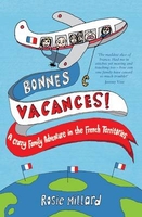
£13.99
Bonn – Ahrtal area of northern Eifel between Bonn & Mayen on a detailed, GPS compatible map at 1:50, 000 from Kompass with local & long-distance footpaths, cycling routes, accommodation, etc, printed on durable, waterproof & tear-resistant synthetic paper.KOMPASS HIKING & RECREATIONAL MAPS: this title is part of an extensive series covering Austria, much of Germany & the Slovenian Alps – TO SEE OTHER TITLES IN THIS SERIES PLEASE CLICK ON THE SERIES LINK. Kompass are Europe’s largest publishers of hiking maps; their mapping of other countries, including expanding coverage of Italy, is listed on our website separately.CARTOGRAPHY: the maps are contoured with additional shading, graphic relief & colouring to provide a more detailed picture of the terrain, vegetation and/or land use. Contour interval varies from 10m in the coastal areas of Northern Germany to 40 or 50 metres in the mountainous regions. All the maps highlight local & long-distance waymarked footpaths, including climbing trails. Most titles also show cycling routes, mountain bike trails, &, the in mountainous areas, ski routes. The maps indicate various types of accommodation (selected inns & hotels, youth hostels, campsites, mountain refuges), as well as recreational facilities, places of interest, etc. Latest editions also show access by public transport with bus stops and/or Park+ Ride facilities.GEOGRAPHICAL COORDINATES: unless indicated to the contrary in the individual description, the maps have a UTM grid for GPS users. MAP LEGEND: most maps now include full English legend, particularly titles covering the Alpine areas. Some maps covering mainly eastern Austria or the less popular parts of Germany may still have a legend in German only.OTHER

Features:
selected titles include on the reverse panorama drawings of their area with names of villages, peaks, valleys, etc. and/or have a booklet with pictures of local wild flowers with their Latin names. Many titles are now published as competitively priced sets of two or more maps, offering a wider coverage.BOOKLETS: PLEASE NOTE BEFORE ORDERING
- many titles come with a booklet describing the area and/or various hiking routes. Unless indicated in the individual description that the booklet

Includes::
English, these booklets are IN GERMAN only. The booklets are not necessary to use the maps since, as stated above, full English language map legend is provided.


...
Archived Product
£7.99
Falk, one of Germany`s leading publishers of street plans, produce their town plans in two different formats. Falk Extra plans are folded in a standard way, where the whole map can be opened to view the entire area it covers. For larger cities, the same mapping is also published with a special folding system designed to show only a small section of the map at one time. The whole map can be opened but it will be cut in several places. Many find these street plans very user-friendly & easier to handle than conventional maps. The plans, which cover towns with their outer suburbs, indicate main landmarks & public buildings & show all the public transport facilities, one way streets & car parks. Plans of lager cities include a separate map of the town centre at a more detailed scale & a diagram of the underground & the suburban rail network. The plans also show the postal divisions & have an extensive street index which, where appropriate, shows individual postal codes for each street. Map legend

Includes::
English. Falk Extra plans also include on the reverse a road map of the surrounding area.

...
Archived Product
£9.99
Street plan of the Bonn conurbation in Falk’s Special Fold format, designed to show only a small section of the map at one time. The whole map can be opened but it will be cut in several places. Many find these street plans very user-friendly & easier to handle than conventional maps, others simply hate them!* About Falk street plans:* The plans indicate main landmarks & public buildings & show all the public transport facilities, one way streets & car parks. Plans of larger cities include a separate diagram of the public transport network & an enlargement of the town centre at a more detailed scale. The plans also show postal divisions & have an extensive street index which, where appropriate, shows individual postal codes for each street. * Map legend

Includes::
English.* Falk street plans are published in three different map formats, plus in a series of regional street atlases.* Falk Extra* plans are folded in a standard way, where the whole map can be opened to view the entire area it covers. In most plans on the reverse is a road map of the surrounding area. Latest editions have a UTM grid.* Falk Special Fold* plans, published only for larger cities, have a folding system designed to show only a small section of the map at one time. The whole map can be opened but it will be cut in several places. Many find these street plans very user-friendly & easier to handle than conventional maps, others simply hate them!* Falk City Plans*, published only for main cities, use the same mapping but cover a smaller area then the Extra plans & have a larger map of the city centre.

...
Archived Product
£6.50
BKB Verlag’s guide to Bonn is specially designed for business trips & short trips, aiming to show you the best of the city in just 3 days. Pocket-sized & printed with full-colour photos, the guide is organised into 4 sections, one for each day plus a final chapter on ‘services’. Each day section has been arranged like a diary, so that the sights are described in the order of a potential itinerary, helping you get the most out of what you see. A small map proceeds each day, showing the recommended route to take for the sights within the chapter. The maps themselves are very basic, & would be better used as a general overview of the area. The final section is over 20 pages of listings & descriptions of cafes, restaurants, local culture, hotels, museums, nightlife, shopping & more. ...
Archived Product
£12.99
Topographic survey of France at 1:25, 000 in IGN`s excellent TOP25 / Série Bleue series. All the maps are GPS compatible, with a 1km UTM grid plus latitude & longitude lines at 5’ intervals. Contours are at 5m intervals except for mountainous areas where the maps have contours at 10m intervals, vividly enhanced by hill shading & graphics for rocky terrain. Colouring with graphics indicates different types of vegetation or land use (deciduous or coniferous forests, moors, orchards, vineyards, etc). PLEASE NOTE: coverage of France at this scale is currently being revised – the format & the presentation of each title are indicated by the letters at the end of its Sheet Reference number (e.g. 0416ET, 3531ETR, 1923SB, etc.)MAPS WITH FULL TOURIST OVERPRINT & AN ENGLISH MAP LEGEND: all TOP25 maps & the SB editions of Série Bleue have an overprint highlighting waymarked walking trails including long-distance GR routes &, where appropriate, ski routes. Symbols indicate campsites, gîtes d’etape, refuges, equestrian centres & other recreational facilities or sites, tourist information centres, cultural heritage, etc. Towns & locations of particular interest are highlighted.- ET or OT = single-sided TOP25 map covering approx. 29x 21 km / 18x 13 miles.- ETR or OTR = waterproof & tear resistant TOP25 map covering the same area as the corresponding ET or OT number, but double-sided, printed on a smaller size sheet with a good overlap between the sides.- SB = Série Bleue map with full tourist overprint; these maps, first introduced in summer 2014, each cover approx. 29x 24km / 18x 15 miles.SÉRIE BLEUE maps with numbers ending in E (Est) or O (Ouest): most editions now indicate the GR routes, but do not show any other tourist information. Map legend is in French only. Each map covers approx. 14x 20km / 9x 12 miles. ...
Archived Product
£2.50
Bonnybridge street map from Nicolson Maps; coverage

Includes::
Banknock, Denny & Dunipace. Nicolson Maps,

...
Archived Product
£8.99
Bestselling illustrator Bob Shea & poet Deanna Caswell are back, this time with a haiku book filled with frights that delight. Here`s a spooky haiku just for you! broom across the moon pointed hat at the window hair-raising cackle Can you guess who from this haiku? A witch, a bat, a skeleton, a jack-o-lantern, a ghost, a black cat, a spider, an owl & a scarecrow are all hiding in the pages of this clever Halloween-themed book. Deanna Caswell`s playful haiku cleverly hint at the creatures revealed after each turn of the page while Bob Shea`s bright illustrations capture the scary silliness. ...
Archived Product
£12.99
From Number One bestselling author David Walliams comes a hilarious & heartwarming picture book, brilliantly illustrated by the artistic genius, Tony Ross. Up at the North Pole, a big furry polar bear is swimming, fishing & eating. But when she nods off & finds herself far from home, she thinks things can`t get any worse. But they can... Much worse! An outrageously funny picture book with an incredibly heartwarming message about celebrating difference
- in all its forms.
...
Archived Product
£12.99
Quirky & humorous, part poetry, part reflection, this is the story of the book told by none other than Book himself! This extraordinary character begins by reminding us of his origins in oral story & clay tablets, then ponders on papyrus, parchment & paper, & on being a scroll who finally gets a spine. We see him lovingly illuminated by monks in medieval monasteries, then witness the massive changes brought about by the invention of the printing press, & the coming of paperbacks & e-books in the 20th century. But Book`s not a straightforwardly chronological chap; he can`t help musing
- & his musings, whether they`re on the evolution of the alphabet, libraries, book-burning or blurbs, are delightful & thought-provoking. Years of reflection & observation have gone into this charming title
- John Agard signed the contract with Walker 16 years ago!

...
Archived Product

Bonnes Vacances!

`Looks like not many tourists visit St Pierre et Miquelon, ` I mutter excitedly to Pip. `That is why this trip is going to be so brilliant.` He looks at me questioningly. I am distracted by Gabriel`s unusually pallid face. `Oh my God, he`s going to be sick.` Rosie set out on a tour of the French Overseas Departments and Territories (the `Dom- Toms`) with her husband and four young children, partly to make a documentary series but also to show the children it is possible to survive fourteen weeks without Hannah Montana. From Martinique to Reunion, crossing five continents, they eat stewed iguana, 400 croissants and - since the budget is small - copious amounts of Campbell`s soup. Candid, darkly humorous and slightly mad, cut with a dash of French history, this memoir offers
insights, amusement and hope for anyone who has ever travelled en famille.
RIP - This product is no longer available on our network. It was last seen on 25.09.2019

This page now acts as a permanent archive for this product. Add more information using the comments box below to ensure it can still be found by future generations.

Use our search facility to see if it is available from an alternative contributor.
  • External links may include paid for promotion
  • Availability: Out Of Stock
  • Supplier: Stanfords
  • SKU: 9781849531498
Availability: In Stock
£4.99

Product Description

` Looks like not many tourists visit St Pierre et Miquelon, ` I mutter excitedly to Pip. ` That is why this trip is going to be so brilliant.` He looks at me questioningly. I am distracted by Gabriel`s unusually pallid face. ` Oh my God, he`s going to be sick.` Rosie set out on a tour of the French Overseas Departments & Territories (the ` Dom- Toms`) with her husband & four young children, partly to make a documentary series but also to show the children it is possible to survive fourteen weeks without Hannah Montana. From Martinique to Reunion, crossing five continents, they eat stewed iguana, 400 croissants &
- since the budget is small
- copious amounts of Campbell`s soup. Candid, darkly humorous & slightly mad, cut with a dash of French history, this memoir offers insights, amusement & hope for anyone who has ever travelled en famille.

Reviews/Comments

Add New

Intelligent Comparison

Oooops!
We couldn't find anything!
Perhaps this product's unique.... Or perhaps we are still looking for comparisons!
Click to bump this page and we'll hurry up.

Price History

Vouchers

No voucher codes found.
Do you know a voucher code for this product or supplier? Add it to Insights for others to use.

Facebook

Jargon Buster

History - Anything that happens in the past. An acedemic subject.
Set - a group of items usually related to one another. Some objects cannot function without the complete set of items.
Small - something that takes up less space than normal.
Children - A young life form within the early stages of physical development,

Supplier Information

Stanfords
Stanfords was established in 1853 and opened their iconic Covent Garden flagship store in 1901. They have become the top retailer of maps, travel books and accessories in the UK and arguably offer the largest selection of maps and travel books worldwide. Famous names such as Captain Robert Falcon Scott, Ranulph Fiennes and Michael Palin have purchased from Stanfords. They now have a shop in Bristol and both stores together with other venues operate a calendar of events including talks, book signings and exhibitions. As a specialist map retailer, the map selection is comprehensive and includes road maps, street maps and walking maps from worldwide destinations, as well as a selection of world atlases and wall maps. Books include travel guides and travel literature. Stanfords also stock globes, from miniatures made of blue marble to magnificent floor-standing globes. The website features a selection of interesting articles on travel topics.
Page Updated: 2023-11-12 20:15:36

Community Generated Product Tags

Oh No! The productWIKI community hasn't generated any tags for this product yet!
Menu