
 United Kingdom
 France
 Germany
 Netherlands
 Sweden
 USA
USA
 Italy
Italy
 Spain
Spain
More From Contributor


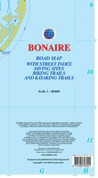
Bonaire
Bonaire at 1:40, 000 on a map from the Caribbean-based cartographer Michal Kasprowski highlighting numerous diving sites and various places of interest, plus indexed street plans of the Kralendijk area and Rincon.Topography is shown by altitude colouring with spot heights; the island’s two national parks are clearly marked. Road network indicates main roads and shows secondary roads and local tracks or footpaths. Recommended biking and hiking trails are highlighted. Symbols indicate various facilities and places of interest including beaches and snorkelling sites, birds watching areas and other locations with interesting fauna, petroglyph sites, caves, petrol stations, etc. Along the coast of both Bonaire and Klein Bonaire numerous diving sites are marked and cross-referenced to
the list giving the GPS coordinates. Latitude and longitude lines are marked at 2’ intervals. Map legend is in English.Also provided are indexed street plans of Rincon and of the Kralendijk area with coverage along the coast extending north to Santa Barbara crowns and south beyond the island’s international airport to Belnem and Punt Vierkant.
the list giving the GPS coordinates. Latitude and longitude lines are marked at 2’ intervals. Map legend is in English.Also provided are indexed street plans of Rincon and of the Kralendijk area with coverage along the coast extending north to Santa Barbara crowns and south beyond the island’s international airport to Belnem and Punt Vierkant.

Product Description
Reviews/Comments
Add New
Vouchers
No voucher codes found.
Do you know a voucher code for this product or supplier? Add it to Insights for others to use.
Do you know a voucher code for this product or supplier? Add it to Insights for others to use.
 Denmark