More From Contributor

£3.95
Bochum & Wattenscheid in 1944 in the Alan Godfrey series of reproductions of British War Office survey maps first published in 1945 prior to the Allied occupation of the area. The map is dominated by the major city of Bochum & by Wattenscheid, now part of Bochum but once a major mining town in its own right. Other locations covered by this title include Ückendorf, Wasserstrasse, Hamme, Weitmar, Kray, Kanarienberg, Sevinghausen. Industrial information

Includes::
the Bochumer Verein Höntrop Works & several mines: Präsident, Prinz Regent, Zentrum, Fröhliche Morgensonne, Holland Mine, Karolinenglück, etc. To see other titles in this series please click on the series link. This series of reproductions from Alan Godfrey covers the major industrial area east of the Rhine that

Includes::
Bochum, Cologne, Dortmund, Duisburg, Düsseldorf, Essen, Gelsenkirchen, Oberhausen & other towns, with their great network of railways & industries. The maps are taken from the British War Office 1:12, 500 plans & reduced at Approx. 1:19, 000. Published in 1945, prior to the Allied occupation of the area, the maps are especially good at showing industry, collieries & transport. They are not bombing maps
- indeed, they make clear that allowance is not made for bomb damage
- but show the areas with all their industrial sites & railways largely as they were before the bombing raids of 1943-44. The maps have additional information added by British intelligence. This is normally accurate but allowance must be made for the `fog of war` & occasional spelling mistakes, etc. Each title has on the reverse a specially written introduction to the area in English, with a shorter text in German. Map legend is in English only.


...
Archived Product
£7.99
Falk, one of Germany`s leading publishers of street plans, produce their town plans in two different formats. Falk Extra plans are folded in a standard way, where the whole map can be opened to view the entire area it covers. For larger cities, the same mapping is also published with a special folding system designed to show only a small section of the map at one time. The whole map can be opened but it will be cut in several places. Many find these street plans very user-friendly & easier to handle than conventional maps. The plans, which cover towns with their outer suburbs, indicate main landmarks & public buildings & show all the public transport facilities, one way streets & car parks. Plans of lager cities include a separate map of the town centre at a more detailed scale & a diagram of the underground & the suburban rail network. The plans also show the postal divisions & have an extensive street index which, where appropriate, shows individual postal codes for each street. Map legend

Includes::
English. Falk Extra plans also include on the reverse a road map of the surrounding area.

...
Archived Product
£23.99
Map No. 10127, Bodø, in the new topographic survey of Norway at 1:50, 000 covering the country on 195 double-sided sheets & first published by Nordeca in 2011
- 2012; fully GPS compatible, indicating waymarked footpaths, campsites, tourist huts, illuminated ski runs, etc. The maps, now published by Nordeca, the successors to Statens Kartverk & its subsequent owners the Ugland Group, are printed on light, waterproof & tear-resistant synthetic paper. Each map covers an area of 62x 45 kilometres (39 x 28 miles approx.), with a 2-km overlap between the sheets. The maps have contours at 20m intervals (10m glacier contours), plus colouring & graphics to show cultivated areas, bogs, forests, etc. In addition to all the information expected of topographic mapping at this scale the maps distinguish between waymarked & unmarked footpaths & show campsites, tourist huts (serviced/self service/no supplies), country hotels & restaurants, & illuminated ski trails. The series uses EUREF89 (WGS84) datum & the maps have a 1-km UTM grid. Map legend is in Norwegian & English. Each title comes in a sturdy protective card envelope.
...
Archived Product
£16.99
Topographic survey of Sweden at 1:50, 000, the Terrängkartan, from the Lantmäteriet, covering most of the country in 244 double-sided maps. Please note: the mountainous regions of central & northern Sweden are not covered by this series but presented in a separate “ Fjällkartan
- Mountain Map” series also listed on our website. Each 1:50, 000 topographic survey map covers an area of 37.5 x 40km. The maps have contours at 5 metre intervals, plus relief shading & graphics for rocky outcrops & boulders. Further graphics and/or colouring show different types of land use or vegetation (forests, arable l&, orchards, marshes, peat bogs, etc). An unusual feature of this survey is the colouring indicating buildings below or above two storeys high & “leisure/holiday homes”. The maps indicate privately maintained roads & include all other information expected of topographic survey at this scale. The maps have a 1-km UTM grid, plus latitude & longitude lines 5’ intervals. Map legend

Includes::
English. For coverage of the country’s most visited hiking areas in central & northern Sweden please see Lantmäteriet’s Mountain Map series, listed separately on our website.


...
Archived Product
£16.99
Sverigeserien is an outdoor map series consisting of 116 sheets with coverage of southern & central Sweden & the northern coastline. The map is suitable for outdoor activities such as hiking, excursions, trail running, hunting, fishing, riding, cycling, mountain biking, paddling, skating & much more. Every sheet covers an area of 45x 68km. These topographical maps in scale 1:50 000 contain all the information needed for outdoor activities: Terrain information, hiking trails, illuminated tracks, camping, shelters, golf courses, leisure baths, historical remains, roads in different categories, railway lines & much more. Easy to read topography with contour lines, vertical interval 5 m. Sverigeserien is a high-quality map series & is durable for frequent use! Updated content with map data from Lantmäteriet (National Land Survey of Sweden) & printed on Polyart which is water & tear resistant. This means that the map can be folded repeatedly without breaking & can withstand the challenging weather in Sweden during both winter & summer. Legend is in Swedish, English & German. ...
Archived Product
£9.99
Bodie was on death row in a Los Angeles shelter, having been abandoned by his owner. Belinda was in a heap on the floor of her vintage apartment, having been dumped by the man of her dreams. Two lost souls ready to find a new life. Together they embark on a 2, 000-mile West Coast road trip taking in spectacular Big Sur, a pack run in the wilds of Oregon, afternoon tea at Doris Day`s dog-loving hotel in Carmel, a fragrant encounter with the creator of Kennel No.5 furfume & a bar stop in a small town near San Francisco where a dog was elected mayor, two years running... Join Belinda & Bodie on this soul-searching adventure along one of the most iconic highways in America & you too will feel the wind in your hair & a wag in your tail. ...
Archived Product
£8.99
Bodies of Light is a deeply poignant tale of a psychologically tumultuous nineteenth century upbringing set in the atmospheric world of Pre-Raphaelitism & the early suffrage movement. Ally (older sister of May in Night Waking), is intelligent, studious & engaged in an eternal
- & losing
- battle to gain her mother`s approval & affection. Her mother, Elizabeth, is a religious zealot, keener on feeding the poor & saving prostitutes than on embracing the challenges of motherhood. Even when Ally wins a scholarship & is accepted as one of the first female students to read medicine in London, it still doesn`t seem good enough. The first in a two-book sequence, Bodies of Light will propel Sarah Moss into the upper echelons of British novelists. It is a triumphant piece of historical fiction & a profoundly moving master class in characterisation.

...
Archived Product
£8.99
After ministering to fallen women in Victorian London, Evelyn has suffered a nervous breakdown & finds herself treated by the Water Doctors in the imposing Wakewater House, a hydropathy sanatorium. Years later, Wakewater House is renovated into modern apartments & Kirsten moves in, fresh from a break up & eager for the restorative calm of the Thames. But her archivist neighbour, Manon, fills her head with the river`s murky past & with those men of science & art who were obsessed with the drowned women who were washed up on its banks. As Kirsten learns more about Wakewater`s secrets, she becomes haunted by a solitary figure in the river & increasingly desperate to understand what the water wants from her. ...
Archived Product
£9.99
Part of a series of exciting & luxurious Flame Tree Notebooks. Combining high-quality production with magnificent fine art, ...
Archived Product
£12.99
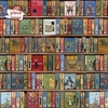
Part of an exciting series of sturdy, square-box 1000-piece jigsaw puzzles from Flame Tree, featuring powerful & popular works of art. This new jigsaw will satisfy your need for a challenge, with the beautiful Bodleian Library: High Jinks Bookshelves. ...
Archived Product

Bodensee / Lake Constance Swisstopo 28

Swiss topographic survey at 1:100, 000 from Swisstopo, highly regarded for it superb use of graphic relief and hill shading, presenting an almost 3-D picture of the country`s mountainous terrain. Coverage is available either as small size standard sheets – Nos 26 to 48, each covering 70 x 48 km / 43 x 30 miles approx, or as larger size maps - Nos. 101 onwards, each covering 100 x 70 km / 62 x 43 miles approx.Both formats have identical cartography, with contours at 50-metres intervals. Standard sheets include margin ticks showing latitude and longitude in steps of 10`, and both formats have an overprint showing the Swiss national grid lines at 10km intervals; latest editions of the larger sheets now have the Swiss grid lines at 1km intervals.Standard sheets have a map legend in
the language of the area covered by the map. The larger sheets have no legend but a separate “Conventional Signs” leaflet in English can be provided with the map.To see the list of titles in this series please click on the series link.
RIP - This product is no longer available on our network. It was last seen on 25.09.2019

This page now acts as a permanent archive for this product. Add more information using the comments box below to ensure it can still be found by future generations.

Use our search facility to see if it is available from an alternative contributor.
  • Availability: Out Of Stock
  • Supplier: Stanfords
  • SKU: 9783302000282
Availability: In Stock
£12.99

Product Description

Swiss topographic survey at 1:100, 000 from Swisstopo, highly regarded for it superb use of graphic relief & hill shading, presenting an almost 3-D picture of the country`s mountainous terrain. Coverage is available either as small size standard sheets – Nos 26 to 48, each covering 70 x 48 km / 43 x 30 miles approx, or as larger size maps
- Nos. 101 onwards, each covering 100 x 70 km / 62 x 43 miles approx. Both formats have identical cartography, with contours at 50-metres intervals. Standard sheets include margin ticks showing latitude & longitude in steps of 10`, & both formats have an overprint showing the Swiss national grid lines at 10km intervals; latest editions of the larger sheets now have the Swiss grid lines at 1km intervals. Standard sheets have a map legend in the language of the area covered by the map. The larger sheets have no legend but a separate “ Conventional Signs” leaflet in English can be provided with the map. To see the list of titles in this series please click on the series link.

Reviews/Comments

Add New

Price History

Vouchers

No voucher codes found.
Do you know a voucher code for this product or supplier? Add it to Insights for others to use.

Facebook

Jargon Buster

Metres - A unit of measure, one metre equals 100 centimetres
swiss - Short for Switzerland, one of the richest countries in the world
Size - is the measurement of how big an object is in space.
Language - the method of communication used in different areas. Humans and computers have many different languages.
Km - Kilometre. A unit of measurement equal to 1000 metres.
Small - something that takes up less space than normal.
Language - The way humans communicate either written and spoken.

Supplier Information

Stanfords
Stanfords was established in 1853 and opened their iconic Covent Garden flagship store in 1901. They have become the top retailer of maps, travel books and accessories in the UK and arguably offer the largest selection of maps and travel books worldwide. Famous names such as Captain Robert Falcon Scott, Ranulph Fiennes and Michael Palin have purchased from Stanfords. They now have a shop in Bristol and both stores together with other venues operate a calendar of events including talks, book signings and exhibitions. As a specialist map retailer, the map selection is comprehensive and includes road maps, street maps and walking maps from worldwide destinations, as well as a selection of world atlases and wall maps. Books include travel guides and travel literature. Stanfords also stock globes, from miniatures made of blue marble to magnificent floor-standing globes. The website features a selection of interesting articles on travel topics.
Page Updated: 2023-11-12 20:15:36

Community Generated Product Tags

Oh No! The productWIKI community hasn't generated any tags for this product yet!
Menu