More From Contributor

£19.99
The southern part of Sweden in a series of 30 double-sided cycling maps from Norstedts printed on light, waterproof & tear-resistant synthetic paper. Mainland is covered at 1:90, 000 with Gotland at 1:100, 000. The maps, prepared in association with Cykelfrämjandet
- Sweden’s largest national cycling organization, highlight all the national & other major cycle routes, plus a selection of local routes. The overprint indicates sections which are on gravel roads and/or not singposted. Also marked are selected hiking trails. A range of symbols indicate various facilities & places of interest, including campsites & youth hostels, wind shelters, cultural & historical sites, interesting nature & geological spots, etc. The maps provide a very detailed picture of the road network, including privately maintained roads open to the general public. Railway lines are shown with stations & ferry connections are marked. Topography is indicated by light relief shading with spot heights, plus colouring and/or graphics for forests & marshl&. The maps have a UTM grid, plus latitude & longitude lines at intervals of 10’. Map legend

Includes::
English. Each map also provides phone numbers & web addresses of local tourist offices.


...
Archived Product
£19.95
Blekinge Province Cycling Map in a series of 30 double-sided maps from Norstedts of the southern part of Sweden, printed on light, waterproof & tear-resistant synthetic paper. Mainland is covered at 1:90, 000 with Gotland at 1:100, 000. The maps, prepared in association with Cykelfr ...
Archived Product
£11.50
Topographic survey of France at 1:25, 000 in IGN`s excellent TOP25 / Série Bleue series. All the maps are GPS compatible, with a 1km UTM grid plus latitude & longitude lines at 5’ intervals. Contours are at 5m intervals except for mountainous areas where the maps have contours at 10m intervals, vividly enhanced by hill shading & graphics for rocky terrain. Colouring with graphics indicates different types of vegetation or land use (deciduous or coniferous forests, moors, orchards, vineyards, etc). PLEASE NOTE: coverage of France at this scale is currently being revised – the format & the presentation of each title are indicated by the letters at the end of its Sheet Reference number (e.g. 0416ET, 3531ETR, 1923SB, etc.)MAPS WITH FULL TOURIST OVERPRINT & AN ENGLISH MAP LEGEND: all TOP25 maps & the SB editions of Série Bleue have an overprint highlighting waymarked walking trails including long-distance GR routes &, where appropriate, ski routes. Symbols indicate campsites, gîtes d’etape, refuges, equestrian centres & other recreational facilities or sites, tourist information centres, cultural heritage, etc. Towns & locations of particular interest are highlighted.- ET or OT = single-sided TOP25 map covering approx. 29x 21 km / 18x 13 miles.- ETR or OTR = waterproof & tear resistant TOP25 map covering the same area as the corresponding ET or OT number, but double-sided, printed on a smaller size sheet with a good overlap between the sides.- SB = Série Bleue map with full tourist overprint; these maps, first introduced in summer 2014, each cover approx. 29x 24km / 18x 15 miles.SÉRIE BLEUE maps with numbers ending in E (Est) or O (Ouest): most editions now indicate the GR routes, but do not show any other tourist information. Map legend is in French only. Each map covers approx. 14x 20km / 9x 12 miles. ...
Archived Product
£12.99
Topographic survey of France at 1:25, 000 in IGN`s excellent TOP25 / Série Bleue series. All the maps are GPS compatible, with a 1km UTM grid plus latitude & longitude lines at 5’ intervals. Contours are at 5m intervals except for mountainous areas where the maps have contours at 10m intervals, vividly enhanced by hill shading & graphics for rocky terrain. Colouring with graphics indicates different types of vegetation or land use (deciduous or coniferous forests, moors, orchards, vineyards, etc). PLEASE NOTE: coverage of France at this scale is currently being revised – the format & the presentation of each title are indicated by the letters at the end of its Sheet Reference number (e.g. 0416ET, 3531ETR, 1923SB, etc.)MAPS WITH FULL TOURIST OVERPRINT & AN ENGLISH MAP LEGEND: all TOP25 maps & the SB editions of Série Bleue have an overprint highlighting waymarked walking trails including long-distance GR routes &, where appropriate, ski routes. Symbols indicate campsites, gîtes d’etape, refuges, equestrian centres & other recreational facilities or sites, tourist information centres, cultural heritage, etc. Towns & locations of particular interest are highlighted.- ET or OT = single-sided TOP25 map covering approx. 29x 21 km / 18x 13 miles.- ETR or OTR = waterproof & tear resistant TOP25 map covering the same area as the corresponding ET or OT number, but double-sided, printed on a smaller size sheet with a good overlap between the sides.- SB = Série Bleue map with full tourist overprint; these maps, first introduced in summer 2014, each cover approx. 29x 24km / 18x 15 miles.SÉRIE BLEUE maps with numbers ending in E (Est) or O (Ouest): most editions now indicate the GR routes, but do not show any other tourist information. Map legend is in French only. Each map covers approx. 14x 20km / 9x 12 miles. ...
Archived Product
£7.99
The Oslo police are baffled. Crime scenes are being found covered with blood, but there is no victim. Only an odd series of numbers is left behind. When a girl is brutally raped in her apartment, Detective Hanne Wilhelmsen is charged with solving the case. Hanne quickly notices strange similarities with the blood-stained crime scenes. But the victim`s father has started an independent hunt for the rapist...and Hanne will have to race against time to prevent a victim becoming a vigilante. ...
Archived Product
£6.99
Bletchley Park, known to those who worked there as Station X, was the scene of one of the greatest Allied triumphs of the Second World War. The breaking of the Nazi Enigma cyphers by Britain`s wartime code-breakers continues to fascinate, with well over 100, 000 people visiting the scene of their successes every year. Bletchley Park provided the intelligence that ensured Allied victories in the Battle of Atlantic, the war in North Africa &, most crucially, the D-Day invasion of Europe, & it was also the birthplace of the modern computer. The code-breakers were led by men like Dilly Knox & Alan Turing, but also included thousands of `ordinary` people, the vast majority of them young women. This book contains previously unpublished photographs showing them at work & play. It not only explains how their work influenced the battle against Nazi Germany & its Italian & Japanese allies, but also describes how they lived & loved. ...
Archived Product
£7.99
Britain. What`s that all about then? Having skewered modern life & culture in the bestselling Is it Just Me or is Everything Shit?, Steve Lowe & Alan Mc Arthur set out to uncover the deep dark truth about Britain ? its history, its myths & its people. Over the course of a year they endure the Last Night of the Proms & search for a couple of pissed dragons under a hill in Wales. They witness Scotland rising again (a bit), encounter terrifying Europhobe ladies in Surrey & lose the will to live in Gibraltar. They also meet a lot of druids. Hilarious, provocative & filled with fascinating facts, Blighty offers a brilliant, alternative vision of Britain ? the island in the Atlantic that some people call Britain. ...
Archived Product
£17.99
During the First World War, the railways of Great Britain were run for the benefit of the armed services. With minimal investment & much of the workforce conscripted, the railways paid the price for their war service. Many railway-owned ships were commandeered & never returned, some lost, others unfit for service at the end of the war, while yet others were retained by the Navy. The railway workshops were turned over to war work, building ambulance trains, armaments & munitions; the railway ports were heavily utilised while the tracks themselves, especially in the south of Engl&, were turned over for military use. A fascinating insight into railways operating at their peak. For the first time, archival documents from the Railway Executive Committee have been analysed, & combined with data from previously untapped resources, to show the sheer scale of the railways` contribution to the winning of a war unprecedented in its scale & violence. ...
Archived Product
£11.99
One of the titles in a series of topographic maps covering much of north-west Africa, produced as part of the IMW* project in 1960’s. Each map covers an area spanning 6° in longitude & 4° in latitude. There is some variation in colouring & the depiction of terrain, but hill-shading, spot heights & contours are used to show the general relief. Additional graphics show features such as dunes, rock outcrops, cliffs, sand areas, escarpments, marshes, seasonal lakes & watercourses, & areas liable to flooding. Bathymetric contours are also included. Communications detail

Includes::
roads, major trails & railways, although there is some inconsistency in colouring & the extent of classification, e.g. not all maps distinguish seasonal roads. On most maps intermediate road distances are indicated on main routes. Symbols show airports, mosques, mines, oil & gas fields, lighthouses, ruins & significant isolated buildings. Administrative boundaries are marked & latitude & longitude lines are drawn at 1° intervals, with further margin ticks at 1’ intervals. The map legend is in French only on some sheets, & in English & French on others.* The International Map of the World was a project conceived in the early 20th century to compile a world map series at 1:1, 000, 000 through the efforts of participating nations. The value of the program has declined since 1970 & the IMW is no longer regarded as an active international series.

...
Archived Product
£8.99
The deepest cave on earth was a prize that had remained unclaimed for centuries, long after every other ultimate discovery had been made. This is the story of the men & women who risked everything to find it, earning their place in history beside the likes of Peary, Amundsen, Hillary, & Armstrong. In 2004, two great scientist-explorers attempted to find the bottom of the world. Bold, American Bill Stone was committed to the vast Cheve Cave, located in southern Mexico & deadly even by supercave standards. On the other side of the globe, legendary Ukrainian explorer Alexander Klimchouk
- Stone`s opposite in temperament & style
- had targeted Krubera, a freezing nightmare of a supercave in the Republic of Georgia. ” Blind Descent” explores both the brightest & darkest aspects of the timeless human urge to discover
- to be first. It is also a thrilling epic about a pursuit that makes even extreme mountaineering & ocean exploration pale by comparison. These supercavers spent months in multiple camps almost two vertical miles deep & many more miles from their caves` exits. They had to contend with thous&-foot drops, deadly flooded tunnels, raging whitewater rivers, monstrous waterfalls, mile-long belly crawls, & much more. Perhaps even worse were the psychological horrors produced by weeks plunged into absolute, perpetual darkness, beyond all hope of rescue, including a particularly insidious derangement called ” The Rapture”. ” Blind Descent” is a testament to human survival & endurance
- & to two extraordinary men whose relentless pursuit of greatness led them to heights of triumph & depths of tragedy neither could have imagined.


...
Archived Product

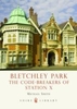
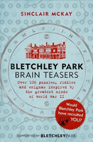
Bletchley Park Brainteasers

Do you fancy finding out if you have a talent for morse code? Or discovering whether your crossword hobby might have seen you recruited into the history books? If so and you`re a Bletchley Park history buff or a fan of the GCHQ Quiz Book, then this is the book for you.When scouring the land for top-level code-breakers, the Bletchley Park recruiters left no stone unturned. From mathematical-geniuses to sixth-form students who could read orchestral scores, chess masters, linguists, and Egyptologists who could interpret hieroglyphics, code-breakers were gathered from all around the country. Once selected, the chosen few had to complete various tests - chess puzzles, crosswords, secret language translations, complex riddles and more - to see if they had what it takes to join the
country`s elite code-breaking team. Now you can see if you have what it takes, too.Accompanied by nuggets of historical fascination such as the story of David Omand who was asked to translate an essay written in made-up Elvish and ended up as Director of GCHQ, or Jean Valentine, who volunteered in Dundee aged 18, disclosed that she loved the challenge of a cryptic crossword and found herself whisked down to Bletchley, these brain-teasing puzzles and riddles will give you a taste of what it felt like to be tested by the keenest minds in the country.
RIP - This product is no longer available on our network. It was last seen on 25.09.2019

This page now acts as a permanent archive for this product. Add more information using the comments box below to ensure it can still be found by future generations.

Use our search facility to see if it is available from an alternative contributor.
  • External links may include paid for promotion
  • Availability: Out Of Stock
  • Supplier: Stanfords
  • SKU: 9781472252609
Availability: In Stock
£12.99

Product Description

Do you fancy finding out if you have a talent for morse code? Or discovering whether your crossword hobby might have seen you recruited into the history books? If so & you`re a Bletchley Park history buff or a fan of the GCHQ Quiz Book, then this is the book for you. When scouring the land for top-level code-breakers, the Bletchley Park recruiters left no stone unturned. From mathematical-geniuses to sixth-form students who could read orchestral scores, chess masters, linguists, & Egyptologists who could interpret hieroglyphics, code-breakers were gathered from all around the country. Once selected, the chosen few had to complete various tests
- chess puzzles, crosswords, secret language translations, complex riddles & more
- to see if they had what it takes to join the country`s elite code-breaking team. Now you can see if you have what it takes, too. Accompanied by nuggets of historical fascination such as the story of David Omand who was asked to translate an essay written in made-up Elvish & ended up as Director of GCHQ, or Jean Valentine, who volunteered in Dundee aged 18, disclosed that she loved the challenge of a cryptic crossword & found herself whisked down to Bletchley, these brain-teasing puzzles & riddles will give you a taste of what it felt like to be tested by the keenest minds in the country.

Reviews/Comments

Add New

Intelligent Comparison

Oooops!
We couldn't find anything!
Perhaps this product's unique.... Or perhaps we are still looking for comparisons!
Click to bump this page and we'll hurry up.

Price History

Vouchers

No voucher codes found.
Do you know a voucher code for this product or supplier? Add it to Insights for others to use.

Facebook

Jargon Buster

Students - A group of humans who are still in full time education
team - A group of people or animals linked by a common purpose.
History - Anything that happens in the past. An acedemic subject.
Felt - A non woven cloth made from compressed wool
Stone - Or Rock is a naturally occuring mineral categorised into three types, Igneous, Sedimentary and Metamorphic
Language - the method of communication used in different areas. Humans and computers have many different languages.
Fan - A piece of equipment that has blades that rotate to cool the air, can be installed within other equipment,
Language - The way humans communicate either written and spoken.

Supplier Information

Stanfords
Stanfords was established in 1853 and opened their iconic Covent Garden flagship store in 1901. They have become the top retailer of maps, travel books and accessories in the UK and arguably offer the largest selection of maps and travel books worldwide. Famous names such as Captain Robert Falcon Scott, Ranulph Fiennes and Michael Palin have purchased from Stanfords. They now have a shop in Bristol and both stores together with other venues operate a calendar of events including talks, book signings and exhibitions. As a specialist map retailer, the map selection is comprehensive and includes road maps, street maps and walking maps from worldwide destinations, as well as a selection of world atlases and wall maps. Books include travel guides and travel literature. Stanfords also stock globes, from miniatures made of blue marble to magnificent floor-standing globes. The website features a selection of interesting articles on travel topics.
Page Updated: 2023-11-12 20:15:36

Community Generated Product Tags

Oh No! The productWIKI community hasn't generated any tags for this product yet!
Menu