More From Contributor
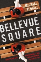
£12.95
Belledonne area in a series of hiking maps from Rando Editions with tourist information on a topographic base from the Institut Géographique National. Finely detailed cartography has contours at 20m intervals with relief-shading. Glaciers, cliffs, scree & wooded areas are shown, as well as springs, intermittent streams, etc. Local footpaths & the long-distance GR routes are highlighted & indicate whether signposted, difficult passages, ice hiking trails, & high mountain routes. Symbols highlight mountain huts, refuges & shelters, gîtes d’etape, campsites, numerous leisure & sport centres, places of interest, etc. Ski lifts indicate those open in summer. Boundaries of national parks & other protected areas are marked. The maps have a 2km UTM grid. Map legend

Includes::
English.* In this title:* coverage extends from Lac du Chambon in the south to Pontcharra in the north, & from Grenoble in the west to Valloire in the east.

...
Archived Product
£3.50
Belleek & Pettigo in 1900 in the Alan Godfrey Edition of historical Ordnance Survey mapping at one inch to one mile. The map is split roughly equally between Counties Donegal & Fermanagh. Coverage stretches from Belleek eastward to Kesh & northward to Lough Derg. Features include much of lower Lough Erne, Lough Derg, Boa Isl&, the Great Northern Railway, Lustymore Isl&, Shinnan Hill, Crockkinagoe. On the reverse there are two more detailed maps. One is for the Fermanagh village of Belleek, famous for its Pottery Works, including its railway with station, RC church, hotels, White Cat Cave etc. The second plan is for Pettigoe (or Pettigo), split between Donegal & Fermanagh & this shows the village in detail; features include the Main Street with individual buildings, part of the station, churches, corn & saw mills. Also included are directories for both villages.* About Alan Godfrey Editions of OS 1” to 1 mile maps of Ireland:* The maps provide an invaluable overview of a wider area, typically 18 x 12 miles (29 x 19kms approx.), & offer historical mapping for small villages not covered by the more detailed series for which the Godfrey Editions are better known. All the maps include historical notes & all, unless indicated in the individual description, also include a large scale map of a small town or village in the area. ...
Archived Product
£12.99
Topographic survey of France at 1:25, 000 in IGN`s excellent TOP25 / Série Bleue series. All the maps are GPS compatible, with a 1km UTM grid plus latitude & longitude lines at 5’ intervals. Contours are at 5m intervals except for mountainous areas where the maps have contours at 10m intervals, vividly enhanced by hill shading & graphics for rocky terrain. Colouring with graphics indicates different types of vegetation or land use (deciduous or coniferous forests, moors, orchards, vineyards, etc). PLEASE NOTE: coverage of France at this scale is currently being revised – the format & the presentation of each title are indicated by the letters at the end of its Sheet Reference number (e.g. 0416ET, 3531ETR, 1923SB, etc.)MAPS WITH FULL TOURIST OVERPRINT & AN ENGLISH MAP LEGEND: all TOP25 maps & the SB editions of Série Bleue have an overprint highlighting waymarked walking trails including long-distance GR routes &, where appropriate, ski routes. Symbols indicate campsites, gîtes d’etape, refuges, equestrian centres & other recreational facilities or sites, tourist information centres, cultural heritage, etc. Towns & locations of particular interest are highlighted.- ET or OT = single-sided TOP25 map covering approx. 29x 21 km / 18x 13 miles.- ETR or OTR = waterproof & tear resistant TOP25 map covering the same area as the corresponding ET or OT number, but double-sided, printed on a smaller size sheet with a good overlap between the sides.- SB = Série Bleue map with full tourist overprint; these maps, first introduced in summer 2014, each cover approx. 29x 24km / 18x 15 miles.SÉRIE BLEUE maps with numbers ending in E (Est) or O (Ouest): most editions now indicate the GR routes, but do not show any other tourist information. Map legend is in French only. Each map covers approx. 14x 20km / 9x 12 miles. ...
Archived Product
£12.99
Map No. 1105, Bellelay, in the topographic survey of Switzerland at 1:25, 000 from Bundesamt für Landestopographie (swisstopo), covering the whole country on 247 small format sheets, with special larger maps published for popular regions including some titles now available in hiking versions. Highly regarded for their superb use of graphic relief & hill shading, the maps give an almost 3-D picture of Switzerland`s mountainous terrain. Contours are at 10 m intervals, with 20m intervals in the mountainous areas. All the maps have a 1-km grid for Swiss national coordinates (datum CH 1903). * Small format sheets (Nos. 1011
- 1374)* Map legend in the language of the area covered by the map. Additional margin ticks show latitude & longitude in steps of 2`. The area covered by each map is 17 x 12 km (11 x 7 miles approx). * Special larger sheets (Nos. from 2501 onwards) – STANDARD editions:* No map legend is included but a separate leaflet can be provided instead. The area covered by each map is 25 x 17 km (15 x 11 miles approx).* Special larger sheets (Nos. from 2501 onwards) – HIKING editions:* An overprint highlights hiking, mountain & alpine paths, including regional & national long-distance trails. The maps also show bus routes with bus stops, plus inns in remote locations. The area covered by each map is 25 x 17 km (15 x 11 miles approx).
...
Archived Product
£8.99
In the heroic days of rail travel, you could dine on kippers & champagne aboard the Brighton Belle; smoke a post-prandial cigar as the Golden Arrow closed in on Paris, or be shaved by the Flying Scotsman`s on-board barber. Everyone from schoolboys to socialites knew of these glamorous `named trains` & aspired to ride aboard them. In Belles & Whistles, Andrew Martin recreates these famous train journeys by travelling aboard their nearest modern day equivalents. Sometimes their names have survived, even if only as a footnote on a timetable leaflet, but what has usually
- if not always
- disappeared is the extravagance & luxury. As Martin explains how we got from there to here, evocations of the Golden Age contrast with the starker modern reality: from monogrammed cutlery to stirring sticks, from silence on trains to tannoy announcements, from compartments to airline seating. For those who wonder whatever happened to porters, dining cars, mellow lighting, timetables, luggage in advance, trunk murders, the answers are all here. Martin`s five journeys add up to an idiosyncratic history of Britain`s railways, combining humour, historical anecdote & reportage from the present & romantic evocations of the past.

...
Archived Product
£12.99
Topographic survey of France at 1:25, 000 in IGN`s excellent TOP25 / Série Bleue series. All the maps are GPS compatible, with a 1km UTM grid plus latitude & longitude lines at 5’ intervals. Contours are at 5m intervals except for mountainous areas where the maps have contours at 10m intervals, vividly enhanced by hill shading & graphics for rocky terrain. Colouring with graphics indicates different types of vegetation or land use (deciduous or coniferous forests, moors, orchards, vineyards, etc). PLEASE NOTE: coverage of France at this scale is currently being revised – the format & the presentation of each title are indicated by the letters at the end of its Sheet Reference number (e.g. 0416ET, 3531ETR, 1923SB, etc.)MAPS WITH FULL TOURIST OVERPRINT & AN ENGLISH MAP LEGEND: all TOP25 maps & the SB editions of Série Bleue have an overprint highlighting waymarked walking trails including long-distance GR routes &, where appropriate, ski routes. Symbols indicate campsites, gîtes d’etape, refuges, equestrian centres & other recreational facilities or sites, tourist information centres, cultural heritage, etc. Towns & locations of particular interest are highlighted.- ET or OT = single-sided TOP25 map covering approx. 29x 21 km / 18x 13 miles.- ETR or OTR = waterproof & tear resistant TOP25 map covering the same area as the corresponding ET or OT number, but double-sided, printed on a smaller size sheet with a good overlap between the sides.- SB = Série Bleue map with full tourist overprint; these maps, first introduced in summer 2014, each cover approx. 29x 24km / 18x 15 miles.SÉRIE BLEUE maps with numbers ending in E (Est) or O (Ouest): most editions now indicate the GR routes, but do not show any other tourist information. Map legend is in French only. Each map covers approx. 14x 20km / 9x 12 miles. ...
Archived Product
£12.99
Map No. 1313, Bellinzona, in the topographic survey of Switzerland at 1:25, 000 from Bundesamt für Landestopographie (swisstopo), covering the whole country on 247 small format sheets, with special larger maps published for popular regions including some titles now available in hiking versions. Highly regarded for their superb use of graphic relief & hill shading, the maps give an almost 3-D picture of Switzerland`s mountainous terrain. Contours are at 10 m intervals, with 20m intervals in the mountainous areas. All the maps have a 1-km grid for Swiss national coordinates (datum CH 1903). * Small format sheets (Nos. 1011
- 1374)* Map legend in the language of the area covered by the map. Additional margin ticks show latitude & longitude in steps of 2`. The area covered by each map is 17 x 12 km (11 x 7 miles approx). * Special larger sheets (Nos. from 2501 onwards) – STANDARD editions:* No map legend is included but a separate leaflet can be provided instead. The area covered by each map is 25 x 17 km (15 x 11 miles approx).* Special larger sheets (Nos. from 2501 onwards) – HIKING editions:* An overprint highlights hiking, mountain & alpine paths, including regional & national long-distance trails. The maps also show bus routes with bus stops, plus inns in remote locations. The area covered by each map is 25 x 17 km (15 x 11 miles approx).
...
Archived Product
£24.95
In ” Bellissima Venice”, the next volume in the Portfolio Collection, ” New York Vertigo” photographer Michel Setboun captures the romantic ` City of Water` in dazzling & inspiring images. Exploring its canals & rooftops with his camera, Setboun gives us compelling perspective, dramatic views & serene panoramas of La Serenissima. From the Piazza San Marco to San Giorgio Maggiore; from the Rialto Bridge to the Bridge of Sighs; from Grand Canal to small water alleyways, readers will be seduced by both the city & the stunning photography, making ” Bellisima Venice” the perfect gift. ...
Archived Product
£3.50
Bellshill in 1935 in a fascinating series of reproductions of old Ordnance Survey plans in the Alan Godfrey Editions, ideal for anyone interested in the history of their neighbourhood or family. The map covers much of Bellshill, stretching westward towards Viewpark. Coverage extends from East Avenue (Viewpark) eastward to Motherwell Road (Bellshill). Features include Bellshill Main street, LMSR & LNER stations, church & manse, South Alderston, Bellziehill, East Parkhead Rows, New Orbiston, Douglas-park, Viewfield, Bothwell Park Brick Works, sections of Bothwell Branch & Hamilton Palace Colliery Branches, Bothwell Park Farm, Bell`s Quarries, Bothwell Cemetery, Bothwell Park Rows, Fallside, Cockhill, Hag Hill, remains of old colliery workings, etc. On the reverse are extracts from a 1920s Bellshill trade directory, plus a Glasgow-Bellshill-Edinburgh railway timetable for 1929. About the Alan Godfrey Editions of the 25” OS Series: Selected towns in Great Britain & Ireland are covered by maps showing the extent of urban development in the last decades of the 19th & early 20th century. The plans have been taken from the Ordnance Survey mapping & reprinted at about 15 inches to one mile (1:4, 340). On the reverse most maps have historical notes & many also include extracts from contemporary directories. Most maps cover about one mile (1.6kms) north/south, one & a half miles (2.4kms) across; adjoining sheets can be combined to provide wider coverage.FOR MORE INFORMATION & A COMPLETE LIST OF ALL AVAILABLE TITLES PLEASE CLICK ON THE SERIES LINK. ...
Archived Product
£10.99
Belluno at 1:5, 000 on an indexed street plan from Litografia Artistica Cartografica, Italy’s leading publishers of city maps with an extensive range of titles. Where appropriate, the plans include an enlargement showing the historic centre in greater detail. On each plan monuments including historic buildings & churches, archaeological sites, cultural or educational institutions, & important municipal buildings or facilities are numbered & listed next to the plan. One way streets are not marked. Street index is on the reverse. ...
Archived Product

Bellevue Square

`Unsettling and bewildering. I was totally hooked` - Sam Baker, The PoolWinner of the 2017 Scotiabank Giller PrizeJean Mason has a doppelganger.She`s never seen her, but others* swear they have.*others noun. A peculiar collection of drug addicts, scam artists, philanthropists, philosophers and vagrants the regulars of Bellevue Square.Jean lives in downtown Toronto with her husband and two kids. The proud owner of a thriving bookstore, she doesn t rattle easily not like she used to. But after two of her customers insist they ve seen her double, Jean decides to investigate. Curiosity grows to obsession and soon Jean s concerns shift from the identity of the woman, to her very own.Funny, dark and surprising, Bellevue Square takes readers down the existentialist rabbit hole and asks
the question: what happens when the sense you ve made of things stops making sense?`Highly original, beautiful and unsettling. Michael Redhill takes a fascinating premise and turns it into something utterly mesmerising. I adored it` - Chris Whitaker, author of Tall Oaks and All the Wicked Girls`An ambitious and engrossing novel by a writer at the height of his powers` - G J Minett, author of Lie in Wait and The Hidden Legacy`Mystifying and haunting... as captivating as it is unsettling` - Toronto Star`Echoes of premises mined by the likes of Philip K. Dick, Kazuo Ishiguro and Stephen King... our admiration of Redhill`s storytelling dexterity burgeons` - Globe and Mail
RIP - This product is no longer available on our network. It was last seen on 25.09.2019

This page now acts as a permanent archive for this product. Add more information using the comments box below to ensure it can still be found by future generations.

Use our search facility to see if it is available from an alternative contributor.
  • External links may include paid for promotion
  • Availability: Out Of Stock
  • Supplier: Stanfords
  • SKU: 9780857302670
Availability: In Stock
£8.99

Product Description

` Unsettling & bewildering. I was totally hooked`
- Sam Baker, The Pool Winner of the 2017 Scotiabank Giller Prize Jean Mason has a doppelganger. She`s never seen her, but others* swear they have.*others noun. A peculiar collection of drug addicts, scam artists, philanthropists, philosophers & vagrants the regulars of Bellevue Square. Jean lives in downtown Toronto with her husband & two kids. The proud owner of a thriving bookstore, she doesn t rattle easily not like she used to. But after two of her customers insist they ve seen her double, Jean decides to investigate. Curiosity grows to obsession & soon Jean s concerns shift from the identity of the woman, to her very own. Funny, dark & surprising, Bellevue Square takes readers down the existentialist rabbit hole & asks the question: what happens when the sense you ve made from things stops making sense?` Highly original, beautiful & unsettling. Michael Redhill takes a fascinating premise & turns it into something utterly mesmerising. I adored it`
- Chris Whitaker, author of Tall Oaks & All the Wicked Girls` An ambitious & engrossing novel by a writer at the height of his powers`
- G J Minett, author of Lie in Wait & The Hidden Legacy` Mystifying & haunting... as captivating as it is unsettling`
- Toronto Star` Echoes of premises mined by the likes of Philip K. Dick, Kazuo Ishiguro & Stephen King... our admiration of Redhill`s storytelling dexterity burgeons`
- Globe & Mail

Reviews/Comments

Add New

Intelligent Comparison

Oooops!
We couldn't find anything!
Perhaps this product's unique.... Or perhaps we are still looking for comparisons!
Click to bump this page and we'll hurry up.

Price History

Vouchers

No voucher codes found.
Do you know a voucher code for this product or supplier? Add it to Insights for others to use.

Facebook

Jargon Buster

Rabbit - A small animal found in several parts of the world both wild and domesticated
star - A giant ball of plasma held together by gravity.
Dark - A colour which absorbs visable ligt so apears less light than objects that reflect light
Mail - Or post is a service for transmitting physical objects or letters between locations
King - The figure head of a monarch
Kids - A young child.

Supplier Information

Stanfords
Stanfords was established in 1853 and opened their iconic Covent Garden flagship store in 1901. They have become the top retailer of maps, travel books and accessories in the UK and arguably offer the largest selection of maps and travel books worldwide. Famous names such as Captain Robert Falcon Scott, Ranulph Fiennes and Michael Palin have purchased from Stanfords. They now have a shop in Bristol and both stores together with other venues operate a calendar of events including talks, book signings and exhibitions. As a specialist map retailer, the map selection is comprehensive and includes road maps, street maps and walking maps from worldwide destinations, as well as a selection of world atlases and wall maps. Books include travel guides and travel literature. Stanfords also stock globes, from miniatures made of blue marble to magnificent floor-standing globes. The website features a selection of interesting articles on travel topics.
Page Updated: 2023-11-12 20:15:36

Community Generated Product Tags

Oh No! The productWIKI community hasn't generated any tags for this product yet!
Menu