More From Contributor
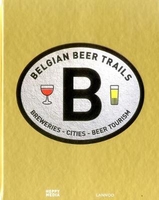
£6.99
Street plan of Belfort, part of an extensive series covering French cities & towns from Blay-Foldex, the country’s largest, oldest & most experienced publisher of urban mapping. Blay plans include outer suburbs &, where appropriate, adjoining localities forming part of the urban agglomeration & provide brief descriptions of the town’s main sights, contact details for hotels & other places of interest, etc. The plans show one way streets, car parks & pedestrian zones. Important public buildings are clearly marked & identified. Blay street maps are usually double-sided & include an enlargement for the town centre & a street index with separate lists of “edifices publics”: main public buildings, places of worship, schools, sport facilities, stations, etc. Each of the outer suburbs or the adjoining localities, identified with its postcode, has a separate index. Many titles also provide a road map of the environs. All the text is in French only.PLEASE NOTE: to see the list of Blay-Foldex street plans of French towns & cities please click on the series link – the series description also

Includes::
a comparison between Blay & IGN street plans.

...
Archived Product
£12.99
Topographic survey of France at 1:25, 000 in IGN`s excellent TOP25 / Série Bleue series. All the maps are GPS compatible, with a 1km UTM grid plus latitude & longitude lines at 5’ intervals. Contours are at 5m intervals except for mountainous areas where the maps have contours at 10m intervals, vividly enhanced by hill shading & graphics for rocky terrain. Colouring with graphics indicates different types of vegetation or land use (deciduous or coniferous forests, moors, orchards, vineyards, etc). PLEASE NOTE: coverage of France at this scale is currently being revised – the format & the presentation of each title are indicated by the letters at the end of its Sheet Reference number (e.g. 0416ET, 3531ETR, 1923SB, etc.)MAPS WITH FULL TOURIST OVERPRINT & AN ENGLISH MAP LEGEND: all TOP25 maps & the SB editions of Série Bleue have an overprint highlighting waymarked walking trails including long-distance GR routes &, where appropriate, ski routes. Symbols indicate campsites, gîtes d’etape, refuges, equestrian centres & other recreational facilities or sites, tourist information centres, cultural heritage, etc. Towns & locations of particular interest are highlighted.- ET or OT = single-sided TOP25 map covering approx. 29x 21 km / 18x 13 miles.- ETR or OTR = waterproof & tear resistant TOP25 map covering the same area as the corresponding ET or OT number, but double-sided, printed on a smaller size sheet with a good overlap between the sides.- SB = Série Bleue map with full tourist overprint; these maps, first introduced in summer 2014, each cover approx. 29x 24km / 18x 15 miles.SÉRIE BLEUE maps with numbers ending in E (Est) or O (Ouest): most editions now indicate the GR routes, but do not show any other tourist information. Map legend is in French only. Each map covers approx. 14x 20km / 9x 12 miles. ...
Archived Product
£11.99
Belgian Ardennes: Dinant
- Marche-en-Femenne area in a series of cycling maps from Sportoena covering Belgium & the adjoining regions
...
Archived Product
£11.99
Belgian Adrennes: Malmedy
- Hautes Fanges National Park area in a series of cycling maps from Sportoena covering Belgium & the
...
Archived Product
£11.99
Belgian Ardennes: Sedan
- Bastogne area in a series of cycling maps from Sportoena covering Belgium & the adjoining regions of
...
Archived Product
£24.95
Beer Professor Kevin Verstrepen & Beer Doctor Miguel Roncoroni put 250 Belgian beers to the test in their lab, resulting in a complete encyclopaedia with scientific analyses of the taste & aroma profiles & the chemical composition of beer. The beer team of the Flemish Institute for Biotechnology (VIB) went into the laboratory for 2 years to subject 252 Belgian beers to thorough chemical analysis & to a panel of objective guinea pigs. The result is this definitive guide, which finally decomposes the complex composition of our favourite barley into the molecule & illustrates it for every type of beer lover. Get to know which flavour you prefer & search for similar flavours & varieties amongst the huge range of Belgian beers. ...
Archived Product
£9.99
The coast of Belgium at 1:50, 000 in a series from Falk B.V. showing the network of signposted cycling routes on large, double-sided indexed maps with prominent highlighting of long-distance LF routes, symbols indicating accommodation & other tourist services, plus in each title two or more panels with recommended local circuits & additional tourist information. The Falk 50K cycling series, which

Includes::
some adjoining areas in Lower Saxony & has now been extended to cover Flanders, shows the extensive network of sign-posted cycling routes. The network consists of numbered junctions joined by sign-posted connecting routes in either direction. At each junction there is an information panel showing an overview map of the whole network with the junction numbers. A second panel shows all the intersections directly connected to that junction. The system enables cyclists to plan their own routes by preparing a list of junction numbers through which they want to travel. Falk maps give cycling distances between the junctions & indicate which roads, both within the numbered network & outside it, have separate cycling paths. Routes which are part of the LF network of long-distance cycle routes are clearly marked. A wide range of symbols shows various accommodation options, bars & restaurants, & various places of interest. Landscape information is provided by colouring for woodlands, dunes, etc. The maps are indexed & show in the margins latitude & longitude at 1`52” intervals. Map legend

Includes::
English.PLEASE NOTE: to see other titles in the Falk series please click on the series link, where the series description

Includes::
a comparison between the Falk maps & the ANWB cycling series also covering the Netherlands at 1:50, 000.


...
Archived Product
£14.99
Cycling Atlas of the Belgian province of Limburg with an extension to Maastricht & Aachen, a total of 740km of cycling paths, presented by the Verlag Esterbauer in guide with maps at 1:75, 000 showing the routes & their variants. Extensive information is conveyed by symbols, indicating road surface, campsites & other accommodation, repair workshops, recreational facilities, places of interest, etc. A list of various types of accommodation facilities is included.IMPORTANT
- PLEASE NOTE BEFORE ORDERING
- ALL THE TEXT IN THIS TITLE IS GERMAN ONLY. MAP LEGEND

Includes::
ENGLISH (please see our sample image) & the information provided on the maps is sufficient to use this title without any knowledge of German.ABOUT THE BIKELINE SERIES: all the titles have been meticulously researched & are highly regarded in their native Germany. Most titles, as indicated in their individual descriptions, also include a separate section listing selected accommodation, from hotels to campsites, youth hostels & rooms in private houses, all with addresses, telephone numbers & price range. Information on towns along each route

Includes::
a list of places of interest, with opening hours, etc. Several of the guides also have street plans. To see the list of other titles in the Bikeline series please click on the series link.


...
Archived Product
£9.99
The Limburg province of Belgium at 1:50, 000 in a series from Falk B.V. showing the network of signposted cycling routes on large, double-sided indexed maps with prominent highlighting of long-distance LF routes, symbols indicating accommodation & other tourist services, plus in each title two or more panels with recommended local circuits & additional tourist information. The Falk 50K cycling series, which

Includes::
some adjoining areas in Lower Saxony & has now been extended to cover Flanders, shows the extensive network of sign-posted cycling routes. The network consists of numbered junctions joined by sign-posted connecting routes in either direction. At each junction there is an information panel showing an overview map of the whole network with the junction numbers. A second panel shows all the intersections directly connected to that junction. The system enables cyclists to plan their own routes by preparing a list of junction numbers through which they want to travel. Falk maps give cycling distances between the junctions & indicate which roads, both within the numbered network & outside it, have separate cycling paths. Routes which are part of the LF network of long-distance cycle routes are clearly marked. A wide range of symbols shows various accommodation options, bars & restaurants, & various places of interest. Landscape information is provided by colouring for woodlands, dunes, etc. The maps are indexed & show in the margins latitude & longitude at 1`52” intervals. Map legend

Includes::
English.PLEASE NOTE: to see other titles in the Falk series please click on the series link, where the series description

Includes::
a comparison between the Falk maps & the ANWB cycling series also covering the Netherlands at 1:50, 000.


...
Archived Product
£55.00
This book offers a complete overview of all thirty Belgian abbey beers. Where is the rich patrimony of Belgian abbey beers rooted? What are the remarkable stories about this authentic, labour-intensive product. In which way are Trappist beers different from the others? In Belgian Trappist & Abbey Beers, Jef Van den Steen unravels the different stages in the production process of the beers & talks very passionately about the origin & development of the various breweries within the walls or under the license of the abbey. Each brewery is presented with practical information, different types of beer, & the author always

Includes::
tips for tourists. Photographer Andrew Verschetze magnificently captures the beers from the barrel to the glass.

...
Archived Product

Belgian Beer Trails

This book will guide you around Belgium`s breweries, large and small. Wherever you travel on Belgian roads, you will come across brewers. Often invisible - lurking behind abbey walls, or tucked away in castles, barns, stables, cafes, garages, kitchens or sheds - brewers are making beer in kettles, basins, tanks, and whatever else they have to hand! In large breweries you will find the brewers in the control room, the `cockpit` of the enterprise. Entire dynasties are built around the industry; they are proud of their brewing traditions, which go back as many as fifteen generations. Meanwhile, at the other end of the spectrum, starters are cobbling together their own equipment or buying basic brewing kits. They are often acquainted with an experienced colleague, who is only
too happy to lend a helping hand and share wisdom and experience. It is up to you whether or not you approve of their beers. Are you voting for weak, strong, pale, fruity, zesty, spicy, mild, sour, bitter or sweet? For accessible or layered, for a warming beer or a thirst-quencher, a degustation beer or a quaffable one? Tasting is the message.This book taps the keg, encouraging you to weigh up all the options and make your choice.
RIP - This product is no longer available on our network. It was last seen on 25.09.2019

This page now acts as a permanent archive for this product. Add more information using the comments box below to ensure it can still be found by future generations.

Use our search facility to see if it is available from an alternative contributor.
  • External links may include paid for promotion
  • Availability: Out Of Stock
  • Supplier: Stanfords
  • SKU: 9789401441476
Availability: In Stock
£29.95

Product Description

This book will guide you around Belgium`s breweries, large & small. Wherever you travel on Belgian roads, you will come across brewers. Often invisible
- lurking behind abbey walls, or tucked away in castles, barns, stables, cafes, garages, kitchens or sheds
- brewers are making beer in kettles, basins, tanks, & whatever else they have to hand! In large breweries you will find the brewers in the control room, the `cockpit` of the enterprise. Entire dynasties are built around the industry; they are proud of their brewing traditions, which go back as many as fifteen generations. Meanwhile, at the other end of the spectrum, starters are cobbling together their own equipment or buying basic brewing kits. They are often acquainted with an experienced colleague, who is only too happy to lend a helping hand & share wisdom & experience. It is up to you whether or not you approve of their beers. Are you voting for weak, strong, pale, fruity, zesty, spicy, mild, sour, bitter or sweet? For accessible or layered, for a warming beer or a thirst-quencher, a degustation beer or a quaffable one? Tasting is the message. This book taps the keg, encouraging you to weigh up all the options & make your choice.

Reviews/Comments

Add New

Intelligent Comparison

Oooops!
We couldn't find anything!
Perhaps this product's unique.... Or perhaps we are still looking for comparisons!
Click to bump this page and we'll hurry up.

Price History

Vouchers

No voucher codes found.
Do you know a voucher code for this product or supplier? Add it to Insights for others to use.

Facebook

Jargon Buster

Hand - A part of the body at the end of the arm
Hand - A pointer which indicates time on a clock face
Invisible - Something that cant be seen by the human eye
strong - A descriptive word for an item that has physical strength
Large - something that takes up more space than normal.
Small - something that takes up less space than normal.
Equipment - A product or good that is tactile.
Experience - To gain further knowledge by practising.

Supplier Information

Stanfords
Stanfords was established in 1853 and opened their iconic Covent Garden flagship store in 1901. They have become the top retailer of maps, travel books and accessories in the UK and arguably offer the largest selection of maps and travel books worldwide. Famous names such as Captain Robert Falcon Scott, Ranulph Fiennes and Michael Palin have purchased from Stanfords. They now have a shop in Bristol and both stores together with other venues operate a calendar of events including talks, book signings and exhibitions. As a specialist map retailer, the map selection is comprehensive and includes road maps, street maps and walking maps from worldwide destinations, as well as a selection of world atlases and wall maps. Books include travel guides and travel literature. Stanfords also stock globes, from miniatures made of blue marble to magnificent floor-standing globes. The website features a selection of interesting articles on travel topics.
Page Updated: 2023-11-12 20:15:36

Community Generated Product Tags

Oh No! The productWIKI community hasn't generated any tags for this product yet!
Menu