More From Contributor
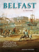
£2.95
The Falls Road area of Belfast in 1931 in a fascinating series of reproductions of old Ordnance Survey plans in the Alan Godfrey Editions, ideal for anyone interested in the history of their neighbourhood or family. Coverage stretches from Roden Street westward to Whiterock Road & Falls Park, & from Cupar Street southward to Donegall Road. Features include Springfield Road, Royal Victoria Hospital, St Mary's Training College, Belfast Children's Hospital, Boyne Bridge Works, tramways, Celtic Park, Belfast Cemetery, Royal Irish Distillery, Broadway Damask Works, match factory, Dunville Park, St Mary's Dominican Convent, Springfield Linen Factory, bakery, Forth River Mills, Mulhouse Works, Grosvenor Finishing Works, Albert Foudnry, Blackstaff Weaving Mill, Milfort Weaving Works, Falls Foundry, Forth River Mills, Clowney Brick Works, Ballymurphy Brick Works, Beech Mount, Mac Rory Park, Corrigan Park, etc. On the reverse are street directory entries for Bombay Street, Falls Road & Raglan Street in 1928. About the Alan Godfrey Editions of the 25 ...
Archived Product
£3.50
The Falls Road area of Belfast in 1931 in a fascinating series of reproductions of old Ordnance Survey plans in the Alan Godfrey Editions, ideal for anyone interested in the history of their neighbourhood or family. Coverage stretches from Roden Street westward to Whiterock Road & Falls Park, & from Cupar Street southward to Donegall Road. Features include Springfield Road, Royal Victoria Hospital, St Mary`s Training College, Belfast Children`s Hospital, Boyne Bridge Works, tramways, Celtic Park, Belfast Cemetery, Royal Irish Distillery, Broadway Damask Works, match factory, Dunville Park, St Mary`s Dominican Convent, Springfield Linen Factory, bakery, Forth River Mills, Mulhouse Works, Grosvenor Finishing Works, Albert Foudnry, Blackstaff Weaving Mill, Milfort Weaving Works, Falls Foundry, Forth River Mills, Clowney Brick Works, Ballymurphy Brick Works, Beech Mount, Mac Rory Park, Corrigan Park, etc. On the reverse are street directory entries for Bombay Street, Falls Road & Raglan Street in 1928. About the Alan Godfrey Editions of the 25” OS Series: Selected towns in Great Britain & Ireland are covered by maps showing the extent of urban development in the last decades of the 19th & early 20th century. The plans have been taken from the Ordnance Survey mapping & reprinted at about 15 inches to one mile (1:4, 340). On the reverse most maps have historical notes & many also include extracts from contemporary directories. Most maps cover about one mile (1.6kms) north/south, one & a half miles (2.4kms) across; adjoining sheets can be combined to provide wider coverage.FOR MORE INFORMATION & A COMPLETE LIST OF ALL AVAILABLE TITLES PLEASE CLICK ON THE SERIES LINK. ...
Archived Product
£6.95
Belfast in the Wallpaper* City Guide series published by Phaidon encompassing a collection of pocket-size guides dedicated to the design elements in major cities. Compiled by experts at the Wallpaper* magazine, the guides are widely recognised for appealing to design-conscious travellers & are aimed at those interested in art, design & architecture. Each guide identifies the best bars, restaurants, hotels, places to shop, leisure activities & excursions with a unique emphasis on the finest examples of unusual architecture & design. Each Wallpaper* City Guide has the same layout, with separate tabs allowing readers & travellers to access individual sections easily. The tabs consist of Landmarks, Hotels, 24 Hours, Urban Life, Architour, Shopping, Sports & Escapes. High quality colour photographs appear alongside brief descriptions of each hotel, bar or attraction, highlighting distinctive & unusual styles of architecture & design. Extra pages are provided at the back of each guide, allowing readers to record their own notes & sketches. ...
Archived Product
£11.99
Street atlas of Belfast, Antrim, Bangor, & Lisburn from Collins, with enlarged city centre mapping of Belfast. The street mapping has been sourced from Ordnance Survey data with bold road classification colouring on a plain white base; main mapping is at 1:50, 000 & 1:18, 000. These scales show motorways, A & B roads, & minor roads, with names clearly displayed; railways lines & stops, bus stops, & tramway lines & stops are marked. Local facilities such as post offices, police & fire stations, schools, car parks & mare are displayed. The enlarged city centre map of Belfast shows streets in greater detail at Approx. 1:9, 000, with one ways streets prominently highlighted. All mapping is indexed by street name, with highlighted schools, industrial estates, hospitals, & sports centres
- towns & villages included.
...
Archived Product
£5.99
This is in the series of pocket sized, folded maps to the National Cycle Network which include clearly mapped on-road & traffic-free paths, easy to read contours & detailed town insets. Published by Sustrans. 1:110, 000 scale; folded 155mm x 99mm; flat 792mm x 630mm. Belfast, Down & Armagh Cycle Map (49). Including Loughshore Trail, Lagan & Lough Cycle Way, Newry Canal Towpath & 5 individual day rides. ...
Archived Product
£6.99
Street plan of Belfort, part of an extensive series covering French cities & towns from Blay-Foldex, the country’s largest, oldest & most experienced publisher of urban mapping. Blay plans include outer suburbs &, where appropriate, adjoining localities forming part of the urban agglomeration & provide brief descriptions of the town’s main sights, contact details for hotels & other places of interest, etc. The plans show one way streets, car parks & pedestrian zones. Important public buildings are clearly marked & identified. Blay street maps are usually double-sided & include an enlargement for the town centre & a street index with separate lists of “edifices publics”: main public buildings, places of worship, schools, sport facilities, stations, etc. Each of the outer suburbs or the adjoining localities, identified with its postcode, has a separate index. Many titles also provide a road map of the environs. All the text is in French only.PLEASE NOTE: to see the list of Blay-Foldex street plans of French towns & cities please click on the series link – the series description also

Includes::
a comparison between Blay & IGN street plans.

...
Archived Product
£12.99
Topographic survey of France at 1:25, 000 in IGN`s excellent TOP25 / Série Bleue series. All the maps are GPS compatible, with a 1km UTM grid plus latitude & longitude lines at 5’ intervals. Contours are at 5m intervals except for mountainous areas where the maps have contours at 10m intervals, vividly enhanced by hill shading & graphics for rocky terrain. Colouring with graphics indicates different types of vegetation or land use (deciduous or coniferous forests, moors, orchards, vineyards, etc). PLEASE NOTE: coverage of France at this scale is currently being revised – the format & the presentation of each title are indicated by the letters at the end of its Sheet Reference number (e.g. 0416ET, 3531ETR, 1923SB, etc.)MAPS WITH FULL TOURIST OVERPRINT & AN ENGLISH MAP LEGEND: all TOP25 maps & the SB editions of Série Bleue have an overprint highlighting waymarked walking trails including long-distance GR routes &, where appropriate, ski routes. Symbols indicate campsites, gîtes d’etape, refuges, equestrian centres & other recreational facilities or sites, tourist information centres, cultural heritage, etc. Towns & locations of particular interest are highlighted.- ET or OT = single-sided TOP25 map covering approx. 29x 21 km / 18x 13 miles.- ETR or OTR = waterproof & tear resistant TOP25 map covering the same area as the corresponding ET or OT number, but double-sided, printed on a smaller size sheet with a good overlap between the sides.- SB = Série Bleue map with full tourist overprint; these maps, first introduced in summer 2014, each cover approx. 29x 24km / 18x 15 miles.SÉRIE BLEUE maps with numbers ending in E (Est) or O (Ouest): most editions now indicate the GR routes, but do not show any other tourist information. Map legend is in French only. Each map covers approx. 14x 20km / 9x 12 miles. ...
Archived Product
£11.99
Belgian Ardennes: Dinant
- Marche-en-Femenne area in a series of cycling maps from Sportoena covering Belgium & the adjoining regions
...
Archived Product
£11.99
Belgian Adrennes: Malmedy
- Hautes Fanges National Park area in a series of cycling maps from Sportoena covering Belgium & the
...
Archived Product
£11.99
Belgian Ardennes: Sedan
- Bastogne area in a series of cycling maps from Sportoena covering Belgium & the adjoining regions of
...
Archived Product

Belfast: A History

Understanding the past - where we have come from and what has moulded us - is important everywhere, and nowhere more so than in Northern Ireland`s largest city. For 250 years Belfast, though quite unlike anywhere else in Ireland, was similar to many of the other great industrial cities of the United Kingdom. It embraced the industrial revolution wholeheartedly, and witnessed enormous economic success and expansion as a result. In its heyday it was a great port, a powerhouse of linen manufacturing, ship-building, and engineering, and a truly dominant force in the northern Irish economy. As the iconic shell of RMS Titanic was taking shape high above her Queen`s Island birthplace, Edwardian Belfast was near the peak of her economic might. But within the city there developed patterns
of community division and conflict - based on religion - which in their severity and seeming permanence have rendered it quite unique among the cities of the British Isles.From the seventeenth-century Ulster plantations to Catholic migration from elsewhere in Ireland, the particular mix of people in Belfast has always been different from everywhere else and has fundamentally shaped the city`s identity and history over successive centuries. Much of the industry has now gone, and for many years the city had to struggle with the pain of adjustment, at the same time as it was being scarred by a generation of the Troubles. Now, with a hard-won peace, investment and renewed hope, it is an excellent time to stand back and make a new assessment of the history that has brought Belfast to
where it is today. Historian William Maguire, who has lived in Belfast for most of his life, succeeds here in painting an accurate, authentic and above all a balanced picture of the city, its events and its people.
RIP - This product is no longer available on our network. It was last seen on 25.09.2019

This page now acts as a permanent archive for this product. Add more information using the comments box below to ensure it can still be found by future generations.

Use our search facility to see if it is available from an alternative contributor.
  • External links may include paid for promotion
  • Availability: Out Of Stock
  • Supplier: Stanfords
  • SKU: 9781859361894
Availability: In Stock
£12.99

Product Description

Understanding the past
- where we have come from & what has moulded us
- is important everywhere, & nowhere more so than in Northern Ireland`s largest city. For 250 years Belfast, though quite unlike anywhere else in Irel&, was similar to many of the other great industrial cities of the United Kingdom. It embraced the industrial revolution wholeheartedly, & witnessed enormous economic success & expansion as a result. In its heyday it was a great port, a powerhouse of linen manufacturing, ship-building, & engineering, & a truly dominant force in the northern Irish economy. As the iconic shell of RMS Titanic was taking shape high above her Queen`s Island birthplace, Edwardian Belfast was near the peak of her economic might. But within the city there developed patterns of community division & conflict
- based on religion
- which in their severity & seeming permanence have rendered it quite unique among the cities of the British Isles. From the seventeenth-century Ulster plantations to Catholic migration from elsewhere in Irel&, the particular mix of people in Belfast has always been different from everywhere else & has fundamentally shaped the city`s identity & history over successive centuries. Much of the industry has now gone, & for many years the city had to struggle with the pain of adjustment, at the same time as it was being scarred by a generation of the Troubles. Now, with a hard-won peace, investment & renewed hope, it is an excellent time to stand back & make a new assessment of the history that has brought Belfast to where it is today. Historian William Maguire, who has lived in Belfast for most of his life, succeeds here in painting an accurate, authentic & above all a balanced picture of the city, its events & its people.

Reviews/Comments

Add New

Intelligent Comparison

Oooops!
We couldn't find anything!
Perhaps this product's unique.... Or perhaps we are still looking for comparisons!
Click to bump this page and we'll hurry up.

Price History

Vouchers

No voucher codes found.
Do you know a voucher code for this product or supplier? Add it to Insights for others to use.

Facebook

Jargon Buster

History - Anything that happens in the past. An acedemic subject.
Shell - A hard external structure or surface.
Moulded - The shape of a product coming from a factory "mould".
Accurate - A measurement of precision when all elements are correct.

Supplier Information

Stanfords
Stanfords was established in 1853 and opened their iconic Covent Garden flagship store in 1901. They have become the top retailer of maps, travel books and accessories in the UK and arguably offer the largest selection of maps and travel books worldwide. Famous names such as Captain Robert Falcon Scott, Ranulph Fiennes and Michael Palin have purchased from Stanfords. They now have a shop in Bristol and both stores together with other venues operate a calendar of events including talks, book signings and exhibitions. As a specialist map retailer, the map selection is comprehensive and includes road maps, street maps and walking maps from worldwide destinations, as well as a selection of world atlases and wall maps. Books include travel guides and travel literature. Stanfords also stock globes, from miniatures made of blue marble to magnificent floor-standing globes. The website features a selection of interesting articles on travel topics.
Page Updated: 2023-11-12 20:15:36

Community Generated Product Tags

Oh No! The productWIKI community hasn't generated any tags for this product yet!
Menu