
 United Kingdom
 France
 Germany
 Netherlands
 Sweden
 USA
USA
 Italy
Italy
 Spain
Spain
More From Contributor
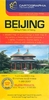


Beijing & The Great Wall ITMB
Beijing on a light, waterproof and tear-resistant map combining a street plan of the city at 1:23, 000 with, on the reverse, a road map of its environs clearly showing the existing parts of the Great Wall and its entire course, plus numerous other historical and recreational sites.On one side is a very clear, easy to read street plan of the capital at 1:23, 000. Metro, railway and bus stations and ferry terminals are prominently marked and main traffic arteries are indicated. Numerous places of interest to visitors are highlighted, including selected hotels, cultural institutions and historical sites, shopping centres, etc, - most shown with their names. Also provided are an enlargement of the Forbidden City and a diagram of Beijing’s metro network.On the reverse is a road map
at 1:280, 000 of the surrounding region prominently highlighting the course of the Great Wall of China, indicating the remaining sections and the missing ones. Also marked are numerous other sights, including temples, museums, tombs, scenic areas and recreational sites, etc. The map has no geographical coordinates.Both the plan and the road map show all place names in the Latin alphabet only and both are indexed.
at 1:280, 000 of the surrounding region prominently highlighting the course of the Great Wall of China, indicating the remaining sections and the missing ones. Also marked are numerous other sights, including temples, museums, tombs, scenic areas and recreational sites, etc. The map has no geographical coordinates.Both the plan and the road map show all place names in the Latin alphabet only and both are indexed.

Product Description
Reviews/Comments
Add New
Vouchers
No voucher codes found.
Do you know a voucher code for this product or supplier? Add it to Insights for others to use.
Do you know a voucher code for this product or supplier? Add it to Insights for others to use.
 Denmark