More From Contributor
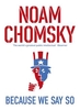
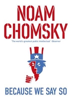
£11.50
Topographic survey of France at 1:25, 000 in IGN`s excellent TOP25 / Série Bleue series. All the maps are GPS compatible, with a 1km UTM grid plus latitude & longitude lines at 5’ intervals. Contours are at 5m intervals except for mountainous areas where the maps have contours at 10m intervals, vividly enhanced by hill shading & graphics for rocky terrain. Colouring with graphics indicates different types of vegetation or land use (deciduous or coniferous forests, moors, orchards, vineyards, etc). PLEASE NOTE: coverage of France at this scale is currently being revised – the format & the presentation of each title are indicated by the letters at the end of its Sheet Reference number (e.g. 0416ET, 3531ETR, 1923SB, etc.)MAPS WITH FULL TOURIST OVERPRINT & AN ENGLISH MAP LEGEND: all TOP25 maps & the SB editions of Série Bleue have an overprint highlighting waymarked walking trails including long-distance GR routes &, where appropriate, ski routes. Symbols indicate campsites, gîtes d’etape, refuges, equestrian centres & other recreational facilities or sites, tourist information centres, cultural heritage, etc. Towns & locations of particular interest are highlighted.- ET or OT = single-sided TOP25 map covering approx. 29x 21 km / 18x 13 miles.- ETR or OTR = waterproof & tear resistant TOP25 map covering the same area as the corresponding ET or OT number, but double-sided, printed on a smaller size sheet with a good overlap between the sides.- SB = Série Bleue map with full tourist overprint; these maps, first introduced in summer 2014, each cover approx. 29x 24km / 18x 15 miles.SÉRIE BLEUE maps with numbers ending in E (Est) or O (Ouest): most editions now indicate the GR routes, but do not show any other tourist information. Map legend is in French only. Each map covers approx. 14x 20km / 9x 12 miles. ...
Archived Product
£9.50
Topographical survey of Belgium at 1:20, 000 from Nationaal Geografisch Instituut / Institut Géographique National, the country’s national survey organization. Each 20K map covers one quarter of the corresponding 1:50, 000 map (with adjustments in the border & coastal areas). The maps provide all the information expected of topographic mapping at this scale & in addition have an unusually large amount of vegetation and/or land use information (different types of woodlands, gardens, orchards, heath, etc). The maps have a 1-km UTM grid, with margin ticks for latitude & longitude at intervals of 1`. Map legend & a glossary of terms used on the maps include English. Stanfords keeps as regular stock 20K maps for the World War I battlefields around the Ypres, Messines & Passchendaele, & for the area of the Battle of Waterloo. The 1:20, 000 survey covers the whole of Belgium & maps for other regions can be supplied as special orders. To see the list of titles in this series please click on the series link.PLEASE NOTE: the Long-Distance Footpaths Map of Belgium at 1:300, 000 which shows the division of Belgium into the 50K survey sheets can also be used to see in more detail coverage by the 20K maps. ...
Archived Product
£8.99
Because I am a girl I am less likely to go to school. Because I am a girl I am more likely to suffer from malnutrition. Because I am a girl I am more likely to suffer violence in the home. Because I am a girl I am more likely to marry & start a family before I reach my twenties. Seven authors have visited seven different countries & spoken to young women & girls about their lives, struggles & hopes. The result is an extraordinary collection of writings about prejudice, abuse, & neglect, but also about courage, resilience & changing attitudes. Proceeds from sales of this book will go to PLAN, one of the world`s largest child-centered community development organisations. ...
Archived Product
£10.99
Because of an acorn, a tree grows, a bird nests, a seed becomes a flower. Enchanting die-cuts illustrate the vital connections between the layers of an ecosystem in this magical book. Wander down the forest path to learn how every tree, flower, plant & animal connect to one another in spiraling circles of life. An acorn is just the beginning. ...
Archived Product
£12.99
Because We Say So is Noam Chomsky`s essential counter punch to American hegemony. In 1962, the eminent statesman Dean Acheson enunciated a principle that has dominated global politics ever since: that no legal issue arises when the United States responds to a challenge to its `power, position, & prestige`. In short, whatever the world may think, US actions are legitimate because they say so. Spanning the impact of Edward Snowden`s whistleblowing & Palestinian-Israeli relations to deeper reflections on political philosophy & the importance of a commons to democracy, Because We Say So takes American imperialism head on. ” Noam Chomsky is one of a small band of individuals fighting a whole industry. & that makes him not only brilliant, but heroic.” (Arundhati Roy). ” The world`s greatest public intellectual.” (Observer). ...
Archived Product
£7.99
Ollie & Moritz are two teenagers who will never meet. Each of them lives with a life-affecting illness. Contact with electricity sends Ollie into debilitating seizures, while Moritz has a heart defect & is kept alive by an electronic pacemaker. If they did meet, Ollie would seize, but turning off the pacemaker would kill Moritz. Through an exchange of letters, the two boys develop a strong bond of friendship which becomes a lifeline during dark times
- until Moritz reveals that he holds the key to their shared, sinister past, & has been keeping it from Ollie all along.
...
Archived Product
£2.95
Beccles in 1926 in a fascinating series of reproductions of old Ordnance Survey plans in the Alan Godfrey Editions, ideal for anyone interested in the history of their neighbourhood or family. Selected towns in Great Britain & Ireland are covered by maps showing the extent of urban development in the last decades of the 19th & early 20th century. In this title: the town itself is on the west side of the map, & coverage extends eastward to Worlingham Hall. Features include Old Market, New Market, Blyburgate Street, Hungate Street, Ballygate Street, Northgate Street, Smallgate Street, Newgate Street, St Michael's church, Caxton printing works, Ingate Iron Works, railway station, engine shed & junction, malthouses, auction mart, River Waveney. Coverage extends south to Peddars Lane, north to Beccles Bridge & The Quay. On the reverse is a commercial directory of the town in 1896. About the Alan Godfrey Editions of the 25 ...
Archived Product
£3.50
Beccles in 1926 in a fascinating series of reproductions of old Ordnance Survey plans in the Alan Godfrey Editions, ideal for anyone interested in the history of their neighbourhood or family. The town itself is on the west side of the map, & coverage extends eastward to Worlingham Hall. Features include Old Market, New Market, Blyburgate Street, Hungate Street, Ballygate Street, Northgate Street, Smallgate Street, Newgate Street, St Michael`s church, Caxton printing works, Ingate Iron Works, railway station, engine shed & junction, malthouses, auction mart, River Waveney. Coverage extends south to Peddars Lane, north to Beccles Bridge & The Quay. On the reverse is a commercial directory of the town in 1896. About the Alan Godfrey Editions of the 25” OS Series: Selected towns in Great Britain & Ireland are covered by maps showing the extent of urban development in the last decades of the 19th & early 20th century. The plans have been taken from the Ordnance Survey mapping & reprinted at about 15 inches to one mile (1:4, 340). On the reverse most maps have historical notes & many also include extracts from contemporary directories. Most maps cover about one mile (1.6kms) north/south, one & a half miles (2.4kms) across; adjoining sheets can be combined to provide wider coverage.FOR MORE INFORMATION & A COMPLETE LIST OF ALL AVAILABLE TITLES PLEASE CLICK ON THE SERIES LINK. ...
Archived Product
£6.95
Topographic coverage of mainland Spain at 1:50, 000 in the MTN50 (Mapa Topográfico Nacional) series from the Centro Nacional de Información Geografica, the country’s civilian survey organization. The maps have contours at 20m intervals, enhanced by relief shading, plus colouring and/or graphics to show different types of terrain, vegetation or land use. Boundaries of national parks & other protected areas are marked. In addition to all the usual information featured on topographic mapping at this scale, detailed presentation of the road & rail networks, rural tracks & paths, etc, the maps also show campsites & mountain refuges. On more recent editions some GRs, the official long-distance hiking routes, are also marked (although not as clearly as on hiking maps from other publishers). Each map covers 29.5x 18.5 km (with adjustments in the border or coastal areas). The maps have a 1-km UTM grid, plus margin ticks for latitude & longitude at 1` intervals. Map legend is in Spanish only.HOW TO CHOOSE THE RIGHT 50K MAP: all the titles in CNIG’s 200K Provincial Road Maps series at 1:200, 000 are overprinted with the grid for the 1:50, 000 maps & can be used to see the area covered by each 50K title. TO SEE THE LIST OF TITLES IN THIS SERIES PLEASE CLICK ON THE SERIES LINK.PLEASE NOTE
- MAP TITLES: the grids shown on our website serve both the civilian & the military 1:50, 000 topographic series. Although the areas covered by maps in both series are identical (apart from some border or coastal sheets), occasionally map titles differ – only one title is shown on the grid, usually the military one. In Galicia, the Basque country & in the Catalan speaking areas the tendency now is to use local place names rather than the often better known Castilian ones. Where possible, both versions are included in our titles. Map titles listed on our website are based on information received by us at the time of publication, but sometimes maps arrive showing a completely different title! As long as the map number is as ordered, the correct map has been supplied.
...
Archived Product

Because We Say So

Because We Say So is Noam Chomsky`s essential counter punch to American hegemony In 1962, the eminent statesman Dean Acheson enunciated a principle that has dominated global politics ever since: that no legal issue arises when the United States responds to a challenge to its `power, position, and prestige`. In short, whatever the world may think, U.S. actions are legitimate because they say so. Spanning the impact of Edward Snowden`s whistleblowing and Palestinian-Israeli relations to deeper reflections on political philosophy and the importance of a commons to democracy, Because We Say So takes American imperialism head on. `Noam Chomsky is one of a small band of individuals fighting a whole industry. And that makes him not only brilliant, but heroic` Arundhati Roy `The world`s
greatest public intellectual` Observer
RIP - This product is no longer available on our network. It was last seen on 25.09.2019

This page now acts as a permanent archive for this product. Add more information using the comments box below to ensure it can still be found by future generations.

Use our search facility to see if it is available from an alternative contributor.
  • External links may include paid for promotion
  • Availability: Out Of Stock
  • Supplier: Stanfords
  • SKU: 9780241972489
Availability: In Stock
£9.99

Product Description

Because We Say So is Noam Chomsky`s essential counter punch to American hegemony In 1962, the eminent statesman Dean Acheson enunciated a principle that has dominated global politics ever since: that no legal issue arises when the United States responds to a challenge to its `power, position, & prestige`. In short, whatever the world may think, U.S. actions are legitimate because they say so. Spanning the impact of Edward Snowden`s whistleblowing & Palestinian-Israeli relations to deeper reflections on political philosophy & the importance of a commons to democracy, Because We Say So takes American imperialism head on. ` Noam Chomsky is one of a small band of individuals fighting a whole industry. & that makes him not only brilliant, but heroic` Arundhati Roy ` The world`s greatest public intellectual` Observer

Reviews/Comments

Add New

Intelligent Comparison

Oooops!
We couldn't find anything!
Perhaps this product's unique.... Or perhaps we are still looking for comparisons!
Click to bump this page and we'll hurry up.

Price History

Vouchers

No voucher codes found.
Do you know a voucher code for this product or supplier? Add it to Insights for others to use.

Facebook

Jargon Buster

World - A physical grouping, commonly used to describe earth and everything associated with ti
Small - something that takes up less space than normal.
Head - The upper part of a body typically separated by the neck.

Supplier Information

Stanfords
Stanfords was established in 1853 and opened their iconic Covent Garden flagship store in 1901. They have become the top retailer of maps, travel books and accessories in the UK and arguably offer the largest selection of maps and travel books worldwide. Famous names such as Captain Robert Falcon Scott, Ranulph Fiennes and Michael Palin have purchased from Stanfords. They now have a shop in Bristol and both stores together with other venues operate a calendar of events including talks, book signings and exhibitions. As a specialist map retailer, the map selection is comprehensive and includes road maps, street maps and walking maps from worldwide destinations, as well as a selection of world atlases and wall maps. Books include travel guides and travel literature. Stanfords also stock globes, from miniatures made of blue marble to magnificent floor-standing globes. The website features a selection of interesting articles on travel topics.
Page Updated: 2023-11-12 20:15:36

Community Generated Product Tags

Oh No! The productWIKI community hasn't generated any tags for this product yet!
Menu