More From Contributor
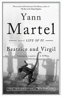
£8.99
Beasts Royal is the second book written by Patrick O` Brian
- made available, at last, for the first time since the 1930s & elegantly
...
Archived Product
£17.95
Mammals are the animals that most people come to wilderness areas to see. They range in size from the pygmy shrew (2g) to the blue whale (120 tonnes). But what makes a mammal a mammal
- indeed why is the blue whale not a fish? How does the elephant`s trunk work? Why do many mammals have coat pattern. This title follows in the footsteps of its immensely popular predecessor, Beat about the bush
- mammals & birds. This expanded version has, however, been revised to cover mammals in a much more comprehensive manner with updated classifications, new questions & answers, a more user-friendly format & more than 600 full-colour photographs. The section on tracks & signs is superbly illustrated to make this intimidating & confusing subject easy to grasp. The overall result is a field companion that still manages to answer all those everyday questions about mammals in a style that appeals to tourists, bush enthusiasts & field guides alike, by presenting the fundamentals of our wildlife in a detailed, yet easily understandable fashion.

...
Archived Product
£13.99

A companion to our guides to San Francisco & New York, Beat Atlas: A Guide to the Beat Generation in America is a state-by-state

...
Archived Product
£12.99
Map No. 1208, Beatenberg, in the topographic survey of Switzerland at 1:25, 000 from Bundesamt für Landestopographie (swisstopo), covering the whole country on 247 small format sheets, with special larger maps published for popular regions including some titles now available in hiking versions. Highly regarded for their superb use of graphic relief & hill shading, the maps give an almost 3-D picture of Switzerland`s mountainous terrain. Contours are at 10 m intervals, with 20m intervals in the mountainous areas. All the maps have a 1-km grid for Swiss national coordinates (datum CH 1903). * Small format sheets (Nos. 1011
- 1374)* Map legend in the language of the area covered by the map. Additional margin ticks show latitude & longitude in steps of 2`. The area covered by each map is 17 x 12 km (11 x 7 miles approx). * Special larger sheets (Nos. from 2501 onwards) – STANDARD editions:* No map legend is included but a separate leaflet can be provided instead. The area covered by each map is 25 x 17 km (15 x 11 miles approx).* Special larger sheets (Nos. from 2501 onwards) – HIKING editions:* An overprint highlights hiking, mountain & alpine paths, including regional & national long-distance trails. The maps also show bus routes with bus stops, plus inns in remote locations. The area covered by each map is 25 x 17 km (15 x 11 miles approx).
...
Archived Product
£8.99
WINNER OF THE GOLDSMITHS PRIZE SHORTLISTED FOR THE IRISH BOOK AWARDS ” John is so many miles from love now & home. This is the story of his strangest trip.” A novel of family, ghosts, love, music & the quest for truth, Beatlebone recounts a wild journey through the west of Ireland in 1978. At its helm is John, a maddened genius fleeing fame & seeking peace. With his deadpan Irish driver, Cornelius, at his side, John is hellbent on reaching the Island of Dorinish, an assignment he arranged ten years before. Lyrical, freewheeling, quixotic & fun, Beatlebone is a sad & beautiful comedy. ...
Archived Product
£40.00
This is a perfect gift to introduce children to the world of Beatrix Potter, ” The Complete Tales” is a timeless & classic essential for any nursery shelf. This complete & unabridged collection contains all 23 of Beatrix Potter`s tales in one deluxe volume with all their original illustrations. The tales are arranged in the order in which they were first published & a section at the end of the book contains four additional works by Beatrix Potter that were not published in her own lifetime. The stories inside are: ” The Tale of Peter Rabbit”, ” The Tale of Squirrel Nutkin”, ” The Tailor of Gloucester”, ” The Tale of Benjamin Bunny”, ” The Tale of Two Bad Mice”, ” The Tale of Mrs. Tiggy-Winkle”, ” The Tale of The Pie & The Patty-Pan”, ” The Tale of Mr. Jeremy Fisher”, ” The Story of A Fierce Bad Rabbit”, ” The Story of Miss Moppet”, ” The Tale of Tom Kitten”, ” The Tale of Jemima Puddle-Duck”, ” The Tale of Samuel Whiskers”, ” The Tale of The Flopsy Bunnies”, ” The Tale of Ginger & Pickles”, ” The Tale of Mrs. Tittlemouse”, ” The Tale of Timmy Tiptoes”, ” The Tale of Mr. Tod”, ” The Tale of Pigling Bland”, ” Appley Dapply`s Nursery Rhymes”, ” The Tale of Johnny Town-Mouse”, ” Cecily Parsley`s Nursery Rhymes”, ” The Tale of Little Pig Robinson”, ” Three Little Mice”, ” The Sly Old Cat”, ” The Fox & the Stork” & ” The Rabbit`s Christmas Party”. ...
Archived Product
£12.99
” Beatrix Potter”`s books are adored by millions, but they were just one aspect of an extraordinary life. This captivating biography brings us the passionate, unconventional woman behind the beloved stories: a gifted artist & shrewd businesswoman; a pioneering scientific researcher; a powerful landowner who conserved acres of Lakeland countryside; a daughter who defied her parents with her first tragically short engagement & who, finally was given a second chance of love & happiness. ...
Archived Product
£3.50
Beaufort in 1915 in a fascinating series of reproductions of old Ordnance Survey plans in the Alan Godfrey Editions, ideal for anyone interested in the history of their neighbourhood or family. The map covers the industrial village of Beaufort, just west of Brynmawr & north of Ebbw Vale. Most of the village is covered & features include LNWR railway with station, LNWR Ebbw Vale Branch, Carmeltown, Rhyd-y-Blew Pond, northern tip of GWR Ebbw Vale Branch, tramways, St David`s church, Picture Theatre, chapels, old pits & levels, old tramway routes, Humphrey`s Houses, old workings, Waun-goch, etc. On the reverse is a directory of Beaufort plus a timetable for the LNWR Merthyr-Abergavenny line. This map is also Brecknockshire sheet 47.06. About the Alan Godfrey Editions of the 25” OS Series: Selected towns in Great Britain & Ireland are covered by maps showing the extent of urban development in the last decades of the 19th & early 20th century. The plans have been taken from the Ordnance Survey mapping & reprinted at about 15 inches to one mile (1:4, 340). On the reverse most maps have historical notes & many also include extracts from contemporary directories. Most maps cover about one mile (1.6kms) north/south, one & a half miles (2.4kms) across; adjoining sheets can be combined to provide wider coverage.FOR MORE INFORMATION & A COMPLETE LIST OF ALL AVAILABLE TITLES PLEASE CLICK ON THE SERIES LINK. ...
Archived Product
£29.99
Map No. 3222, Beaufort West, in South Africa’s official topographic survey at 1:250, 000 from the country’s national survey organization, the Chief Directorate of Surveys & Mapping. The maps have altitude colouring & contours at 50m or 100m intervals, depending on the map edition, plus spot heights. Deserts, marshes, dry pans, perennial & seasonal water features, etc, as well as protected areas are shown. The maps present the country’s road & rail networks & include the usual information expected on topographic mapping at this scale, although in more rapidly developing areas road information may not necessarily be up to date. Also indicated are magisterial district & provincial boundaries. Latitude & longitude values are shown in the margins at 5` intervals together with South African grid co-ordinates. Typically, each sheet covers an area of one degree of latitude & two degrees of longitude. The projection used is Gauss Conformal. The legend is in English & Afrikaans. ...
Archived Product
£10.99
Massif du Mont Blanc – Beaufortain region in a series of GPS compatible, contoured TOP 75 maps at 1:75, 000 from the IGN, highlighting local & long-distance hiking paths, cycling routes & sites for other recreational activities. In this revised 2015 edition the main 75K map now covers the whole of the Tour of Mont Blanc (TMB) including its parts in Italy & Switzerl&. Five large panels with IGN’s topographic mapping at 1:25, 000 & extensive overprint for local hiking paths & tourist facilities including campsites present: two areas either side of Chamonix (Le Brévent & the Montagne de Blaitière part of the Mont Blanc massif), two areas near Les Contamines-Montjoie (Aiguille Croche & Col de la Croix du Bonhomme), plus La Grand Mont. Cartography of the main map at 1:75, 000 is a direct enlargement of the mapping used in the IGN’s TOP100 series. Contours are at 40m intervals, enhanced by relief shading; additional colouring shows different types of vegetation (woods, brushwood, vineyards/orchards). Boundaries of national parks & other protected areas are marked. An overprint highlights long-distance GR hiking routes & cycling trails. Symbols
- more numerous than on the TOP100 maps
- indicate various places of interest including mountain refuges & gîtes d’etape (campsites on the enlargements), areas for other recreational pursuits such as climbing, hand gliding or water & winter sports, historic or cultural sites, etc. The map has a UTM grid & an index of communes. Map legend

Includes::
English. Coverage of the main 75K map starts at Cluses, Samoëns & Col de la Forclaz & extends southwards to the northern part of the Vanoise massif with Moutiers & Val d’ Isère. In the west the map extends to La Cluzas & Albertville, & in the east across the French border to cover the Italian & Swiss parts of the TMB. Other locations include St-Gervais-les-Bains, Passy, Sallanches, Cordon, Combloux, le Grand Born&, Thônes, St-Jean-de-Sixt, les Villards-sur-Thônes, Praz-sur-Arly, Ugine, Beaufort, Bourg-St-Maurice, la Rosière, Séez, Ste-Foy-Tarentaise, Tignes, la Plagne, les Arces, Moûtiers, Aiguebelle, Aigueblanche, Aime, as well as Col des Aravis, Col du Petit St-Bernard, Mont Poyrri, Dôme de la Sache, Mont Dolent, Mont Jovet, Roche de Mio, etc. To see the list of other maps in this series please click on the series link.


...
Archived Product

Beatrice & Virgil

This is the story of an extraordinary journey undertaken by a man named Henry. It begins with a mysterious parcel. It ends in a place that will make you think again about one of the most significant events of the twentieth century. It also involves a howler monkey, a donkey, an enigmatic taxidermist, and a dog named Erasmus. Once you have finished reading it, it is impossible to forget.
RIP - This product is no longer available on our network. It was last seen on 25.09.2019

This page now acts as a permanent archive for this product. Add more information using the comments box below to ensure it can still be found by future generations.

Use our search facility to see if it is available from an alternative contributor.
  • External links may include paid for promotion
  • Availability: Out Of Stock
  • Supplier: Stanfords
  • SKU: 9781847677679
Availability: In Stock
£8.99

Product Description

This is the story of an extraordinary journey undertaken by a man named Henry. It begins with a mysterious parcel. It ends in a place that will make you think again about one of the most significant events of the twentieth century. It also involves a howler monkey, a donkey, an enigmatic taxidermist, & a dog named Erasmus. Once you have finished reading it, it is impossible to forget.

Reviews/Comments

Add New

Intelligent Comparison

Oooops!
We couldn't find anything!
Perhaps this product's unique.... Or perhaps we are still looking for comparisons!
Click to bump this page and we'll hurry up.

Price History

Vouchers

No voucher codes found.
Do you know a voucher code for this product or supplier? Add it to Insights for others to use.

Facebook

Jargon Buster

Monkey - A medium sized primate animal that lives in tropical countries in the trees

Supplier Information

Stanfords
Stanfords was established in 1853 and opened their iconic Covent Garden flagship store in 1901. They have become the top retailer of maps, travel books and accessories in the UK and arguably offer the largest selection of maps and travel books worldwide. Famous names such as Captain Robert Falcon Scott, Ranulph Fiennes and Michael Palin have purchased from Stanfords. They now have a shop in Bristol and both stores together with other venues operate a calendar of events including talks, book signings and exhibitions. As a specialist map retailer, the map selection is comprehensive and includes road maps, street maps and walking maps from worldwide destinations, as well as a selection of world atlases and wall maps. Books include travel guides and travel literature. Stanfords also stock globes, from miniatures made of blue marble to magnificent floor-standing globes. The website features a selection of interesting articles on travel topics.
Page Updated: 2023-11-12 20:15:36

Community Generated Product Tags

Oh No! The productWIKI community hasn't generated any tags for this product yet!
Menu