
 United Kingdom
 France
 Germany
 Netherlands
 Sweden
 USA
USA
 Italy
Italy
 Spain
Spain
More From Contributor

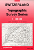
Basel
One of the titles in the topographic survey of Switzerland at 1:50, 000, covering the whole country on 78 small format sheets (Nos. 205 - 297), with special larger maps published for popular tourist destinations. Highly regarded for their superb use of graphic relief and hill shading, the maps give an almost 3-D picture of Switzerland's mountainous terrain. Contours are at 20m intervals.Small format sheets:- Map legend in the language of the area covered by the map.- 1km grid for Swiss national coordinates (datum CH 1903 - Bessel) plus margin ticks showing latitude and longitude in steps of 5'.- Area covered is 35 x 24 km / 21 x 15 miles approx. Special larger sheets: - No map legend included but a separate leaflet can be provided instead.- 1km grid for Swiss national coordinates (datum
CH 1903 - Bessel).- Area covered is 50 x 35 km / 31 x 22 miles approx.Alternatives on our website from Swiss topographic survey: - Switzerland: Swiss Survey 50K Hiking Editions of Topographic Maps series. Editions with an overprint highlighting local footpaths and bus routes with bus stops - the whole country is covered on small format sheets, with special larger maps also available for selected areas.- Switzerland: Swiss Survey 25K Topographic Maps series. Standard editions without an overprint - the whole country is covered on small format sheets, each one covering a quarter of the corresponding 1:50, 000 map, plus a selection of special larger sheets for popular areas.
CH 1903 - Bessel).- Area covered is 50 x 35 km / 31 x 22 miles approx.Alternatives on our website from Swiss topographic survey: - Switzerland: Swiss Survey 50K Hiking Editions of Topographic Maps series. Editions with an overprint highlighting local footpaths and bus routes with bus stops - the whole country is covered on small format sheets, with special larger maps also available for selected areas.- Switzerland: Swiss Survey 25K Topographic Maps series. Standard editions without an overprint - the whole country is covered on small format sheets, each one covering a quarter of the corresponding 1:50, 000 map, plus a selection of special larger sheets for popular areas.
Product Description
Reviews/Comments
Add New
Vouchers
No voucher codes found.
Do you know a voucher code for this product or supplier? Add it to Insights for others to use.
Do you know a voucher code for this product or supplier? Add it to Insights for others to use.
 Denmark