
 United Kingdom
 France
 Germany
 Netherlands
 Sweden
 USA
USA
 Italy
Italy
 Spain
Spain
More From Contributor


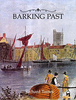


Barking (Upney) 1939
Barking (Upney) in 1939 in a fascinating series of reproductions of old Ordnance Survey plans in the Alan Godfrey Editions, ideal for anyone interested in the history of their neighbourhood or family. Three versions have been published for this area. The maps cover the eastern side of Barking but they are from different series, the `Old` (map no. 74.09) and `New` (maps no. 68.04) Essex Series, so the sheetlines are somewhat different. The `New` Series maps link up more conveniently with the London Series.The Barking and Upney 1897 (No. 74.09) map is on different sheetlines than the other two versions, showing much the same area but stretching somewhat further west and south. This means that it does cover part of central Barking, including the station, Local Board Offices on East
Street, Ripple Road, St Paul`s Road and southward to Morley Road. Along the southern part of the map are Greatfield, Mowers House, Eastbury House and the cemetery. The village of Upney is top centre. The map includes a commercial directory for Barking 1894. The Upney 1915 (No. 86.04a) map captures the eastern side of Barking showing the streets off Longbridge Road gradually being built up: Cecil Avenue, Wilmington Gardens, Hulse Avenue etc. North of this is Barking Park. From here coverage extends a mile eastward into open country. The hamlet of Upney is bottom centre, with its Isolation Hospital, Manor Farm is to the north-east. The LTS railway crosses the map west-east but no stations are shown. A directory listing of private residents in Barking in 1895 and 1920 is included. The
Upney 1939 (No. 86.04b) map provides a strong contrast, for the area is now largely built up, with many roads now developed off Longbridge Road. Upney station is now open, and other features include Lodge Avenue and streets to its east, Sandringham Road, Barking Park, isolation hospital (no longer very isolated!) Extracts from a 1933 directory are included. About the Alan Godfrey Editions of the 25” OS Series:Selected towns in Great Britain and Ireland are covered by maps showing the extent of urban development in the last decades of the 19th and early 20th century. The plans have been taken from the Ordnance Survey mapping and reprinted at about 15 inches to one mile (1:4, 340). On the reverse most maps have historical notes and many also include extracts from contemporary
directories. Most maps cover about one mile (1.6kms) north/south, one and a half miles (2.4kms) across; adjoining sheets can be combined to provide wider coverage.FOR MORE INFORMATION AND A COMPLETE LIST OF ALL AVAILABLE TITLES PLEASE CLICK ON THE SERIES LINK.
%201939 "Pin It")
Product Description
Reviews/Comments
Add New
Intelligent Comparison
Archived Product

Barking And Upney 1897 Stanfords
£3.50
Vouchers
No voucher codes found.
Do you know a voucher code for this product or supplier? Add it to Insights for others to use.
Do you know a voucher code for this product or supplier? Add it to Insights for others to use.
 Denmark