
 United Kingdom
 France
 Germany
 Netherlands
 Sweden
 USA
USA
 Italy
Italy
 Spain
Spain
More From Contributor


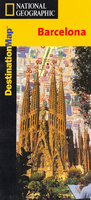
Barcelona
The National Geographic map of Barcelona at 1:10, 650 is a durable waterproof city map and transport guide designed for tourism. Clear and easy-to-read street mapping has main attractions highlighted and 3D illustrations of top sights. Hotels, churches, theatres and information points are among the tourist features marked on the map. One-way streets and pedestrian areas are indicated. The area covered is a rectangle from Camp Nou stadium in the top-left to Vila Olímpica in the bottom-right (the rectangle is aligned with the coast and the city street grid, not north-south). An enlargement on the reverse shows the Old Town (Cuitat Vella) at 1:8, 000.The reverse of the map features background information, top sights and activities, basic essential tourist info and city transport network
details, as well as a small map of the Barcelona airport terminals. The map is indexed for streets, points of interest and hotels, and includes regional and national overview maps. This map is laminated with a stiff, glossy coating, and split into sections making it easy to fold.
details, as well as a small map of the Barcelona airport terminals. The map is indexed for streets, points of interest and hotels, and includes regional and national overview maps. This map is laminated with a stiff, glossy coating, and split into sections making it easy to fold.

Product Description
Reviews/Comments
Add New
Vouchers
No voucher codes found.
Do you know a voucher code for this product or supplier? Add it to Insights for others to use.
Do you know a voucher code for this product or supplier? Add it to Insights for others to use.
 Denmark