
 United Kingdom
 France
 Germany
 Netherlands
 Sweden
 USA
USA
 Italy
Italy
 Spain
Spain
More From Contributor


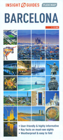
Barcelona Flexi Map
Central Barcelona on an Insight Flexi Map in their new format introduced to provide more convenient access to the special features of this series: various additional maps and/or street plans plus tourist information including a list of must-see sights. The map is tear-resistant, waterproof, and can be written on with non-permanent marker pens.On one side is an indexed street plan at 1:12, 000. Unlike most maps of Barcelona, this street plan is oriented with the north rather than north-west on top, showing less of the port area but providing more convenient coverage of the city’s most popular sights: the Sagrada Familia at the top edge, Camp Nou in the west, and most of Muntanya de Montjuà c Parc in the south. A separate inset extends the plan to cover Park Güel. The index is on
the reverse and in addition to streets also lists public buildings and points of interest.On the reverse are also this title’s other additional features: - A diagram of the city’s metro and rail networks (NB. VERY small print).- An indexed road map of Catalonia at 1:1, 250, 000 - Brief descriptions of the city’s 25 main sights, neatly grouped into sections covering Major Attractions, Major Museums and Art Galleries, Main Shopping Areas and Markets, plus Further Afield - all prominently highlighted on the street plan and/or the road map of the environs.- Information about Getting Around and Facts for Visitors, including tourist offices, public holidays, opening times, money, tipping, telecommunications and monthly climate charts.To see the list of other Insight Flexi titles
in this series please click on the series link.

Product Description
Reviews/Comments
Add New
Vouchers
No voucher codes found.
Do you know a voucher code for this product or supplier? Add it to Insights for others to use.
Do you know a voucher code for this product or supplier? Add it to Insights for others to use.
 Denmark