
 United Kingdom
 France
 Germany
 Netherlands
 Sweden
 USA
USA
 Italy
Italy
 Spain
Spain
More From Contributor
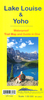


Banff - Mount Assiniboine
Banff - Mount Assiniboine area at 1:100, 000 on a light, waterproof and tear-resistant map from Gem Trek Publishing in their series of detailed hiking maps of the Canadian Rockies. On the reverse are descriptions of several day hikes and overnight trips, plus plenty of other tourist information.The map covers the most popular hiking and mountain biking terrain in the Banff National Park, from Lake Louise in the north to the southern boundary of the park, plus all of Mt. Assiniboine Provincial Park. Contours are at 50m intervals, with subtle relief shading and colouring for forested areas, rocky or alpine terrain and glaciers. The map has a 2km UTM grid and margin ticks at 5
Product Description
Reviews/Comments
Add New
Vouchers
No voucher codes found.
Do you know a voucher code for this product or supplier? Add it to Insights for others to use.
Do you know a voucher code for this product or supplier? Add it to Insights for others to use.
 Denmark