More From Contributor

£8.95
Map No. 872, Baden-Baden
- Murgtal, in a series of hiking maps from Kompass providing extensive coverage of Austria & Germany
...
Archived Product
£10.95
Map No. 872, Baden-Baden
- Murgtal, in a series of hiking maps from Kompass providing extensive coverage of Austria & Germany
...
Archived Product
£13.99
Baden-Baden – Murgtal area of the Black Forest in a detailed, GPS compatible map at 1:50, 000 from Kompass with local & long-distance footpaths, cycling routes, accommodation, etc, printed on durable, waterproof & tear-resistant synthetic paper. KOMPASS HIKING & RECREATIONAL MAPS: This title is part of an extensive series covering Austria, much of Germany & the Slovenian Alps. Kompass are Europe’s largest publishers of hiking maps; their mapping of other countries, including expanding coverage of Italy, is listed on our website separately.CARTOGRAPHY: The maps are contoured with additional shading, graphic relief & colouring to provide a more detailed picture of the terrain, vegetation and/or land use. Contour interval varies from 10m in the coastal areas of Northern Germany to 40 or 50 metres in the mountainous regions. All the maps highlight local & long-distance waymarked footpaths, including climbing trails. Most titles also show cycling routes, mountain bike trails, &, the in mountainous areas, ski routes. The maps indicate various types of accommodation (selected inns & hotels, youth hostels, campsites, mountain refuges), as well as recreational facilities, places of interest, etc. Latest editions also show access by public transport with bus stops and/or Park+ Ride facilities.GEOGRAPHICAL COORDINATES: Unless indicated to the contrary in the individual description, the maps have a UTM grid for GPS users. MAP LEGEND: Most maps now include full English legend, particularly titles covering the Alpine areas. Some maps covering mainly eastern Austria or the less popular parts of Germany may still have a legend in German only.OTHER
Features: Selected titles include on the reverse panorama drawings of their area with names of villages, peaks, valleys, etc. and/or have a booklet with pictures of local wild flowers with their Latin names. Many titles are now published as competitively priced sets of two or more maps, offering a wider coverage.BOOKLETS: PLEASE NOTE BEFORE ORDERING! Many titles come with a booklet describing the area and/or various hiking routes. Unless indicated in the individual description that the booklet

Includes::
English, these booklets are IN GERMAN only. The booklets are not necessary to use the maps since, as stated above, full English language map legend is provided.


...
Archived Product
£6.50
Falk, one of Germany`s leading publishers of street plans, produce their town plans in two different formats. Falk Extra plans are folded in a standard way, where the whole map can be opened to view the entire area it covers. For larger cities, the same mapping is also published with a special folding system designed to show only a small section of the map at one time. The whole map can be opened but it will be cut in several places. Many find these street plans very user-friendly & easier to handle than conventional maps. The plans, which cover towns with their outer suburbs, indicate main landmarks & public buildings & show all the public transport facilities, one way streets & car parks. Plans of lager cities include a separate map of the town centre at a more detailed scale & a diagram of the underground & the suburban rail network. The plans also show the postal divisions & have an extensive street index which, where appropriate, shows individual postal codes for each street. Map legend

Includes::
English. Falk Extra plans also include on the reverse a road map of the surrounding area.

...
Archived Product
£12.50
Baden-Württemberg including the Black Forest at 1:275, 000 in a series of eight regional road maps from Kümmerly + Frey printed on sturdy waterproof & tear-resistant plastic paper, indexed & with highlighting of picturesque locations & other places of interest. Each title is double-sided, with part of one of the sides taken by the index. Road network clearly shows the motorways with junction numbers, parking places & roadside facilities. Smaller roads indicate scenic sections and/or special tourist routes, entry restrictions, seasonal closures, roads not recommended for caravans, steep gradients, etc. Main railway lines are shown with stations, local airports are marked, & where appropriate car or passenger ferry connections are also indicated. Picturesque towns or villages are prominently highlighted. Other places of tourist interest are also clearly marked, but with their names in German (e.g. Uhrenmuseum, Röm. Gutshof, Hexenlochmühle, etc.). The maps also show boundaries of national or natural parks. Topography is indicated by light relief shading with names of mountain chains, valleys, etc, plus colouring for woodlands. Latitude & longitude lines are drawn at 10’ intervals. Map legend

Includes::
English.

...
Archived Product
£10.50
German state of Baden-Württemberg at 1:250, 000 on a GPS compatible road map from its survey organization, showing the road network with its official numbers at all levels, railways, airports & internal administrative divisions. The map presents the state’s road network in colours indicating the official classification & all the sections, as appropriate, show their official road numbers. Small, unnumbered country roads are included. On autobahns distances are marked at 10km intervals, various facilities are marked & interchanges are shown with both their numbers & their names. Railway lines are shown with station & stops. The map also indicates locations of airports, aerodromes & helicopter landing pads. Three levels of internal administrative boundaries are also marked. The map has no contours or relief shading to indicate topography, just colouring showing forested areas. The state’s various protected areas are not marked. Latitude & longitude lines are at 6’ & 10’ respectively to correspond to the German national grid. The numbering in the margin enables the users to work sheet numbers for the 1:25, 000 standard topographic mapping of the state. The map is not indexed. Map legend is in German only. ...
Archived Product
£9.99
German state of Baden-Württemberg on a double-sided, indexed road map at 1:200, 000 in the Mair Dumont’s Marco Polo series, prominently highlighting interesting locations & protected areas. The map divides the region north/south with a very generous overlap; Stuttgart & Strasburg are included on both sides & the whole of the Black Forest Natural Park is on the southern side of the map. A 143-page index booklet

Includes::
city centre street plans plus enlargements at 1:100, 000 showing in greater detail the environs & road access to Freiburg, Friedrichshafen, Heidelberg, Heilbronn, Karlsruhe, Mannheim, Reutlingen
- Tübingen area with plans of both cities, Stuttgart & Ulm
- Neu Ulm. Also included are plans of terminals at the Stuttgart, Friedrichshafen & Karlsruhe airports, plus plans of the Messe exhibition grounds in Stuttgart & Friedriechshafen. Maps in this Mair Dumont Marco Polo series indicate topography by light relief shading & the series is particularly good for identifying geographical

Features:
mountain & hill chains, valleys, national/natural parks, etc. The maps boldly stress main roads & motorways in strong colours & selected towns in large letters, but also show minor roads & villages in considerable detail. Road information

Includes::
toll roads, traffic restrictions & seasonal closures, gradient marking for steep roads, etc. Motorway services clearly indicate types of facilities available there, & driving distances are marked on many small local roads. Scenic roads & special tourist routes are highlighted. Railway network

Includes::
narrow gauge & tourist lines, cable car lines, & chair lifts. Where appropriate, ferry connections are shown. Locations worth visiting, both town/villages & natural sites, are highlighted & graded; 15 best sites are prominently marked & cross-referenced to their descriptions in the accompanying booklet. Other tourist information

Includes::
campsites & youth hostels, landmarks, recreational facilities etc. Latitude & longitude grid is drawn at intervals of 10`. Each title comes with a booklet attached to the map cover containing street plans & maps at 1:100, 000 showing in greater detail road access to main cities. The booklet also provides an index listing towns/villages with their postcodes as well as rivers & landscape features, plus a table with distances/travelling times, & for route planning an overview of the whole area covered by the main map indicating the 15 special places of interest. Map legend & the descriptions include English. To see the list of titles in this series please click on the series link.


...
Archived Product
£6.39
A detailed topographic map of Badenoch & Upper Strathspey from the Ordnance Survey Explorer series, covering Kingussie & Newtonmore. Edition A1; Publication date July 2007 About this series: These highly detailed maps show all the administrative boundaries, settlements as small as isolated farms, the road network down to unfenced roads & country tracks, & field boundaries (hedges & drystone walls) which make navigation across the countryside much easier. Steep gradients on roads are indicated. Various landmarks, e.g. powerlines, archaeological sites, windmills, churches & lighthouses are shown & additional graphics indicate natural terrain features such as cliffs, scree, mud & vegetation variations. The contour interval is 5 metres in the lower parts of the country & 10 metres in the uplands, & spot heights are marked. Each map covers an area of 30 x 20km (i.e. approx. 19 x 12 miles), with some double-sided maps covering more, as indicated in the individual descriptions. The maps are fully GPS compatible, with the National Grid shown at 1km intervals & latitude & longitude indicated by margin ticks at 1'. The Explorer series has replaced the earlier, green-cover Pathfinder maps. The Explorer series is now complete & covers all of Engl&, Wales & Scotl&. Some sheets for popular areas like the National Parks are still branded as Outdoor Leisure (OL) maps, but are now included in this series as the cartography is the same as that in the Explorer Maps. The Explorer maps offer a substantial improvement on the Pathfinder series, with greater use of colour, larger area per map, & stronger emphasis on information for ramblers & tourists. This series is ideal for walking & other outdoor pursuits & each map shows a large amount of information for ramblers & tourists. Public rights of way are shown (except in Scotland), together with other routes with public access: National Trails & Recreational Paths, permitted paths & bridleways, & selected cycle routes. Open access land created under the Countryside & Rights of Way Act 2000 is marked. Tourist information

Includes::
caravan & camp sites, Park & Ride locations, recreation/leisure/sport centres, museums, historic buildings, English Heritage & National Trust sites, rural pubs, etc. The map legend is in English only, except for the tourist information content which is also in French & German.

...
Archived Product
£14.99
Badenoch & Upper Strathspey area of the Cairmgorms National Park on a detailed topographic & GPS compatible map OL56, waterproof version, from the Ordnance Survey’s 1:25, 000 Explorer series. Coverage

Includes::
Kingussie, Newtonmore, three Munro peaks including A’ Chailleach, Monadhliath Mountains, etc.MOBILE DOWNLOADS: this title & all the other OS Explorer maps include a code for downloading after purchase the digital version onto your smartphone or tablet for viewing on the OS smartphone app.OS EXPLORER SERIES: to see the list of all the titles in the OS Explorer series, both paper & waterproof versions, please click on the series link. The Explorer series, Ordnance Survey’s most detailed maps recommended for anyone enjoying outdoor activities, provides topographic coverage of Great Britain at 1:25, 000 on GPS compatible maps with hiking trails, cycling routes & extensive tourist information. Each printed map is available either on paper or as a waterproof & tear-resistant OS Active Map, as indicated in its title. Britain’s National Parks & other areas of particular tourist interest are presented on often double-sided OL (Outdoor Leisure) maps, whilst most standard format Explorers cover an area of 30 x 20km (approx. 19 x 12 miles). All three versions (paper, waterproof & digital) are the same & provide plenty of recreational & tourist information, indicating the traditional public right of way paths (except in Scotland where different laws apply), including bridleways & byways. National Trails & other long-distance paths are marked, as well as permissive footpaths or bridleways & on-road or traffic-free cycle routes with, where appropriate, their National/ Regional Cycle Network numbers. Boundaries of access land are clearly marked. A wide range of symbols provides additional tourist information, highlighting camping & caravanning sites, information offices & visitors’ centres, parking & picnicking places, country pubs, sport & recreational facilities including cycle hire locations & mountain biking trails, historic buildings & museums, etc. Exceptionally clear presentation of the landscape is provided by contours at 5m or in the uplands at 10m intervals, with additional spot heights plus colouring and/or graphics for different types of woodlands, orchards, heath, marshl&, scree or boulders, & other topographic features. For GPS users the maps have British National Grid lines at 1km intervals, with latitude & longitude given by margin ticks at 1`. Clearly laid out map legend

Includes::
French & German translations for the tourist information symbols.


...
Archived Product
£8.99
Badenoch & Upper Strathspey area of the Cairmgorms National Park on a detailed topographic & GPS compatible map OL56, paper version, from the Ordnance Survey’s 1:25, 000 Explorer series. Coverage

Includes::
Kingussie, Newtonmore, three Munro peaks including A’ Chailleach, Monadhliath Mountains, etc.MOBILE DOWNLOADS: this title & all the other OS Explorer maps include a code for downloading after purchase the digital version onto your smartphone or tablet for viewing on the OS smartphone app.OS EXPLORER SERIES: to see the list of all the titles in the OS Explorer series, both paper & waterproof versions, please click on the series link. The Explorer series, Ordnance Survey’s most detailed maps recommended for anyone enjoying outdoor activities, provides topographic coverage of Great Britain at 1:25, 000 on GPS compatible maps with hiking trails, cycling routes & extensive tourist information. Each printed map is available either on paper or as a waterproof & tear-resistant OS Active Map, as indicated in its title. Britain’s National Parks & other areas of particular tourist interest are presented on often double-sided OL (Outdoor Leisure) maps, whilst most standard format Explorers cover an area of 30 x 20km (approx. 19 x 12 miles). All three versions (paper, waterproof & digital) are the same & provide plenty of recreational & tourist information, indicating the traditional public right of way paths (except in Scotland where different laws apply), including bridleways & byways. National Trails & other long-distance paths are marked, as well as permissive footpaths or bridleways & on-road or traffic-free cycle routes with, where appropriate, their National/ Regional Cycle Network numbers. Boundaries of access land are clearly marked. A wide range of symbols provides additional tourist information, highlighting camping & caravanning sites, information offices & visitors’ centres, parking & picnicking places, country pubs, sport & recreational facilities including cycle hire locations & mountain biking trails, historic buildings & museums, etc. Exceptionally clear presentation of the landscape is provided by contours at 5m or in the uplands at 10m intervals, with additional spot heights plus colouring and/or graphics for different types of woodlands, orchards, heath, marshl&, scree or boulders, & other topographic features. For GPS users the maps have British National Grid lines at 1km intervals, with latitude & longitude given by margin ticks at 1`. Clearly laid out map legend

Includes::
French & German translations for the tourist information symbols.


...
Archived Product

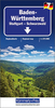
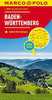
Baden-Württemberg F&B

One of the titles in a series of large, indexed regional maps with fine, clear cartography. General relief is portrayed by hill-shading with selected spot heights without distracting from the other detail. The motorway network and recommended scenic routes stand out well from the background, but some may find minor local roads a little too faint. In some places exits from motorways are also rather lightly coloured. Intermediate driving distances are indicated throughout and special tourist routes are marked.The maps highlight picturesque towns and national parks, with a range of symbols marking campsites, youth hostels, museums, spas, various landmarks and places of interest, etc. Latitude and longitude grid is drawn at intervals of 10’. Map legend includes English. A separate
index attached to the cover gives the postcode for each locality, including those beyond the German territory on sheets covering border regions. NB. This title is currently reprinting and will not be available until spring 2008.
RIP - This product is no longer available on our network. It was last seen on 25.09.2019

This page now acts as a permanent archive for this product. Add more information using the comments box below to ensure it can still be found by future generations.

Use our search facility to see if it is available from an alternative contributor.
  • Availability: Out Of Stock
  • Supplier: Stanfords
  • SKU: 9783707900675
Availability: In Stock
£10.99

Product Description

One of the titles in a series of large, indexed regional maps with fine, clear cartography. General relief is portrayed by hill-shading with selected spot heights without distracting from the other detail. The motorway network & recommended scenic routes stand out well from the background, but some may find minor local roads a little too faint. In some places exits from motorways are also rather lightly coloured. Intermediate driving distances are indicated throughout & special tourist routes are marked. The maps highlight picturesque towns & national parks, with a range of symbols marking campsites, youth hostels, museums, spas, various landmarks & places of interest, etc. Latitude & longitude grid is drawn at intervals of 10’. Map legend

Includes::
English. A separate index attached to the cover gives the postcode for each locality, including those beyond the German territory on sheets covering border regions. NB. This title is currently reprinting & will not be available until spring 2008.

Reviews/Comments

Add New

Intelligent Comparison

Oooops!
We couldn't find anything!
Perhaps this product's unique.... Or perhaps we are still looking for comparisons!
Click to bump this page and we'll hurry up.

Price History

Vouchers

No voucher codes found.
Do you know a voucher code for this product or supplier? Add it to Insights for others to use.

Facebook

Jargon Buster

Network - A link and communication between things. Often computers or people.
Large - something that takes up more space than normal.
Regional - An adjective to describe a set geographic area.

Supplier Information

Stanfords
Stanfords was established in 1853 and opened their iconic Covent Garden flagship store in 1901. They have become the top retailer of maps, travel books and accessories in the UK and arguably offer the largest selection of maps and travel books worldwide. Famous names such as Captain Robert Falcon Scott, Ranulph Fiennes and Michael Palin have purchased from Stanfords. They now have a shop in Bristol and both stores together with other venues operate a calendar of events including talks, book signings and exhibitions. As a specialist map retailer, the map selection is comprehensive and includes road maps, street maps and walking maps from worldwide destinations, as well as a selection of world atlases and wall maps. Books include travel guides and travel literature. Stanfords also stock globes, from miniatures made of blue marble to magnificent floor-standing globes. The website features a selection of interesting articles on travel topics.
Page Updated: 2023-11-12 20:15:36

Community Generated Product Tags

Oh No! The productWIKI community hasn't generated any tags for this product yet!
Menu