More From Contributor

£2.50
Ayr
- Prestwick street map from Nicolson Maps; coverage

Includes::
Alloway, Annbank, Coylton, Monkton


...
Archived Product
£3.50
Ayr in 1909 in a fascinating series of reproductions of old Ordnance Survey plans in the Alan Godfrey Editions, ideal for anyone interested in the history of their neighbourhood or family. The map covers much of Ayr, including the town centre. Coverage stretches from the Esplanade eastward to Craigie House, & from Tryfield Place & Hawkhill Avenue southward to the Cemetery & Bellevue Crescent. Features include tramways, railway with station, Ayr County Hospital, Craigie Park, part of Race Course, River Ayr, part of Harbour, Low Green, football ground, Infantry Barracks, Goods station, Wallacetown, Old Church, Hotel Dalblair, Cattle Market, Burns Statue, saw mills, etc. On the reverse is a selection of street directory entries, includin Main Street, Miller Road, Newmarket Street, Sandgate, South Harbour Street & Wallace Street. About the Alan Godfrey Editions of the 25” OS Series: Selected towns in Great Britain & Ireland are covered by maps showing the extent of urban development in the last decades of the 19th & early 20th century. The plans have been taken from the Ordnance Survey mapping & reprinted at about 15 inches to one mile (1:4, 340). On the reverse most maps have historical notes & many also include extracts from contemporary directories. Most maps cover about one mile (1.6kms) north/south, one & a half miles (2.4kms) across; adjoining sheets can be combined to provide wider coverage.FOR MORE INFORMATION & A COMPLETE LIST OF ALL AVAILABLE TITLES PLEASE CLICK ON THE SERIES LINK. ...
Archived Product
£14.99
Waterproof & tear-resistant OS Active version of map No. 70 from the Ordnance Survey’s Landranger series at 1:50, 000, with contoured & GPS compatible topographic mapping plus tourist information.MOBILE DOWNLOADS: As well as the physical edition of the map, each Landranger title now

Includes::
a code for downloading after purchase its digital version onto your smartphone or tablet for viewing on the OS smartphone app.OS LANDRANGER SERIES: to see the list of all the titles in the OS Landranger series, both paper & waterproof versions, please click on the series link. Maps in the Landranger series provide plenty of recreational & tourist information, indicating the traditional public right of way paths (except in Scotland where different laws apply), including bridleways & byways restricted or open to motorized traffic. National Trails & selected other long-distance paths are marked, as well as on-road & traffic-free cycle routes with their National/ Regional Cycle Network numbers. National Trust/ National Trust for Scotland & Forestry Commission land is clearly marked, indicating open or restricted access. A range of symbols highlights camping & caravanning sites, youth hostels, tourist information offices & visitors’ centres, parking & picnicking places, World Heritage sites, sport & recreational facilities, etc. The maps provide detailed presentation of topography with contours at 10m intervals, numerous spot heights & additional colouring and/or graphics for different types of woodlands, orchards or parkl&, rock features including scree & cliffs, water features inland & along the sea shore with marshl&, dunes, s&, mud, shingle & the high water mark. All the standard information expected of survey mapping at this scale is included: finely graded road network, railway lines with stations, cuttings, embankments, etc; individual isolated buildings; archaeological & historical sites, etc. For GPS users the British National Grid is shown at 1km intervals, with latitude & longitude given by margin ticks at 1` & cross hairs on the map at 5`. Each map covers an area of 40 x 40km, (approx. 25 x 25 miles).

...
Archived Product
£8.99
Paper version of map No. 70 from the Ordnance Survey’s Landranger series at 1:50, 000, with contoured & GPS compatible topographic mapping plus tourist information.MOBILE DOWNLOADS: As well as the physical edition of the map, each Landranger title now

Includes::
a code for downloading after purchase its digital version onto your smartphone or tablet for viewing on the OS smartphone app.OS LANDRANGER SERIES: to see the list of all the titles in the OS Landranger series, both paper & waterproof versions, please click on the series link. Maps in the Landranger series provide plenty of recreational & tourist information, indicating the traditional public right of way paths (except in Scotland where different laws apply), including bridleways & byways restricted or open to motorized traffic. National Trails & selected other long-distance paths are marked, as well as on-road & traffic-free cycle routes with their National/ Regional Cycle Network numbers. National Trust/ National Trust for Scotland & Forestry Commission land is clearly marked, indicating open or restricted access. A range of symbols highlights camping & caravanning sites, youth hostels, tourist information offices & visitors’ centres, parking & picnicking places, World Heritage sites, sport & recreational facilities, etc. The maps provide detailed presentation of topography with contours at 10m intervals, numerous spot heights & additional colouring and/or graphics for different types of woodlands, orchards or parkl&, rock features including scree & cliffs, water features inland & along the sea shore with marshl&, dunes, s&, mud, shingle & the high water mark. All the standard information expected of survey mapping at this scale is included: finely graded road network, railway lines with stations, cuttings, embankments, etc; individual isolated buildings; archaeological & historical sites, etc. For GPS users the British National Grid is shown at 1km intervals, with latitude & longitude given by margin ticks at 1` & cross hairs on the map at 5`. Each map covers an area of 40 x 40km, (approx. 25 x 25 miles).

...
Archived Product
£5.59
Map No. 70, Ayr, Kilmarnock & Troon, in the Ordnance Survey Landranger series at 1:50, 000, including Prestwick, Ardrossan, Saltcoats, Horse Isle, Kilwinning, Torranyard, Kilmaurs, Fenwick, Irvine, Newmilns, Galston, Dundonald, Symington, Tarbolton, Mauchline, Catrine, Annbank, Ochiltree, Coylton, Drongan, Hollybush, Dalrymple, Minishant, Patna, Rankinston, Waterside, Dalmellington, Crosshill, Maybole, Turnberry, Maidens & Dunure, plus Lady Isle. Edition B2; Revised for selected changes 2007; Copyright date 2007 This title is also available on our website in a waterproof & tear-resistant version. Maps in this series are only published folded. Stanfords can also print flat versions of Ordnance Survey maps through the OS Select system, centring the map on a location of your choice & with a picture provided by you on the cover. For more information please click on the link at the bottom of this description. About Ordnance Survey ...
Archived Product
£10.39
Map No. 70, Ayr, Kilmarnock & Troon, in a waterproof & tear-resistant version of the Ordnance Survey Landranger series at 1:50, 000, including Prestwick, Ardrossan, Saltcoats, Horse Isle, Kilwinning, Torranyard, Kilmaurs, Fenwick, Irvine, Newmilns, Galston, Dundonald, Symington, Tarbolton, Mauchline, Catrine, Annbank, Ochiltree, Coylton, Drongan, Hollybush, Dalrymple, Minishant, Patna, Rankinston, Waterside, Dalmellington, Crosshill, Maybole, Turnberry, Maidens & Dunure, plus Lady Isle. Edition B2; Revised for selected changes 2007; Copyright date 2007 This title is also available on our website in a paper version. Maps in this series are only published folded. Stanfords can also print flat versions of Ordnance Survey maps through the OS Select system, centring the map on a location of your choice & with a picture provided by you on the cover. For more information please click on the link at the bottom of this description. About Ordnance Survey ...
Archived Product
£35.00
Cambridgeshire Pevsner Architectural Guide, in a series of publications begun with the express aim of providing up-to-date guides to the most significant buildings in every part of the country, suitable for both general reader & specialist. Each volume provides an introductory overview of the architecture of the area, followed by a descriptive gazetteer arranged alphabetically by place. Whilst cathedrals & their furnishings, great country houses & their parks form the grand set pieces, the books demonstrate the enjoyable diversity of architecture in the British Isles in accounts of rural churches & farmsteads, Victorian public buildings & industrial monuments. A continuing programme of publication keeps the series up-to-date with new information on older buildings & recent architecture while maintaining the tradition of Pevsner`s own succinct accounts. Each book has over 100 photographs, mostly specially commissioned, numerous maps & plans, a glossary & indexes. ...
Archived Product
£5.99
Ayrshire, Lanark & the Isle of Arran Cycle Map at 1:110, 000 from Sustrans, including Lochs & Glens South route, Ayshire Coast Cycleway, Cunninghame Cycleway, plus three day rides: Neilston Circuit, Larkhall Loop, & Robert Burn Ride. Street plans show Ayr, Hamilton, Irvine, Kilmarnock, Kilwinning & Paisley. Maps is this Sustrans series show all the National & Regional Cycle Network routes clearly numbered & have the colouring distinguishing between the on-road & traffic-free sections. The publishers’ own recommendations are shown in contrasting colour &, in most titles, are in addition presented on the reverse side on separate panels where each circuit is annotated with useful notes. The maps have contours & altitude colouring to show the topography, with additional gradient markings. Towns along the routes are annotated with symbols indicating what facilities can be found there. Also marked are various places of interest, on or near the routes, & railway lines are shown with stations for access to the routes by rail. On the reverse each title also provides large, clear city centre street plans of main towns, highlighting the Cycle Network and/or the recommended routes. Also included are contact details of tourist information centres. To see the list of titles in this series please click on the series link. ...
Archived Product
£9.50
Topographical survey of Belgium at 1:20, 000 from Nationaal Geografisch Instituut / Institut Géographique National, the country’s national survey organization. Each 20K map covers one quarter of the corresponding 1:50, 000 map (with adjustments in the border & coastal areas). The maps provide all the information expected of topographic mapping at this scale & in addition have an unusually large amount of vegetation and/or land use information (different types of woodlands, gardens, orchards, heath, etc). The maps have a 1-km UTM grid, with margin ticks for latitude & longitude at intervals of 1`. Map legend & a glossary of terms used on the maps include English. Stanfords keeps as regular stock 20K maps for the World War I battlefields around the Ypres, Messines & Passchendaele, & for the area of the Battle of Waterloo. The 1:20, 000 survey covers the whole of Belgium & maps for other regions can be supplied as special orders. To see the list of titles in this series please click on the series link.PLEASE NOTE: the Long-Distance Footpaths Map of Belgium at 1:300, 000 which shows the division of Belgium into the 50K survey sheets can also be used to see in more detail coverage by the 20K maps. ...
Archived Product
£11.99
Ardennes Recreational Maps at a scale of 1:25, 000 enable you to discover the Ardennes from junction to junction, each associated with a locality, through a network of hiking, cycling or riding paths. The network of mini walks consists of suggested routes with kilometre distance marked showing field boundaries & urbanised built up areas. Contour markings are at five metre intervals. The map legend is in English, French, Dutch & German. You can scan QR codes on the map for details about the respective locality or upload GPX files of the proposed routes via the provided website. ...
Archived Product

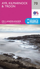
Ayr, Kilmarnock And Troon OS ACTIVE Map

Map No. 70, Ayr, Kilmarnock and Troon, in the waterproof and tear-resistant OS Active version of the Ordnance Survey Landranger series at 1:50, 000, including Prestwick, Ardrossan, Saltcoats, Horse Isle, Kilwinning, Torranyard, Kilmaurs, Fenwick, Irvine, Newmilns, Galston, Dundonald, Symington, Tarbolton, Mauchline, Catrine, Annbank, Ochiltree, Coylton, Drongan, Hollybush, Dalrymple, Minishant, Patna, Rankinston, Waterside, Dalmellington, Crosshill, Maybole, Turnberry, Maidens and Dunure, plus Lady Isle.Edition B2; Publication date April 2012About Ordnance Survey
RIP - This product is no longer available on our network. It was last seen on 25.09.2019

This page now acts as a permanent archive for this product. Add more information using the comments box below to ensure it can still be found by future generations.

Use our search facility to see if it is available from an alternative contributor.
  • Availability: Out Of Stock
  • Supplier: Stanfords
  • SKU: 9780319481127
Availability: In Stock
£9.09

Product Description

Map No. 70, Ayr, Kilmarnock & Troon, in the waterproof & tear-resistant OS Active version of the Ordnance Survey Landranger series at 1:50, 000, including Prestwick, Ardrossan, Saltcoats, Horse Isle, Kilwinning, Torranyard, Kilmaurs, Fenwick, Irvine, Newmilns, Galston, Dundonald, Symington, Tarbolton, Mauchline, Catrine, Annbank, Ochiltree, Coylton, Drongan, Hollybush, Dalrymple, Minishant, Patna, Rankinston, Waterside, Dalmellington, Crosshill, Maybole, Turnberry, Maidens & Dunure, plus Lady Isle. Edition B2; Publication date April 2012 About Ordnance Survey

Reviews/Comments

Add New

Intelligent Comparison

Oooops!
We couldn't find anything!
Perhaps this product's unique.... Or perhaps we are still looking for comparisons!
Click to bump this page and we'll hurry up.

Price History

Vouchers

No voucher codes found.
Do you know a voucher code for this product or supplier? Add it to Insights for others to use.

Facebook

Jargon Buster

Date - A day on a calendar
Date - A social activity whith a current or potential partner
Waterproof - Resistant to water, usualy specified by depth in metres
Resistant - Something that can repel against something.
Horse - A large animal with four legs that tends to be ridden.

Supplier Information

Stanfords
Stanfords was established in 1853 and opened their iconic Covent Garden flagship store in 1901. They have become the top retailer of maps, travel books and accessories in the UK and arguably offer the largest selection of maps and travel books worldwide. Famous names such as Captain Robert Falcon Scott, Ranulph Fiennes and Michael Palin have purchased from Stanfords. They now have a shop in Bristol and both stores together with other venues operate a calendar of events including talks, book signings and exhibitions. As a specialist map retailer, the map selection is comprehensive and includes road maps, street maps and walking maps from worldwide destinations, as well as a selection of world atlases and wall maps. Books include travel guides and travel literature. Stanfords also stock globes, from miniatures made of blue marble to magnificent floor-standing globes. The website features a selection of interesting articles on travel topics.
Page Updated: 2023-11-12 20:15:36

Community Generated Product Tags

Oh No! The productWIKI community hasn't generated any tags for this product yet!
Menu