
 United Kingdom
 France
 Germany
 Netherlands
 Sweden
 USA
USA
 Italy
Italy
 Spain
Spain
More From Contributor


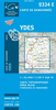


Yazd Province
Yazd Province of Iran on a road map from the Gitashenasi Institute with relief shading showing the topography. Names of towns and some villages are shown in Farsi and Latin alphabet. Symbols highlight locations of petrol stations, historical monuments, tourist accommodation, etc. Also included are a distance table and small maps showing the administrative divisions of the province and of Iran. Map legend and brief notes about the province are in Farsi and English.
Product Description
Reviews/Comments
Add New
Intelligent Comparison
Archived Product
Bari Province Stanfords
£7.95
Archived Product
Enna Province Stanfords
£7.95
Archived Product
Mazandaran Province Stanfords
£24.95
Archived Product
Gilan Province Stanfords
£24.95
Archived Product
Pavia Province Stanfords
£7.95
Archived Product
Genoa Province Stanfords
£7.95
Archived Product
Parma Province Stanfords
£7.95
Archived Product
Salzburg Province Stanfords
£10.50
Vouchers
No voucher codes found.
Do you know a voucher code for this product or supplier? Add it to Insights for others to use.
Do you know a voucher code for this product or supplier? Add it to Insights for others to use.
 Denmark