More From Contributor
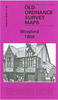
£17.99
Kadaster, Holland`s national survey organization, produces one of the most attractive topographic surveys in Europe. The maps are very colourful, with their characteristic patchwork of polders & an unusually large amount of land use information: meadows, arable l&, different types of forest, marshes, sand dunes, etc. Contours are shown at 5-metre intervals with numerous spot heights &, with such a large part of the country below the sea level, ”spot depths”. Each map covers an area of Approx. 25 x 20 km / 15 x 12 miles, with some sheets slightly larger. The maps have a 1-km Dutch national grid, plus latitude & longitude at intervals of 1`. Map legend

Includes::
English.IMPORTANT
- PLEASE NOTE BEFORE ORDERING: both the west (W) & the east (O) sheet of each number has the same name, although the town after which the two maps are named appears only on one of the sheets. For example: maps 41W & 41O are both called Arnhem, although the city of Arnhem appears only on sheet 40W, etc. To see the list of titles available in this series please click on the series link.


...
Archived Product
£2.95
Winsford in 1908 in a fascinating series of reproductions of old Ordnance Survey plans in the Alan Godfrey Editions, ideal for anyone interested in the history of their neighbourhood or family. Selected towns in Great Britain & Ireland are covered by maps showing the extent of urban development in the last decades of the 19th & early 20th century. In this title: the map covers the Cheshire town of Winsford, also including Over & part of Wharton. Coverage stretches from Sandhole & Delamere Street eastward to Ledward Street at Wharton. Features include the railway termini of both CLC & LNWR, several salt works, Wharton Hall, Knight's Grange, Gravel Hill, High Street, Town Hall, Over Mills. Directories of private residents for Over & Winsford are on the reverse. About the Alan Godfrey Editions of the 25 ...
Archived Product
£3.50
Winsford in 1908 in a fascinating series of reproductions of old Ordnance Survey plans in the Alan Godfrey Editions, ideal for anyone interested in the history of their neighbourhood or family. The map covers the Cheshire town of Winsford, also including Over & part of Wharton. Coverage stretches from Sandhole & Delamere Street eastward to Ledward Street at Wharton. Features include the railway termini of both CLC & LNWR, several salt works, Wharton Hall, Knight`s Grange, Gravel Hill, High Street, Town Hall, Over Mills, etc. Directories of private residents for Over & Winsford are on the reverse. About the Alan Godfrey Editions of the 25” OS Series: Selected towns in Great Britain & Ireland are covered by maps showing the extent of urban development in the last decades of the 19th & early 20th century. The plans have been taken from the Ordnance Survey mapping & reprinted at about 15 inches to one mile (1:4, 340). On the reverse most maps have historical notes & many also include extracts from contemporary directories. Most maps cover about one mile (1.6kms) north/south, one & a half miles (2.4kms) across; adjoining sheets can be combined to provide wider coverage.FOR MORE INFORMATION & A COMPLETE LIST OF ALL AVAILABLE TITLES PLEASE CLICK ON THE SERIES LINK. ...
Archived Product
£3.50
Winson Green & Hockley in 1888 in a fascinating series of reproductions of old Ordnance Survey plans in the Alan Godfrey Editions, ideal for anyone interested in the history of their neighbourhood or family. Two versions have been published for this area; the maps cover the busy Winson Green part of north-west Birmingham, including parts of Hockley, Gib Heath & Brookfields. Coverage stretches from Winson Street eastward to Hockley Hill & from Charleville Road southward to Spring Hill. Features include Winson Green Prison (left blank for security reasons), City Lunatic Asylum, Workhouse & Infirmary, Atlas Works, General Cemetery, Warstone Lane Cemetery, Birmingham Canal, Birmingham Canal (Old Line), GWR railway with Soho station, Hockley station, goods stations, Hockley goods yard; LNWR railway including Winson Green station, Soho Junction; tramways & depot, Soho Pool Wharf, St Chrysostom`s church, Time Watch Works, The Mint, disinfecting station, Soho Hill Chapel, etc. A selection of street directory entries is on the reverse of each map. About the Alan Godfrey Editions of the 25” OS Series: Selected towns in Great Britain & Ireland are covered by maps showing the extent of urban development in the last decades of the 19th & early 20th century. The plans have been taken from the Ordnance Survey mapping & reprinted at about 15 inches to one mile (1:4, 340). On the reverse most maps have historical notes & many also include extracts from contemporary directories. Most maps cover about one mile (1.6kms) north/south, one & a half miles (2.4kms) across; adjoining sheets can be combined to provide wider coverage.FOR MORE INFORMATION & A COMPLETE LIST OF ALL AVAILABLE TITLES PLEASE CLICK ON THE SERIES LINK. ...
Archived Product
£3.50
Winson Green & Hockley in 1903 in a fascinating series of reproductions of old Ordnance Survey plans in the Alan Godfrey Editions, ideal for anyone interested in the history of their neighbourhood or family. Two versions have been published for this area; the maps cover the busy Winson Green part of north-west Birmingham, including parts of Hockley, Gib Heath & Brookfields. Coverage stretches from Winson Street eastward to Hockley Hill & from Charleville Road southward to Spring Hill. Features include Winson Green Prison (left blank for security reasons), City Lunatic Asylum, Workhouse & Infirmary, Atlas Works, General Cemetery, Warstone Lane Cemetery, Birmingham Canal, Birmingham Canal (Old Line), GWR railway with Soho station, Hockley station, goods stations, Hockley goods yard; LNWR railway including Winson Green station, Soho Junction; tramways & depot, Soho Pool Wharf, St Chrysostom`s church, Time Watch Works, The Mint, disinfecting station, Soho Hill Chapel, etc. A selection of street directory entries is on the reverse of each map. About the Alan Godfrey Editions of the 25” OS Series: Selected towns in Great Britain & Ireland are covered by maps showing the extent of urban development in the last decades of the 19th & early 20th century. The plans have been taken from the Ordnance Survey mapping & reprinted at about 15 inches to one mile (1:4, 340). On the reverse most maps have historical notes & many also include extracts from contemporary directories. Most maps cover about one mile (1.6kms) north/south, one & a half miles (2.4kms) across; adjoining sheets can be combined to provide wider coverage.FOR MORE INFORMATION & A COMPLETE LIST OF ALL AVAILABLE TITLES PLEASE CLICK ON THE SERIES LINK. ...
Archived Product
£17.99
Long before his finest hour as Britain`s wartime leader, Winston Churchill emerged on the world stage as a brazen foreign correspondent, covering wars of empire in Cuba, India, the Sudan, & South Africa. In those far-flung corners of the world, reporting from the front lines between 1895 & 1900, Churchill mastered his celebrated command of language & formed strong opinions about war. He thought little of his own personal safety, so convinced was he of his destiny, jumping at any chance to be where bullets flew & canons roared. ”I have faith in my star-that I am intended to do something in the world, ” he wrote to his mother at the age of twenty-three before heading into battle. Based on his private letters & war reportage, Winston Churchill Reporting intertwines young Winston`s daring exploits in combat, adventures in distant corners of the globe, & rise as a major literary talent-experiences that shaped the world leader he was to become. ...
Archived Product
£16.99
The dazzling second novel in Ali Smith`s essential Seasonal Quartet -- from the Baileys Prize-winning, Man Booker-shortlisted author of Autumn & How to be both. Winter? Bleak. Frosty wind, earth as iron, water as stone, so the old song goes. The shortest days, the longest nights. The trees are bare & shivering. The summer`s leaves? Dead litter. The world shrinks; the sap sinks. But winter makes things visible. & if there`s ice, there`ll be fire. In Ali Smith`s Winter, lifeforce matches up to the toughest of the seasons. In this second novel in her acclaimed Seasonal cycle, the follow-up to her sensational Autumn, Smith`s shape-shifting quartet of novels casts a merry eye over a bleak post-truth era with a story rooted in history, memory & warmth, its taproot deep in the evergreens: art, love, laughter. It`s the season that teaches us survival. Here comes Winter. ...
Archived Product
£12.95
This unique guide covers over two dozen winter sports. From snowshoeing, snowboarding & winter camping to dog sledding, skijoring & animal tracking.

Includes::
sections on staying warm, equipment, technique, safety & such natural science questions as why ice is slippy. Every winter outdoors person will find something new here.

...
Archived Product
£10.95
Around the end of the 16th century, several expeditions had undertaken to establish a north-east passage, but sea-fogs, pack-ice & the confusing geography of the coast of Russia consistently frustrated them. No-one pursued the idea of a north-east passage with such tenacious skill as the Dutch sailing-master William Barents. The glory & failure of his third voyage, with which this book is concerned, was the last major attempt to open up such a route until, nearly 300 years later, success came in the age of steam. ...
Archived Product
£30.00
In this stunning book, Lars Jonsson celebrates & explores the beauty of the birds that surround him during the Swedish winter ...
Archived Product

Winstanley 1907

Winstanley in 1907 in a fascinating series of reproductions of old Ordnance Survey plans in the Alan Godfrey Editions, ideal for anyone interested in the history of their neighbourhood or family. The map covers most of Winstanley, just west of Wigan. Coverage stretches from Longshaw Common eastward to New Houses, northward to Rylance Mill Farm. The principal feature is Winstanley Hall and its park. Other features include Winstanley Colliery Nos. 2, 3 and 5 Pits; old shafts; Winstanley Colliery Railway; Windy Arbour, Island Dam, Longshaw Common, Longshaw Bottom, Cropper`s House, etc. On the reverse is a section of a 1926 revision of the map, showing collieries - then Worsley Mesnes Baxter Pit and New Pit at a later stage. About the Alan Godfrey Editions of the 25” OS
Series:Selected towns in Great Britain and Ireland are covered by maps showing the extent of urban development in the last decades of the 19th and early 20th century. The plans have been taken from the Ordnance Survey mapping and reprinted at about 15 inches to one mile (1:4, 340). On the reverse most maps have historical notes and many also include extracts from contemporary directories. Most maps cover about one mile (1.6kms) north/south, one and a half miles (2.4kms) across; adjoining sheets can be combined to provide wider coverage.FOR MORE INFORMATION AND A COMPLETE LIST OF ALL AVAILABLE TITLES PLEASE CLICK ON THE SERIES LINK.
RIP - This product is no longer available on our network. It was last seen on 25.09.2019

This page now acts as a permanent archive for this product. Add more information using the comments box below to ensure it can still be found by future generations.

Use our search facility to see if it is available from an alternative contributor.
  • External links may include paid for promotion
  • Availability: Out Of Stock
  • Supplier: Stanfords
  • SKU: 9781847843081
Availability: In Stock
£3.50

Product Description

Winstanley in 1907 in a fascinating series of reproductions of old Ordnance Survey plans in the Alan Godfrey Editions, ideal for anyone interested in the history of their neighbourhood or family. The map covers most of Winstanley, just west of Wigan. Coverage stretches from Longshaw Common eastward to New Houses, northward to Rylance Mill Farm. The principal feature is Winstanley Hall & its park. Other features include Winstanley Colliery Nos. 2, 3 & 5 Pits; old shafts; Winstanley Colliery Railway; Windy Arbour, Island Dam, Longshaw Common, Longshaw Bottom, Cropper`s House, etc. On the reverse is a section of a 1926 revision of the map, showing collieries
- then Worsley Mesnes Baxter Pit & New Pit at a later stage. About the Alan Godfrey Editions of the 25” OS Series: Selected towns in Great Britain & Ireland are covered by maps showing the extent of urban development in the last decades of the 19th & early 20th century. The plans have been taken from the Ordnance Survey mapping & reprinted at about 15 inches to one mile (1:4, 340). On the reverse most maps have historical notes & many also include extracts from contemporary directories. Most maps cover about one mile (1.6kms) north/south, one & a half miles (2.4kms) across; adjoining sheets can be combined to provide wider coverage.FOR MORE INFORMATION & A COMPLETE LIST OF ALL AVAILABLE TITLES PLEASE CLICK ON THE SERIES LINK.

Reviews/Comments

Add New

Price History

Vouchers

No voucher codes found.
Do you know a voucher code for this product or supplier? Add it to Insights for others to use.

Facebook

Jargon Buster

Contemporary - Modern era design
Contemporary - A design reference to indicate post war modern design
History - Anything that happens in the past. An acedemic subject.
Contemporary - An object that is living in the same time.
Mill - A building which can grind grain into flour.
Hall - A room at the inside of an entrance of a house.
Feature - An attribute that makes something stand out.
Ideal - Something that satisfies a perfect criteria.
Family - A group of people that live together made up from parents and children.

Supplier Information

Stanfords
Stanfords was established in 1853 and opened their iconic Covent Garden flagship store in 1901. They have become the top retailer of maps, travel books and accessories in the UK and arguably offer the largest selection of maps and travel books worldwide. Famous names such as Captain Robert Falcon Scott, Ranulph Fiennes and Michael Palin have purchased from Stanfords. They now have a shop in Bristol and both stores together with other venues operate a calendar of events including talks, book signings and exhibitions. As a specialist map retailer, the map selection is comprehensive and includes road maps, street maps and walking maps from worldwide destinations, as well as a selection of world atlases and wall maps. Books include travel guides and travel literature. Stanfords also stock globes, from miniatures made of blue marble to magnificent floor-standing globes. The website features a selection of interesting articles on travel topics.
Page Updated: 2023-11-12 20:15:36

Community Generated Product Tags

Windy arbour colliery winstanley (1 person tagged the product this way)
Windy arbour pit (1 person tagged the product this way)
Menu