
 United Kingdom
 France
 Germany
 Netherlands
 Sweden
 USA
USA
 Italy
Italy
 Spain
Spain
More From Contributor


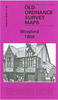

Winsford 1908
Winsford in 1908 in a fascinating series of reproductions of old Ordnance Survey plans in the Alan Godfrey Editions, ideal for anyone interested in the history of their neighbourhood or family. Selected towns in Great Britain and Ireland are covered by maps showing the extent of urban development in the last decades of the 19th and early 20th century.In this title: the map covers the Cheshire town of Winsford, also including Over and part of Wharton. Coverage stretches from Sandhole and Delamere Street eastward to Ledward Street at Wharton. Features include the railway termini of both CLC and LNWR, several salt works, Wharton Hall, Knight's Grange, Gravel Hill, High Street, Town Hall, Over Mills. Directories of private residents for Over and Winsford are on the reverse. About the
Alan Godfrey Editions of the 25
Alan Godfrey Editions of the 25
Product Description
Reviews/Comments
Add New
Intelligent Comparison
Archived Product

Winsford 1908 Stanfords
£3.50
Archived Product
Ainsworth 1908 Stanfords
£2.95
Archived Product
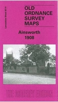
Ainsworth 1908 Stanfords
£3.50
Archived Product

Kingswinford 1901 Stanfords
£3.50
Archived Product

Windsor 1897 Stanfords
£3.50
Vouchers
No voucher codes found.
Do you know a voucher code for this product or supplier? Add it to Insights for others to use.
Do you know a voucher code for this product or supplier? Add it to Insights for others to use.
 Denmark