
 United Kingdom
 France
 Germany
 Netherlands
 Sweden
 USA
USA
 Italy
Italy
 Spain
Spain
More From Contributor


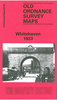
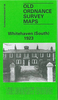


Whitehaven South 1923
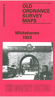
Whitehaven South in 1923 in a fascinating series of reproductions of old Ordnance Survey plans in the Alan Godfrey Editions, ideal for anyone interested in the history of their neighbourhood or family. Selected towns in Great Britain and Ireland are covered by maps showing the extent of urban development in the last decades of the 19th and early 20th century.In this title: this detailed map covers the southern part of Whitehaven, stretching from Thwaiteville and Low Corkickle southward to the Poor Law Institution, and from Kells eastward to Hensingham. Features include railway with Corkickle station, Preston Street Goods Branch, engine shed, mineral railway to Ladysmith Pit, Haig Colliery, Kells, Arrowthwaite Villas, Arrowthwaite, Thwaiteville, Whitehaven & Preston Quarter
Cemetery, Poor Law Institution, Fire Brick Works, The Gardens, Auction Mart, Tower Brewery. The map also includes part of Hensingham with St John's church, Lowther Arms, Bee Hive pub. On the reverse are extracts from a 1921 directory, continuing from those on the Whitehaven map. About the Alan Godfrey Editions of the 25
Cemetery, Poor Law Institution, Fire Brick Works, The Gardens, Auction Mart, Tower Brewery. The map also includes part of Hensingham with St John's church, Lowther Arms, Bee Hive pub. On the reverse are extracts from a 1921 directory, continuing from those on the Whitehaven map. About the Alan Godfrey Editions of the 25
Product Description
Reviews/Comments
Add New
Intelligent Comparison
Archived Product

Whitehaven South 1923 Stanfords
£3.50
Archived Product
Whitehaven 1923 Stanfords
£2.95
Archived Product
Whitehaven 1923 Stanfords
£3.50
Archived Product

Newhaven South 1938 Stanfords
£3.50
Archived Product
Workington South 1923 Stanfords
£2.95
Archived Product
Workington South 1923 Stanfords
£2.95
Vouchers
No voucher codes found.
Do you know a voucher code for this product or supplier? Add it to Insights for others to use.
Do you know a voucher code for this product or supplier? Add it to Insights for others to use.
 Denmark