
 United Kingdom
 France
 Germany
 Netherlands
 Sweden
 USA
USA
 Italy
Italy
 Spain
Spain
More From Contributor


West Cumbria
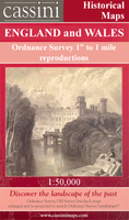
Map No. 89, West Cumbria, in the Ordnance Survey Landranger series at 1:50, 000, including Cockermouth, Workington, Flimby, Dovenby, Maryport, Dearham, Crosby, Blindcrake, Bessenthwaite, Uldale, Bothel and Ireby, Eaglesfield, High Lorton, Keswick, Loweswater, Pardshaw, Distington, Lowca, Lamplugh, Whitehaven, Cleator Moor, Ennerdale Bridge, Buttermere, Seathwaite, St Bees, Egremont, Nethertown, Seascale, Calder Bridge, Gosforth, Eskdale Green and Boot, with the Lake District National Park and the Cumbrian Mountains; the peaks of Skiddaw, Scafell Pike and Cold Pike; plus Bassenthwaite Lake, Derwent Water, Buttermere, Wast Water, Ennerdale Water, Crummock Water and Loweswater. Edition C4; Publication date November 2011About Ordnance Survey
Product Description
Reviews/Comments
Add New
Intelligent Comparison
Archived Product
West Cumbria 1925 Stanfords
£9.99
Archived Product

West Cumbria 1864-1869 Stanfords
£9.99
Archived Product

West Cumbria 1901-1904 Stanfords
£9.99
Vouchers
No voucher codes found.
Do you know a voucher code for this product or supplier? Add it to Insights for others to use.
Do you know a voucher code for this product or supplier? Add it to Insights for others to use.
 Denmark